
VIKTORIA
Tanker
Current Position
| Longitude | 7.63815° |
|---|---|
| Latitude | 51.93535° |
| Status | Under way using engine |
| Speed | 4.4 Knots |
| Course | 163° |
| Area | North Sea |
| Station | T-AIS |
| Position Received | 16 h, 5 m ago |
Info
Information
The current position of VIKTORIA is in North Sea with coordinates 51.93535° / 7.63815° as reported on 2024-06-24 15:01 by AIS to our vessel tracker app. The vessel's current speed is 4.4 Knots and is currently inside the port of MUNSTER.
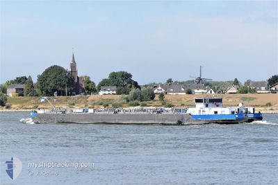
The vessel VIKTORIA (MMSI: 211522860) is a Tanker It's sailing under the flag of [DE] Germany.
In this page you can find informations about the vessels current position, last detected port calls, and current voyage information. If the vessels is not in coverage by AIS you will find the latest position.
The current position of VIKTORIA is detected by our AIS receivers and we are not responsible for the reliability of the data. The last position was recorded while the vessel was in Coverage by the Ais receivers of our vessel tracking app.
The current draught of VIKTORIA as reported by AIS is 2.4 meters
Weather
| Temperature | 24.7°C / 76.46°F |
|---|---|
| Wind Speed | 4 knots |
| Direction | 350° N |
| Pressure | 1018.4 hPa |
| Humidity | 51.1 % |
| Cloud Coverage | 21 % |
Featured Company
Last Port Calls
| Port | Arrival | Departure | Time In Port |
|---|---|---|---|
| 2024-06-22 09:47 | 2024-06-24 14:19 | 2 d | |
| 2024-06-22 07:14 | 2024-06-22 09:22 | 2 h | |
| 2024-06-18 15:39 | 2024-06-19 12:57 | 21 h | |
| 2024-06-18 14:16 | 2024-06-18 15:10 | 53 m | |
| 2024-06-18 06:30 | 2024-06-18 07:13 | 42 m | |
| 2024-06-17 06:38 | 2024-06-17 07:24 | 46 m | |
| 2024-06-16 11:12 | 2024-06-16 12:20 | 1 h | |
| 2024-06-14 18:08 | 2024-06-15 10:02 | 15 h | |
| 2024-06-13 10:59 | |||
| 2024-06-13 10:01 | 2024-06-13 10:30 | 29 m |
Last Trips
| Origin | Departure | Destination | Arrival | Distance | |
|---|---|---|---|---|---|
| 2024-06-22 11:22 | 2024-06-22 11:47 | 2.14 nm | |||
| 2024-06-19 14:57 | 2024-06-22 09:14 | 132.78 nm | |||
| 2024-06-18 17:10 | 2024-06-18 17:39 | 3.88 nm | |||
| 2024-06-18 09:13 | 2024-06-18 16:16 | 63.75 nm | |||
| 2024-06-17 09:24 | 2024-06-18 08:30 | 41.37 nm | |||
| 2024-06-16 14:20 | 2024-06-17 08:38 | 34.96 nm | |||
| 2024-06-15 12:02 | 2024-06-16 13:12 | 71.04 nm | |||
| 2024-06-13 12:30 | 2024-06-14 20:08 | 70.94 nm | |||
| 2024-06-13 12:30 | 2024-06-13 12:59 | 2.10 nm | |||
| 2024-06-11 19:20 | 2024-06-13 12:01 | 82.04 nm |
Events
| Time | Event | Details | Position / Dest | Info |
|---|---|---|---|---|
| 2024-06-24 15:01 | OUT of Coverage |
51.93535 / 7.63815
North Sea
[DE] MUNSTER
|
Speed: 4.4 kn Course: 165.4° |
|
| 2024-06-24 14:32 | START Moving |
51.97070 / 7.66360
[DE] MUNSTER
|
Speed: 5.2 kn Course: 176° |
|
| 2024-06-24 14:30 | Status Changed | Under way using engine Moored |
51.97241 / 7.66350
[DE] MUNSTER
|
Speed: Course: 173° |
| 2024-06-24 14:20 | IN Coverage |
51.97252 / 7.66359
North Sea
[DE] MUNSTER
|
Speed: Course: 174.2° |
|
| 2024-06-24 14:19 | PORT DEPARTURE |
|
51.97252 / 7.66359
AMSTERDAM
|
Speed: Course: 32° |
| 2024-06-24 14:18 | ETA Changed | 2024/06/26 06:56 2024/06/21 17:16 |
52.01685 / 7.66505
[DE] GELMER
|
Speed: Course: 32° |
| 2024-06-24 14:18 | Destination Changed | AMSTERDAM GELMER WESTFALEN |
52.01685 / 7.66505
[DE] GELMER
|
Speed: Course: 32° |
| 2024-06-23 06:06 | OUT of Coverage |
52.01685 / 7.66505
North Sea
[DE] GELMER
|
Speed: Course: 135.1° |
|
| 2024-06-23 06:06 | IN Coverage |
52.01685 / 7.66505
North Sea
[DE] GELMER
|
Speed: Course: 135.1° |
|
| 2024-06-22 09:57 | OUT of Coverage |
52.01686 / 7.66500
North Sea
[DE] GELMER
|
Speed: 0.1 kn Course: 218.9° |