
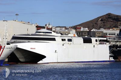
VILLA DE AGAETE
High speed craft
Current Trip
| Time Travelled | 5 h, 8 mins |
|---|---|
| Remaining Time | --- |
| Distance Travelled | 10.12 nm |
| Remaining Distance | --- |
| AVG Speed | 29 Knots |
| MAX Speed | 29 Knots |
| AVG Wind | 17.9 knots |
| MAX Wind | 18 knots |
| MIN Temp | 19.1°C / 66.38°F |
| MAX Temp | 19.2°C / 66.56°F |
| Draught | 3.4 m |
| Position Received | 5 h, 5 m ago |
Current Position
| Longitude | -13.81894° |
|---|---|
| Latitude | 28.48326° |
| Status | Under way using engine |
| Speed | 30.1 Knots |
| Course | 97.7° |
| Area | North Atlantic Ocean |
| Station | T-AIS |
| Position Received | 5 h, 5 m ago |
Info
Information
The current position of VILLA DE AGAETE is in North Atlantic Ocean with coordinates 28.48326° / -13.81894° as reported on 2024-05-06 18:02 by AIS to our vessel tracker app. The vessel's current speed is 30.1 Knots and is heading at the port of ROSARIO. The estimated time of arrival as calculated by vessel tracking app is 2024-05-06 19:25 LT
The vessel VILLA DE AGAETE (IMO: 9206700, MMSI: 224898000) is a High speed craft that was built in 1999 ( 25 years old ). It's sailing under the flag of [ES] Spain.
In this page you can find informations about the vessels current position, last detected port calls, and current voyage information. If the vessels is not in coverage by AIS you will find the latest position.
The current position of VILLA DE AGAETE is detected by our AIS receivers and we are not responsible for the reliability of the data. The last position was recorded while the vessel was in Coverage by the Ais receivers of our vessel tracking app.
The current draught of VILLA DE AGAETE as reported by AIS is 3.4 meters
Weather
| Temperature | 19.4°C / 66.92°F |
|---|---|
| Wind Speed | 8 knots |
| Direction | 17° NNE |
| Pressure | 1016.5 hPa |
| Humidity | 85.8 % |
| Cloud Coverage | 99 % |
Featured Company
Last Port Calls
| Port | Arrival | Departure | Time In Port |
|---|---|---|---|
| 2024-05-06 16:56 | 2024-05-06 17:59 | 1 h | |
| 2024-05-06 12:27 | 2024-05-06 14:08 | 1 h | |
| 2024-05-06 06:57 | 2024-05-06 07:54 | 56 m | |
| 2024-04-26 20:36 | 2024-05-05 07:15 | 8 d | |
| 2024-04-26 16:50 | 2024-04-26 17:21 | 30 m | |
| 2024-04-26 14:51 | 2024-04-26 16:05 | 1 h | |
| 2024-04-26 11:49 | 2024-04-26 14:05 | 2 h | |
| 2024-04-26 08:38 | 2024-04-26 11:04 | 2 h | |
| 2024-04-26 07:01 | 2024-04-26 07:51 | 49 m | |
| 2024-04-25 18:33 | 2024-04-26 06:15 | 11 h |
Most Visited Ports (Last year)
| Port | Arrivals | |
|---|---|---|
| 384 | ||
| 262 | ||
| 125 | ||
| 123 | ||
| 122 | ||
| 95 |
Last Trips
| Origin | Departure | Destination | Arrival | Distance | |
|---|---|---|---|---|---|
| 2024-05-06 15:08 | 2024-05-06 17:56 | 47.28 nm | |||
| 2024-05-06 08:54 | 2024-05-06 13:27 | 46.88 nm | |||
| 2024-05-05 08:15 | 2024-05-06 07:57 | 126.00 nm | |||
| 2024-04-26 18:21 | 2024-04-26 21:36 | 81.40 nm | |||
| 2024-04-26 17:05 | 2024-04-26 17:50 | 21.71 nm | |||
| 2024-04-26 15:05 | 2024-04-26 15:51 | 20.13 nm | |||
| 2024-04-26 12:04 | 2024-04-26 12:49 | 21.55 nm | |||
| 2024-04-26 08:51 | 2024-04-26 09:38 | 21.01 nm | |||
| 2024-04-26 07:15 | 2024-04-26 08:01 | 21.51 nm | |||
| 2024-04-25 18:48 | 2024-04-25 19:33 | 21.97 nm |
Events
| Time | Event | Details | Position / Dest | Info |
|---|---|---|---|---|
| 2024-05-06 19:03 | STOP Moving | 0.23 nm, South of PLAYA BLANCA |
28.85667 / -13.83333
QLY-PTO. ROSARIO-QLY
|
Speed: Course: -1° |
| 2024-05-06 18:05 | Status Changed | Default Under way using engine |
28.48632 / -13.79638
QLY-PTO. ROSARIO-QLY
|
Speed: 30.1 kn Course: 97.7° |
| 2024-05-06 18:02 | OUT of Coverage |
28.48326 / -13.81894
North Atlantic Ocean
QLY-PTO. ROSARIO-QLY
|
Speed: 30.1 kn Course: 97.7° |
|
| 2024-05-06 17:59 | PORT DEPARTURE |
|
28.48638 / -13.84160
QLY-PTO. ROSARIO-QLY
|
Speed: 22.2 kn Course: 96.1° |
| 2024-05-06 17:53 | START Moving |
28.49507 / -13.85660
[ES] PUERTO DEL ROSARIO
|
Speed: 9.6 kn Course: 180.3° |
|
| 2024-05-06 17:07 | STOP Moving |
28.49714 / -13.85648
[ES] PUERTO DEL ROSARIO
|
Speed: 0.1 kn Course: 511° |
|
| 2024-05-06 16:56 | PORT ARRIVAL |
|
28.48511 / -13.84465
[ES] PUERTO DEL ROSARIO
|
Speed: 30 kn Course: 247.7° |
| 2024-05-06 16:52 | Status Changed | Under way using engine Default |
28.50604 / -13.81955
QLY-PTO. ROSARIO-QLY
|
Speed: 30 kn Course: 180° |
| 2024-05-06 16:36 | IN Coverage |
28.50171 / -13.82424
North Atlantic Ocean
QLY-PTO. ROSARIO-QLY
|
Speed: 31.2 kn Course: 223.8° |
|
| 2024-05-06 16:15 | START Moving | 2.72 nm, South of LAS COLORADAS |
28.81167 / -13.81167
QLY-PTO. ROSARIO-QLY
|
Speed: 30 kn Course: 156° |