
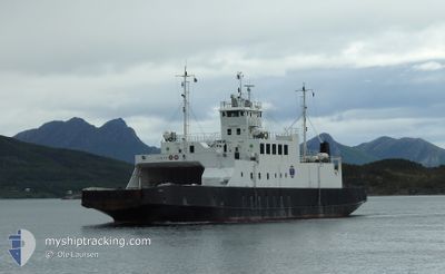
VIRAK
Ro-Ro/Passenger Ship
Current Trip
AAGSKARDET
| Time Travelled | 31 days |
|---|---|
| Remaining Time | --- |
| Distance Travelled | 1245.77 nm |
| Remaining Distance | --- |
| AVG Speed | 8.5 Knots |
| MAX Speed | 11.8 Knots |
| AVG Wind | 6.3 knots |
| MAX Wind | 18.3 knots |
| MIN Temp | 0.8°C / 33.44°F |
| MAX Temp | 22.3°C / 72.14°F |
| Draught | 3.1 m |
| Position Received | 5 m ago |
Current Position
| Longitude | 13.51312° |
|---|---|
| Latitude | 66.73833° |
| Status | Under way using engine |
| Speed | |
| Course | 233° |
| Area | Norwegian Sea |
| Station | T-AIS |
| Position Received | 5 m ago |
Info
Information
The current position of VIRAK is in Norwegian Sea with coordinates 66.73833° / 13.51312° as reported on 2024-06-01 12:46 by AIS to our vessel tracker app. The vessel's current speed is 0 Knots
The vessel VIRAK (IMO: 7805162, MMSI: 257377500) is a Ro-Ro/Passenger Ship that was built in 1979 ( 45 years old ). It's sailing under the flag of [NO] Norway.
In this page you can find informations about the vessels current position, last detected port calls, and current voyage information. If the vessels is not in coverage by AIS you will find the latest position.
The current position of VIRAK is detected by our AIS receivers and we are not responsible for the reliability of the data. The last position was recorded while the vessel was in Coverage by the Ais receivers of our vessel tracking app.
The current draught of VIRAK as reported by AIS is 3.1 meters
Weather
| Temperature | 10.2°C / 50.36°F |
|---|---|
| Wind Speed | 4 knots |
| Direction | 251° WSW |
| Pressure | 1022 hPa |
| Humidity | 81.4 % |
| Cloud Coverage | 77 % |
Featured Company
Last Port Calls
| Port | Arrival | Departure | Time In Port |
|---|---|---|---|
| 2024-05-01 06:45 | 2024-05-01 06:58 | 12 m | |
| 2024-04-30 12:20 | 2024-05-01 06:39 | 18 h | |
| 2024-04-12 11:19 | 2024-04-30 11:19 | 18 d | |
| 2024-04-09 17:51 | 2024-04-12 11:09 | 2 d | |
| 2024-04-09 07:53 |
Last Trips
| Origin | Departure | Destination | Arrival | Distance | |
|---|---|---|---|---|---|
| 2024-05-01 08:39 | 2024-05-01 08:45 | 0.66 nm | |||
| 2024-04-30 13:19 | 2024-04-30 14:20 | 7.96 nm | |||
| 2024-04-12 13:09 | 2024-04-12 13:19 | 0.36 nm | |||
| 2024-04-09 09:53 | 2024-04-09 19:51 | 92.13 nm |
Events
| Time | Event | Details | Position / Dest | Info |
|---|---|---|---|---|
| 2024-06-01 12:28 | STOP Moving | 8.79 nm, North East of JEKTVIK |
66.73832 / 13.51313
AAGSKARDET
|
Speed: Course: 53° |
| 2024-06-01 12:18 | START Moving | 7.73 nm, North East of JEKTVIK |
66.72541 / 13.48210
AAGSKARDET
|
Speed: 10.1 kn Course: 42.1° |
| 2024-06-01 11:30 | STOP Moving | 7.4 nm, North East of JEKTVIK |
66.72046 / 13.47602
AAGSKARDET
|
Speed: Course: 340° |
| 2024-06-01 11:17 | START Moving | 7.58 nm, North East of JEKTVIK |
66.72361 / 13.47761
AAGSKARDET
|
Speed: 8.2 kn Course: 17.9° |
| 2024-06-01 11:13 | STOP Moving | 7.4 nm, North East of JEKTVIK |
66.72046 / 13.47602
AAGSKARDET
|
Speed: Course: 340° |
| 2024-06-01 11:03 | START Moving | 8.4 nm, North East of JEKTVIK |
66.73363 / 13.50120
AAGSKARDET
|
Speed: 10.4 kn Course: 227.8° |
| 2024-06-01 10:43 | STOP Moving | 8.79 nm, North East of JEKTVIK |
66.73833 / 13.51309
AAGSKARDET
|
Speed: 0.3 kn Course: 53° |
| 2024-06-01 10:33 | START Moving | 7.59 nm, North East of JEKTVIK |
66.72343 / 13.47906
AAGSKARDET
|
Speed: 7.8 kn Course: 37° |
| 2024-06-01 10:13 | STOP Moving | 7.4 nm, North East of JEKTVIK |
66.72049 / 13.47600
AAGSKARDET
|
Speed: 0.2 kn Course: 162° |
| 2024-06-01 10:03 | START Moving | 8.58 nm, North East of JEKTVIK |
66.73575 / 13.50668
AAGSKARDET
|
Speed: 9.5 kn Course: 224.9° |