
VISION
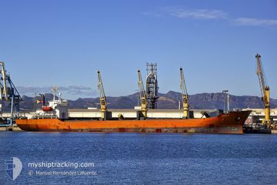
Crude Oil Tanker
Current Trip
| Time Travelled | --- |
|---|---|
| Remaining Time | --- |
| Distance Travelled | --- |
| Remaining Distance | --- |
| AVG Speed | --- |
| MAX Speed | --- |
| AVG Wind | --- |
| MAX Wind | --- |
| MIN Temp | --- |
| MAX Temp | --- |
| Draught | 8.8 m |
| Position Received | 2 h, 30 m ago |
Current Position
| Longitude | -5.95097° |
|---|---|
| Latitude | 35.95458° |
| Status | Under way using engine |
| Speed | 12 Knots |
| Course | 269.9° |
| Area | Strait of Gibraltar |
| Station | T-AIS |
| Position Received | 2 h, 30 m ago |
Info
Information
The current position of VISION is in Strait of Gibraltar with coordinates 35.95458° / -5.95097° as reported on 2024-05-19 05:53 by AIS to our vessel tracker app. The vessel's current speed is 12 Knots and is heading at the port of OCHTEN. The estimated time of arrival as calculated by vessel tracking app is 2024-05-23 23:30 LT
The vessel VISION (IMO: 9236016, MMSI: 305099000) is a Crude Oil Tanker that was built in 2003 ( 21 years old ). It's sailing under the flag of [AG] Antigua Barbuda.
In this page you can find informations about the vessels current position, last detected port calls, and current voyage information. If the vessels is not in coverage by AIS you will find the latest position.
The current position of VISION is detected by our AIS receivers and we are not responsible for the reliability of the data. The last position was recorded while the vessel was in Coverage by the Ais receivers of our vessel tracking app.
The current draught of VISION as reported by AIS is 8.8 meters
Weather
| Temperature | 16.5°C / 61.7°F |
|---|---|
| Wind Speed | 12 knots |
| Direction | 317° NW |
| Pressure | 1013.8 hPa |
| Humidity | 73.3 % |
| Cloud Coverage | 100 % |
Featured Company
Last Port Calls
| Port | Arrival | Departure | Time In Port |
|---|---|---|---|
| 2024-05-03 04:38 | 2024-05-03 13:48 | 9 h | |
| 2024-03-27 06:17 | 2024-03-27 15:51 | 9 h | |
| 2024-03-05 10:08 | 2024-03-05 19:26 | 9 h |
Most Visited Ports (Last year)
| Port | Arrivals | |
|---|---|---|
| 3 |
Last Trips
| Origin | Departure | Destination | Arrival | Distance |
|---|
Events
| Time | Event | Details | Position / Dest | Info |
|---|---|---|---|---|
| 2024-05-19 05:58 | Status Changed | Default Under way using engine |
35.95459 / -5.97309
ARA
|
Speed: 12 kn Course: 269.9° |
| 2024-05-19 05:53 | Change Sea Area | Moroccan part of the Strait of Gibraltar Spanish part of the Strait of Gibraltar |
35.95458 / -5.95097
Strait of Gibraltar
ARA
|
Speed: 12 kn Course: 269.9° |
| 2024-05-19 05:53 | Status Changed | Under way using engine Default |
35.95458 / -5.95097
ARA
|
Speed: 11.9 kn Course: 269° |
| 2024-05-19 05:53 | IN Coverage |
35.95458 / -5.95097
Strait of Gibraltar
ARA
|
Speed: 12 kn Course: 269.9° |
|
| 2024-05-19 05:53 | OUT of Coverage |
35.95458 / -5.95097
Strait of Gibraltar
ARA
|
Speed: 12 kn Course: 269.9° |
|
| 2024-05-19 04:46 | Status Changed | Default Under way using engine |
35.95840 / -5.68692
ARA
|
Speed: 10.2 kn Course: 270.7° |
| 2024-05-19 04:41 | OUT of Coverage |
35.95816 / -5.66866
Strait of Gibraltar
ARA
|
Speed: 10.2 kn Course: 270.7° |
|
| 2024-05-19 04:07 | Status Changed | Under way using engine Default |
35.96912 / -5.55495
ARA
|
Speed: 9.5 kn Course: 248° |
| 2024-05-19 04:06 | Status Changed | Default Under way using engine |
35.96983 / -5.55283
ARA
|
Speed: 9.3 kn Course: 250.1° |
| 2024-05-19 02:53 | Change Sea Area | Spanish part of the Strait of Gibraltar Gibraltarian part of the Strait of Gibraltar |
36.01267 / -5.34082
Strait of Gibraltar
ARA
|
Speed: 8.6 kn Course: 261.6° |