
VISION
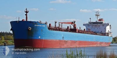
Oil/Chemical Tanker
Current Trip
MERSIN/TURKEY
| Time Travelled | 25 days |
|---|---|
| Remaining Time | --- |
| Distance Travelled | 973.76 nm |
| Remaining Distance | --- |
| AVG Speed | 7.2 Knots |
| MAX Speed | 20.2 Knots |
| AVG Wind | 8.8 knots |
| MAX Wind | 22.5 knots |
| MIN Temp | 10.4°C / 50.72°F |
| MAX Temp | 21.6°C / 70.88°F |
| Draught | 10.6 m |
| Position Received | Now |
Current Position
| Longitude | 28.99607° |
|---|---|
| Latitude | 40.69588° |
| Status | Not under command |
| Speed | 8.3 Knots |
| Course | 220.2° |
| Area | Sea of Marmara |
| Station | T-AIS |
| Position Received | Now |
Info
Information
The current position of VISION is in Sea of Marmara with coordinates 40.69588° / 28.99607° as reported on 2024-05-29 05:46 by AIS to our vessel tracker app. The vessel's current speed is 8.3 Knots
The vessel VISION (IMO: 9295347, MMSI: 538007536) is a Oil/Chemical Tanker that was built in 2006 ( 18 years old ). It's sailing under the flag of [MH] Marshall Is.
In this page you can find informations about the vessels current position, last detected port calls, and current voyage information. If the vessels is not in coverage by AIS you will find the latest position.
The current position of VISION is detected by our AIS receivers and we are not responsible for the reliability of the data. The last position was recorded while the vessel was in Coverage by the Ais receivers of our vessel tracking app.
The current draught of VISION as reported by AIS is 10.6 meters
Weather
| Temperature | 17.2°C / 62.96°F |
|---|---|
| Wind Speed | 3 knots |
| Direction | 87° E |
| Pressure | 1013.6 hPa |
| Humidity | 71.7 % |
| Cloud Coverage | 2 % |
Featured Company
Most Visited Ports (Last year)
| Port | Arrivals | |
|---|---|---|
| 3 | ||
| 2 | ||
| 2 | ||
| 2 | ||
| 2 | ||
| 1 |
Last Trips
| Origin | Departure | Destination | Arrival | Distance | |
|---|---|---|---|---|---|
| 2024-04-11 04:56 | 2024-04-21 18:28 | 547.00 nm | |||
| 2024-03-26 14:37 | 2024-04-09 15:21 | 1043.35 nm | |||
| 2024-03-22 12:04 | 2024-03-26 14:15 | 418.90 nm | |||
| 2024-03-04 14:16 | 2024-03-05 16:56 | 20.92 nm |
Events
| Time | Event | Details | Position / Dest | Info |
|---|---|---|---|---|
| 2024-05-29 05:12 | START Moving | 11.6 nm, West of YALOVA |
40.67112 / 29.02148
MERSIN/TURKEY
|
Speed: 3.2 kn Course: 92° |
| 2024-05-28 23:46 | Status Changed | Not under command Default |
40.68681 / 29.03072
MERSIN/TURKEY
|
Speed: 0.2 kn Course: 98° |
| 2024-05-28 23:40 | Status Changed | Default Not under command |
40.68715 / 29.03092
MERSIN/TURKEY
|
Speed: 0.2 kn Course: 97° |
| 2024-05-28 23:19 | Status Changed | Not under command Default |
40.68826 / 29.03164
MERSIN/TURKEY
|
Speed: 0.2 kn Course: 89° |
| 2024-05-28 23:13 | Status Changed | Default Not under command |
40.68863 / 29.03183
MERSIN/TURKEY
|
Speed: 0.2 kn Course: 89° |
| 2024-05-28 22:37 | Status Changed | Not under command Default |
40.69072 / 29.03290
MERSIN/TURKEY
|
Speed: 0.2 kn Course: 68° |
| 2024-05-28 22:31 | Status Changed | Default Not under command |
40.69105 / 29.03309
MERSIN/TURKEY
|
Speed: 0.2 kn Course: 68° |
| 2024-05-28 21:31 | Status Changed | Not under command Default |
40.69583 / 29.03501
MERSIN/TURKEY
|
Speed: 0.3 kn Course: 54° |
| 2024-05-28 21:25 | Status Changed | Default Not under command |
40.69642 / 29.03509
MERSIN/TURKEY
|
Speed: 0.2 kn Course: 54° |
| 2024-05-28 19:01 | Status Changed | Not under command Default |
40.71173 / 29.03511
MERSIN/TURKEY
|
Speed: 0.4 kn Course: 59° |