
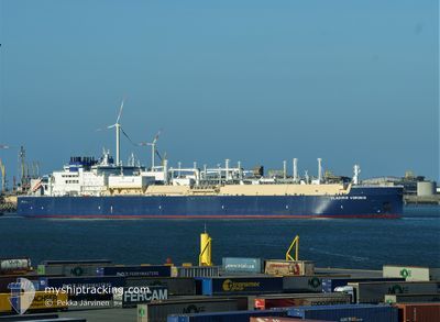
VLADIMIR VORONIN
Tanker D
Current Trip
FOR_ORDERS
| Time Travelled | 7 days |
|---|---|
| Remaining Time | --- |
| Distance Travelled | 2623.08 nm |
| Remaining Distance | --- |
| AVG Speed | 15.9 Knots |
| MAX Speed | 19.5 Knots |
| AVG Wind | 15 knots |
| MAX Wind | 23.1 knots |
| MIN Temp | -1.6°C / 29.12°F |
| MAX Temp | 14.1°C / 57.38°F |
| Draught | 11.1 m |
| Position Received | 3 d ago |
Current Position
| Longitude | 27.52653° |
|---|---|
| Latitude | 73.88406° |
| Status | Under way using engine |
| Speed | 18.5 Knots |
| Course | 52.1° |
| Area | Barentsz Sea |
| Station | T-AIS |
| Position Received | 3 d ago |
Info
Information
The current position of VLADIMIR VORONIN is in Barentsz Sea with coordinates 73.88406° / 27.52653° as reported on 2024-06-17 04:28 by AIS to our vessel tracker app. The vessel's current speed is 18.5 Knots
The vessel VLADIMIR VORONIN (IMO: 9750737, MMSI: 311000632) is a Tanker D It's sailing under the flag of [BS] Bahamas.
In this page you can find informations about the vessels current position, last detected port calls, and current voyage information. If the vessels is not in coverage by AIS you will find the latest position.
The current position of VLADIMIR VORONIN is detected by our AIS receivers and we are not responsible for the reliability of the data. The last position was recorded while the vessel was in Coverage by the Ais receivers of our vessel tracking app.
The current draught of VLADIMIR VORONIN as reported by AIS is 11.1 meters
Weather
| Temperature | -0.1°C / 31.82°F |
|---|---|
| Wind Speed | 6 knots |
| Direction | 16° NNE |
| Pressure | 1005.6 hPa |
| Humidity | 90.3 % |
| Cloud Coverage | 100 % |
Featured Company
Last Port Calls
| Port | Arrival | Departure | Time In Port |
|---|---|---|---|
| 2024-06-12 09:40 | 2024-06-13 09:29 | 23 h | |
| 2024-06-02 14:38 | 2024-06-03 14:45 | 1 d | |
| 2024-05-24 02:26 | 2024-05-25 16:41 | 1 d | |
| 2024-05-15 13:59 | 2024-05-16 13:37 | 23 h | |
| 2024-05-06 02:27 | 2024-05-07 15:29 | 1 d | |
| 2024-04-25 04:11 | 2024-04-26 16:42 | 1 d | |
| 2024-04-14 18:29 | 2024-04-16 14:07 | 1 d | |
| 2024-04-04 20:29 | 2024-04-06 22:31 | 2 d |
Last Trips
| Origin | Departure | Destination | Arrival | Distance | |
|---|---|---|---|---|---|
| 2024-06-03 19:45 | 2024-06-12 11:40 | 2641.32 nm | |||
| 2024-05-25 18:41 | 2024-06-02 19:38 | 3137.40 nm | |||
| 2024-05-16 18:37 | 2024-05-24 04:26 | 3160.93 nm | |||
| 2024-05-07 17:29 | 2024-05-15 18:59 | 3146.96 nm | |||
| 2024-04-26 21:42 | 2024-05-06 04:27 | 3177.65 nm | |||
| 2024-04-16 16:07 | 2024-04-25 09:11 | 2598.63 nm | |||
| 2024-04-07 03:31 | 2024-04-14 20:29 | 2684.39 nm | |||
| 2024-03-27 23:21 | 2024-04-05 01:29 | 2641.23 nm |
Events
| Time | Event | Details | Position / Dest | Info |
|---|---|---|---|---|
| 2024-06-19 11:28 | START Moving |
74.93584 / 73.20950
FOR_ORDERS
|
Speed: 5.9 kn Course: 268° |
|
| 2024-06-19 11:25 | STOP Moving |
74.93613 / 73.22257
FOR_ORDERS
|
Speed: 0.1 kn Course: 270° |
|
| 2024-06-17 04:34 | Status Changed | Default Under way using engine |
73.90166 / 27.61333
FOR_ORDERS
|
Speed: 18.5 kn Course: 52.1° |
| 2024-06-17 04:28 | OUT of Coverage |
73.88406 / 27.52653
Barentsz Sea
FOR_ORDERS
|
Speed: 18.5 kn Course: 52.1° |
|
| 2024-06-17 03:57 | Status Changed | Under way using engine Default |
73.79080 / 27.07557
FOR_ORDERS
|
Speed: 18 kn Course: 55° |
| 2024-06-17 03:32 | Status Changed | Default Under way using engine |
73.71951 / 26.70693
FOR_ORDERS
|
Speed: 18.5 kn Course: 55.2° |
| 2024-06-17 03:15 | Status Changed | Under way using engine Default |
73.66931 / 26.44979
FOR_ORDERS
|
Speed: 18 kn Course: 54° |
| 2024-06-17 03:10 | Status Changed | Default Under way using engine |
73.65334 / 26.36833
FOR_ORDERS
|
Speed: 18.8 kn Course: 53.9° |
| 2024-06-17 02:56 | Status Changed | Under way using engine Default |
73.61042 / 26.16130
FOR_ORDERS
|
Speed: 18 kn Course: 52° |
| 2024-06-17 02:40 | IN Coverage |
73.61042 / 26.16130
Barentsz Sea
FOR_ORDERS
|
Speed: 19.2 kn Course: 51.2° |