
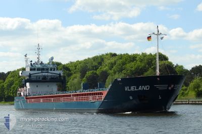
VLIELAND
General Cargo
Current Trip
| Time Travelled | 1 day |
|---|---|
| Remaining Time | --- |
| Distance Travelled | 359.18 nm |
| Remaining Distance | --- |
| AVG Speed | 10.3 Knots |
| MAX Speed | 11 Knots |
| AVG Wind | 8.5 knots |
| MAX Wind | 19 knots |
| MIN Temp | 22.8°C / 73.04°F |
| MAX Temp | 30.5°C / 86.9°F |
| Draught | 5.1 m |
| Position Received | 10 h, 22 m ago |
Current Position
| Longitude | 8.60170° |
|---|---|
| Latitude | 38.74229° |
| Status | Under way using engine |
| Speed | 10.5 Knots |
| Course | 255.9° |
| Area | Mediterranean Sea - Western Basin |
| Station | T-AIS |
| Position Received | 10 h, 22 m ago |
Info
Information
The current position of VLIELAND is in Mediterranean Sea - Western Basin with coordinates 38.74229° / 8.60170° as reported on 2024-06-19 18:30 by AIS to our vessel tracker app. The vessel's current speed is 10.5 Knots and is heading at the port of BREMEN. The estimated time of arrival as calculated by vessel tracking app is 2024-06-28 20:00 LT
The vessel VLIELAND (IMO: 9313814, MMSI: 244376000) is a General Cargo that was built in 2005 ( 19 years old ). It's sailing under the flag of [NL] Netherlands.
In this page you can find informations about the vessels current position, last detected port calls, and current voyage information. If the vessels is not in coverage by AIS you will find the latest position.
The current position of VLIELAND is detected by our AIS receivers and we are not responsible for the reliability of the data. The last position was recorded while the vessel was in Coverage by the Ais receivers of our vessel tracking app.
The current draught of VLIELAND as reported by AIS is 5.1 meters
Weather
| Temperature | 23.1°C / 73.58°F |
|---|---|
| Wind Speed | 8 knots |
| Direction | 317° NW |
| Pressure | 1014.6 hPa |
| Humidity | 84.2 % |
| Cloud Coverage | 62 % |
Featured Company
Last Port Calls
| Port | Arrival | Departure | Time In Port |
|---|---|---|---|
| 2024-06-14 08:27 | 2024-06-18 14:13 | 4 d | |
| 2024-06-07 18:41 | 2024-06-11 14:09 | 3 d | |
| 2024-06-07 18:21 | 2024-06-07 18:33 | 12 m | |
| 2024-05-29 09:04 | 2024-05-30 08:27 | 23 h | |
| 2024-05-26 23:08 | 2024-05-28 22:35 | 1 d | |
| 2024-05-25 12:13 | 2024-05-25 13:47 | 1 h | |
| 2024-05-18 15:36 | 2024-05-21 17:36 | 3 d | |
| 2024-05-16 07:44 | 2024-05-18 07:12 | 1 d | |
| 2024-05-06 17:36 | 2024-05-10 16:20 | 3 d | |
| 2024-05-03 12:54 | 2024-05-06 06:34 | 2 d |
Last Trips
| Origin | Departure | Destination | Arrival | Distance | |
|---|---|---|---|---|---|
| 2024-06-11 16:09 | 2024-06-14 10:27 | 477.51 nm | |||
| 2024-06-07 20:33 | 2024-06-07 20:41 | 0.26 nm | |||
| 2024-05-30 10:27 | 2024-06-07 20:21 | 2134.24 nm | |||
| 2024-05-29 00:35 | 2024-05-29 11:04 | 106.70 nm | |||
| 2024-05-25 15:47 | 2024-05-27 01:08 | 345.47 nm | |||
| 2024-05-21 20:36 | 2024-05-25 14:13 | 926.05 nm | |||
| 2024-05-18 10:12 | 2024-05-18 18:36 | 84.70 nm | |||
| 2024-05-10 18:20 | 2024-05-16 10:44 | 1365.70 nm | |||
| 2024-05-06 08:34 | 2024-05-06 19:36 | 124.91 nm | |||
| 2024-05-03 14:24 | 2024-05-03 14:54 | 5.70 nm |
Events
| Time | Event | Details | Position / Dest | Info |
|---|---|---|---|---|
| 2024-06-19 18:41 | Status Changed | Default Under way using engine |
38.73448 / 8.56305
BREMEN
|
Speed: 10.5 kn Course: 255.9° |
| 2024-06-19 18:30 | OUT of Coverage |
38.74229 / 8.60170
Mediterranean Sea - Western Basin
BREMEN
|
Speed: 10.5 kn Course: 255.9° |
|
| 2024-06-19 17:01 | Detected in Sea | Italian part of the Mediterranean Sea - Western Basin |
38.80950 / 8.92670
Mediterranean Sea - Western Basin
BREMEN
|
Speed: 10.6 kn Course: 251.7° |
| 2024-06-19 11:28 | Status Changed | Under way using engine Default |
39.17454 / 10.07434
BREMEN
|
Speed: 9.9 kn Course: 242° |
| 2024-06-19 11:10 | IN Coverage |
39.17454 / 10.07434
Tyrrhenian Sea
BREMEN
|
Speed: 10 kn Course: 241.7° |
|
| 2024-06-19 05:36 | Status Changed | Default Under way using engine |
39.61261 / 11.21733
BREMEN
|
Speed: 10.1 kn Course: 225.7° |
| 2024-06-19 05:33 | OUT of Coverage |
39.61913 / 11.22602
Tyrrhenian Sea
BREMEN
|
Speed: 10.1 kn Course: 225.7° |
|
| 2024-06-19 05:24 | Status Changed | Under way using engine Default |
39.63677 / 11.24927
BREMEN
|
Speed: 10.4 kn Course: 244° |
| 2024-06-19 05:17 | IN Coverage |
39.63533 / 11.24708
Tyrrhenian Sea
BREMEN
|
Speed: 9.8 kn Course: 230.3° |
|
| 2024-06-19 01:59 | OUT of Coverage |
39.90117 / 11.94007
Tyrrhenian Sea
BREMEN
|
Speed: 10.3 kn Course: 244.9° |