
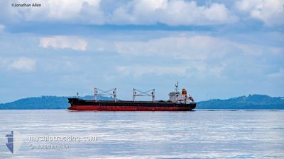
VOGE MIA
Bulk Carrier
Current Trip
| Time Travelled | 1 day |
|---|---|
| Remaining Time | --- |
| Distance Travelled | 453.42 nm |
| Remaining Distance | --- |
| AVG Speed | 10.3 Knots |
| MAX Speed | 13.3 Knots |
| AVG Wind | 13.4 knots |
| MAX Wind | 21 knots |
| MIN Temp | 26.9°C / 80.42°F |
| MAX Temp | 29.7°C / 85.46°F |
| Draught | 9.2 m |
| Position Received | 1 d ago |
Current Position
| Longitude | -74.81200° |
|---|---|
| Latitude | 11.21740° |
| Status | Under way using engine |
| Speed | 12.5 Knots |
| Course | 45.1° |
| Area | Caribbean Sea |
| Station | T-AIS |
| Position Received | 1 d ago |
Info
Information
The current position of VOGE MIA is in Caribbean Sea with coordinates 11.21740° / -74.81200° as reported on 2024-05-30 19:55 by AIS to our vessel tracker app. The vessel's current speed is 12.5 Knots and is heading at the port of PORT TALBOT. The estimated time of arrival as calculated by vessel tracking app is 2024-06-13 08:00 LT
The vessel VOGE MIA (IMO: 9464950, MMSI: 636092602) is a Bulk Carrier that was built in 2011 ( 13 years old ). It's sailing under the flag of [LR] Liberia.
In this page you can find informations about the vessels current position, last detected port calls, and current voyage information. If the vessels is not in coverage by AIS you will find the latest position.
The current position of VOGE MIA is detected by our AIS receivers and we are not responsible for the reliability of the data. The last position was recorded while the vessel was in Coverage by the Ais receivers of our vessel tracking app.
The current draught of VOGE MIA as reported by AIS is 9.2 meters
Weather
| Temperature | 28.3°C / 82.94°F |
|---|---|
| Wind Speed | 18 knots |
| Direction | 98° E |
| Pressure | 1012.7 hPa |
| Humidity | 82.4 % |
| Cloud Coverage | 98 % |
Featured Company
Last Port Calls
| Port | Arrival | Departure | Time In Port |
|---|---|---|---|
| 2024-05-30 12:35 | 2024-05-30 12:38 | 3 m | |
| 2024-05-30 12:02 | 2024-05-30 12:20 | 18 m | |
| 2024-05-30 11:11 | 2024-05-30 11:44 | 33 m | |
| 2024-05-30 10:56 | 2024-05-30 11:02 | 6 m | |
| 2024-05-30 10:41 | 2024-05-30 10:44 | 3 m | |
| 2024-05-30 10:05 | 2024-05-30 10:14 | 9 m | |
| 2024-05-30 09:35 | 2024-05-30 09:38 | 3 m | |
| 2024-05-30 09:14 | 2024-05-30 09:21 | 6 m | |
| 2024-05-30 08:47 | 2024-05-30 09:09 | 21 m | |
| 2024-05-30 08:32 | 2024-05-30 08:38 | 6 m |
Most Visited Ports (Last year)
| Port | Arrivals | |
|---|---|---|
| 210 | ||
| 2 | ||
| 2 | ||
| 1 | ||
| 1 | ||
| 1 |
Last Trips
| Origin | Departure | Destination | Arrival | Distance | |
|---|---|---|---|---|---|
| 2024-05-30 06:44 | 2024-05-30 07:02 | 0.10 nm | |||
| 2024-05-30 06:02 | 2024-05-30 06:11 | 0.10 nm | |||
| 2024-05-30 06:02 | 2024-05-30 05:56 | 0.10 nm | |||
| 2024-05-30 06:02 | 2024-05-30 05:41 | 0.10 nm | |||
| 2024-05-30 04:38 | 2024-05-30 05:05 | 0.10 nm | |||
| 2024-05-30 04:21 | 2024-05-30 04:35 | 0.10 nm | |||
| 2024-05-30 04:09 | 2024-05-30 04:14 | 0.10 nm | |||
| 2024-05-30 03:38 | 2024-05-30 03:47 | 0.10 nm | |||
| 2024-05-30 03:14 | 2024-05-30 03:32 | 0.10 nm | |||
| 2024-05-30 03:03 | 2024-05-30 03:11 | 0.31 nm |
Events
| Time | Event | Details | Position / Dest | Info |
|---|---|---|---|---|
| 2024-05-30 19:59 | Status Changed | Default Under way using engine |
11.22500 / -74.80167
GB PTB
|
Speed: 12.5 kn Course: 45.1° |
| 2024-05-30 19:55 | OUT of Coverage |
11.21740 / -74.81200
Caribbean Sea
GB PTB
|
Speed: 12.5 kn Course: 45.1° |
|
| 2024-05-30 18:16 | ETA Changed | 2024/06/13 08:00 2024/06/13 21:00 |
11.02305 / -75.02297
GB PTB
|
Speed: 12.9 kn Course: 41.1° |
| 2024-05-30 17:42 | Status Changed | Under way using engine Default |
10.93123 / -75.08114
GB PTB
|
Speed: 2 kn Course: -1° |
| 2024-05-30 17:42 | START Moving | 18.74 nm, West of BARRANQUILLA |
10.93123 / -75.08114
GB PTB
|
Speed: 4.3 kn Course: 338° |
| 2024-05-30 17:38 | IN Coverage |
10.93335 / -75.08175
Caribbean Sea
GB PTB
|
Speed: 5.9 kn Course: 352.3° |
|
| 2024-05-30 15:59 | STOP Moving | 18.53 nm, West of BARRANQUILLA |
10.92833 / -75.07667
GB PTB
|
Speed: Course: -1° |
| 2024-05-30 15:53 | Status Changed | Default Under way using engine |
10.92849 / -75.07347
GB PTB
|
Speed: 3.9 kn Course: 209° |
| 2024-05-30 15:51 | OUT of Coverage |
10.93050 / -75.07193
Caribbean Sea
GB PTB
|
Speed: 3.9 kn Course: 190.7° |
|
| 2024-05-30 13:39 | Status Changed | Under way using engine Moored |
11.03946 / -74.81478
GB PTB
|
Speed: 3.3 kn Course: 311° |