
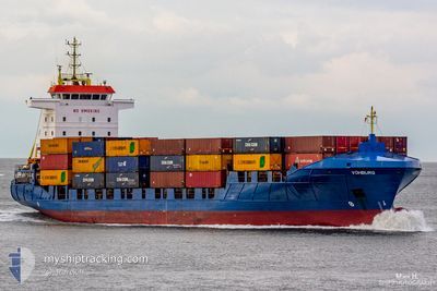
VOHBURG
Container Ship
Current Trip
| Time Travelled | 22 h, 3 mins |
|---|---|
| Remaining Time | 22 h, 58 mins |
| Distance Travelled | 258.96 nm |
| Remaining Distance | 291.04 nm |
| AVG Speed | 11.6 Knots |
| MAX Speed | 17.3 Knots |
| AVG Wind | 9.9 knots |
| MAX Wind | 17 knots |
| MIN Temp | 10.1°C / 50.18°F |
| MAX Temp | 11.9°C / 53.42°F |
| Draught | 7.1 m |
| Position Received | 1 m ago |
Current Position
| Longitude | 12.66138° |
|---|---|
| Latitude | 55.34055° |
| Status | Under way using engine |
| Speed | 12.2 Knots |
| Course | 8.4° |
| Area | Baltic Sea |
| Station | T-AIS |
| Position Received | 1 m ago |
Info
Information
The current position of VOHBURG is in Baltic Sea with coordinates 55.34055° / 12.66138° as reported on 2024-05-18 22:40 by AIS to our vessel tracker app. The vessel's current speed is 12.2 Knots and is heading at the port of OSLO. The estimated time of arrival as calculated by vessel tracking app is 2024-05-19 21:40 LT
The vessel VOHBURG (IMO: 9287807, MMSI: 305773000) is a Container Ship that was built in 2005 ( 19 years old ). It's sailing under the flag of [AG] Antigua Barbuda.
In this page you can find informations about the vessels current position, last detected port calls, and current voyage information. If the vessels is not in coverage by AIS you will find the latest position.
The current position of VOHBURG is detected by our AIS receivers and we are not responsible for the reliability of the data. The last position was recorded while the vessel was in Coverage by the Ais receivers of our vessel tracking app.
The current draught of VOHBURG as reported by AIS is 7.1 meters
Weather
| Temperature | 11.8°C / 53.24°F |
|---|---|
| Wind Speed | 16 knots |
| Direction | 76° ENE |
| Pressure | 1012.3 hPa |
| Humidity | 81.6 % |
| Cloud Coverage | 98 % |
Featured Company
Last Port Calls
| Port | Arrival | Departure | Time In Port |
|---|---|---|---|
| 2024-05-17 06:18 | 2024-05-18 00:39 | 18 h | |
| 2024-05-16 05:15 | 2024-05-16 19:31 | 14 h | |
| 2024-05-14 04:05 | 2024-05-14 11:34 | 7 h | |
| 2024-05-12 18:21 | 2024-05-14 01:43 | 1 d | |
| 2024-05-09 13:15 | 2024-05-10 21:40 | 1 d | |
| 2024-05-08 10:19 | 2024-05-08 21:01 | 10 h | |
| 2024-05-06 09:23 | 2024-05-06 13:49 | 4 h | |
| 2024-05-05 17:23 | 2024-05-06 06:56 | 13 h | |
| 2024-05-03 06:16 | 2024-05-03 20:55 | 14 h | |
| 2024-05-02 03:51 | 2024-05-02 21:03 | 17 h |
Most Visited Ports (Last year)
| Port | Arrivals | |
|---|---|---|
| 30 | ||
| 15 | ||
| 12 | ||
| 12 | ||
| 12 | ||
| 11 |
Last Trips
| Origin | Departure | Destination | Arrival | Distance | |
|---|---|---|---|---|---|
| 2024-05-16 22:31 | 2024-05-17 08:18 | 129.33 nm | |||
| 2024-05-14 13:34 | 2024-05-16 08:15 | 563.49 nm | |||
| 2024-05-14 03:43 | 2024-05-14 06:05 | 35.04 nm | |||
| 2024-05-10 23:40 | 2024-05-12 20:21 | 560.72 nm | |||
| 2024-05-08 22:01 | 2024-05-09 15:15 | 201.96 nm | |||
| 2024-05-06 15:49 | 2024-05-08 11:19 | 523.69 nm | |||
| 2024-05-06 08:56 | 2024-05-06 11:23 | 35.49 nm | |||
| 2024-05-03 22:55 | 2024-05-05 19:23 | 552.40 nm | |||
| 2024-05-03 00:03 | 2024-05-03 08:16 | 128.86 nm | |||
| 2024-04-30 00:04 | 2024-05-02 06:51 | 568.37 nm |
Events
| Time | Event | Details | Position / Dest | Info |
|---|---|---|---|---|
| 2024-05-18 22:40 | Change Sea Area | Swedish part of the Kattegat Swedish part of the Baltic Sea |
55.34055 / 12.66138
Kattegat
NOOSL
|
Speed: 12.2 kn Course: 8.4° |
| 2024-05-18 16:10 | Change Sea Area | Swedish part of the Baltic Sea Danish part of the Kattegat |
55.45095 / 14.66531
Baltic Sea
NOOSL
|
Speed: 11.1 kn Course: 267.6° |
| 2024-05-18 12:19 | Change Sea Area | Danish part of the Kattegat Swedish part of the Baltic Sea |
55.47792 / 15.95628
Kattegat
NOOSL
|
Speed: 11.4 kn Course: 268.7° |
| 2024-05-18 10:22 | Detected in Sea | Swedish part of the Baltic Sea |
55.37897 / 16.58943
Baltic Sea
NOOSL
|
Speed: 11.9 kn Course: 286.3° |
| 2024-05-18 09:39 | Status Changed | Under way using engine Default |
55.34062 / 16.81933
NOOSL
|
Speed: 11.5 kn Course: 287° |
| 2024-05-18 09:33 | IN Coverage |
55.34062 / 16.81933
Baltic Sea
NOOSL
|
Speed: 11.4 kn Course: 287.2° |
|
| 2024-05-18 06:37 | Status Changed | Default Under way using engine |
55.14109 / 17.89600
NOOSL
|
Speed: 11.5 kn Course: 288.2° |
| 2024-05-18 06:30 | OUT of Coverage |
55.13480 / 17.92968
Baltic Sea
NOOSL
|
Speed: 11.5 kn Course: 288.2° |
|
| 2024-05-18 00:39 | PORT DEPARTURE |
|
54.53551 / 18.56647
NOOSL
|
Speed: 4.3 kn Course: 93° |
| 2024-05-18 00:19 | START Moving |
54.54297 / 18.51090
[PL] GDYNIA
|
Speed: 3.2 kn Course: 113° |