
VOLTAIRE
Other Type
Current Trip
DOGGERBANK
| Time Travelled | 28 days |
|---|---|
| Remaining Time | --- |
| Distance Travelled | 149.64 nm |
| Remaining Distance | --- |
| AVG Speed | 9.4 Knots |
| MAX Speed | 12.1 Knots |
| AVG Wind | 10.5 knots |
| MAX Wind | 18 knots |
| MIN Temp | 10°C / 50°F |
| MAX Temp | 15°C / 59°F |
| Draught | 6.6 m |
| Position Received | 2 d ago |
Current Position
| Longitude | 1.67374° |
|---|---|
| Latitude | 54.77268° |
| Status | Moored |
| Speed | |
| Course | 172° |
| Area | North Sea |
| Station | T-AIS |
| Position Received | 2 d ago |
Info
Information
The current position of VOLTAIRE is in North Sea with coordinates 54.77268° / 1.67374° as reported on 2024-06-02 21:37 by AIS to our vessel tracker app. The vessel's current speed is 0 Knots
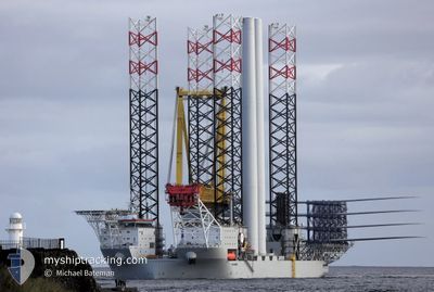
The vessel VOLTAIRE (IMO: 9899284, MMSI: 253813000) is a Other Type It's sailing under the flag of [LU] Luxembourg.
In this page you can find informations about the vessels current position, last detected port calls, and current voyage information. If the vessels is not in coverage by AIS you will find the latest position.
The current position of VOLTAIRE is detected by our AIS receivers and we are not responsible for the reliability of the data. The last position was recorded while the vessel was in Coverage by the Ais receivers of our vessel tracking app.
The current draught of VOLTAIRE as reported by AIS is 6.6 meters
Weather
| Temperature | 12.2°C / 53.96°F |
|---|---|
| Wind Speed | 9 knots |
| Direction | 265° W |
| Pressure | 1023 hPa |
| Humidity | 80.2 % |
| Cloud Coverage | 66 % |
Featured Company
Last Port Calls
| Port | Arrival | Departure | Time In Port |
|---|---|---|---|
| 2024-05-01 19:40 | 2024-05-08 14:58 | 6 d | |
| 2024-04-18 11:13 | 2024-04-26 16:37 | 8 d | |
| 2024-04-16 21:28 |
Most Visited Ports (Last year)
| Port | Arrivals | |
|---|---|---|
| 9 | ||
| 1 | ||
| 1 |
Last Trips
| Origin | Departure | Destination | Arrival | Distance | |
|---|---|---|---|---|---|
| 2024-04-26 17:37 | 2024-05-01 20:40 | 219.30 nm | |||
| 2024-04-16 23:28 | 2024-04-18 12:13 | 306.10 nm |
Events
| Time | Event | Details | Position / Dest | Info |
|---|---|---|---|---|
| 2024-06-02 21:37 | OUT of Coverage |
54.77268 / 1.67374
North Sea
|
Speed: Course: 248.2° |
|
| 2024-06-02 21:10 | IN Coverage |
54.77271 / 1.67368
North Sea
|
Speed: Course: 248.2° |
|
| 2024-06-02 16:55 | OUT of Coverage |
54.77269 / 1.67365
North Sea
|
Speed: Course: 248.2° |
|
| 2024-06-02 16:43 | IN Coverage |
54.77269 / 1.67363
North Sea
|
Speed: Course: 248.2° |
|
| 2024-06-02 15:31 | OUT of Coverage |
54.77264 / 1.67361
North Sea
|
Speed: Course: 248.2° |
|
| 2024-06-02 14:28 | Status Changed | Moored Restricted manoeuverability |
54.77267 / 1.67364
DOGGERBANK
|
Speed: Course: 172° |
| 2024-06-02 12:01 | IN Coverage |
54.77269 / 1.67368
North Sea
|
Speed: Course: 248.2° |
|
| 2024-06-02 10:54 | OUT of Coverage |
54.77267 / 1.67367
North Sea
|
Speed: Course: 248.2° |
|
| 2024-06-02 09:49 | IN Coverage |
54.77270 / 1.67362
North Sea
|
Speed: Course: 248.2° |
|
| 2024-06-02 07:05 | OUT of Coverage |
54.77273 / 1.67367
North Sea
|
Speed: Course: 248.2° |