
VS LEIA
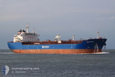
Oil Products Tanker
Current Trip
| Trip Time | 19 days |
|---|---|
| Trip Distance | 3105.74 nm |
| AVG Speed | 9 Knots |
| MAX Speed | 14.3 Knots |
| Draught | 7.2 m |
| AVG Wind | 11.9 knots |
| MAX Wind | 28.8 knots |
| MIN Temp | 15.7°C / 60.26°F |
| MAX Temp | 25.6°C / 78.08°F |
| Position Received | 2 d ago |
Current Position
| Longitude | 29.72642° |
|---|---|
| Latitude | 31.24029° |
| Status | At anchor |
| Speed | 0.1 Knots |
| Course | 227° |
| Area | Mediterranean Sea - Eastern Basin |
| Station | T-AIS |
| Position Received | 2 d ago |
Info
Information
The current position of VS LEIA is in Mediterranean Sea - Eastern Basin with coordinates 31.24029° / 29.72642° as reported on 2024-05-26 22:19 by AIS to our vessel tracker app. The vessel's current speed is 0.1 Knots and is currently inside the port of EL DEKHEILA.
The vessel VS LEIA (IMO: 9303730, MMSI: 232019341) is a Oil Products Tanker that was built in 2006 ( 18 years old ). It's sailing under the flag of [GB] United Kingdom.
In this page you can find informations about the vessels current position, last detected port calls, and current voyage information. If the vessels is not in coverage by AIS you will find the latest position.
The current position of VS LEIA is detected by our AIS receivers and we are not responsible for the reliability of the data. The last position was recorded while the vessel was in Coverage by the Ais receivers of our vessel tracking app.
The current draught of VS LEIA as reported by AIS is 7.2 meters
Weather
| Temperature | 21.4°C / 70.52°F |
|---|---|
| Wind Speed | 8 knots |
| Direction | 334° NNW |
| Pressure | 1014.2 hPa |
| Humidity | 64.6 % |
| Cloud Coverage | --- |
Featured Company
Last Port Calls
| Port | Arrival | Departure | Time In Port |
|---|---|---|---|
| 2024-05-27 08:13 | |||
| 2024-05-05 22:14 | 2024-05-07 15:45 | 1 d | |
| 2024-04-20 06:07 | 2024-04-21 03:34 | 21 h | |
| 2024-04-12 16:09 | 2024-04-13 20:23 | 1 d | |
| 2024-04-04 10:21 | 2024-04-08 06:15 | 3 d | |
| 2024-03-27 10:33 | 2024-03-28 20:03 | 1 d | |
| 2024-03-23 07:20 | 2024-03-25 08:48 | 2 d | |
| 2024-03-19 15:54 | |||
| 2024-03-12 08:17 | 2024-03-14 15:37 | 2 d | |
| 2024-03-04 11:50 | 2024-03-09 10:01 | 4 d |
Most Visited Ports (Last year)
| Port | Arrivals | |
|---|---|---|
| 8 | ||
| 4 | ||
| 3 | ||
| 3 | ||
| 2 | ||
| 2 |
Last Trips
| Origin | Departure | Destination | Arrival | Distance | |
|---|---|---|---|---|---|
| 2024-05-07 17:45 | 2024-05-27 10:13 | 3105.74 nm | |||
| 2024-04-21 05:34 | 2024-05-06 00:14 | 1554.12 nm | |||
| 2024-04-13 22:23 | 2024-04-20 08:07 | 1656.46 nm | |||
| 2024-04-08 08:15 | 2024-04-12 18:09 | 402.59 nm | |||
| 2024-03-28 21:03 | 2024-04-04 12:21 | 237.68 nm | |||
| 2024-03-25 09:48 | 2024-03-27 11:33 | 448.17 nm | |||
| 2024-03-14 16:37 | 2024-03-19 15:54 | 1266.28 nm | |||
| 2024-03-09 12:01 | 2024-03-12 09:17 | 615.87 nm | |||
| 2024-02-26 00:00 | 2024-03-04 13:50 | 758.12 nm |
Events
| Time | Event | Details | Position / Dest | Info |
|---|---|---|---|---|
| 2024-05-27 08:45 | STOP Moving |
31.13635 / 29.80553
[EG] EL DEKHEILA
|
Speed: 0.2 kn Course: 358° |
|
| 2024-05-27 08:13 | PORT ARRIVAL |
|
31.15476 / 29.80800
[EG] EL DEKHEILA
|
Speed: 5.8 kn Course: 174° |
| 2024-05-27 06:49 | START Moving | 4.59 nm, North West of ALEXANDRIA |
31.24822 / 29.81803
EGEDK
|
Speed: 3.5 kn Course: 239° |
| 2024-05-27 06:33 | STOP Moving | 4.47 nm, North West of ALEXANDRIA |
31.24810 / 29.82236
EGEDK
|
Speed: 0.1 kn Course: 308° |
| 2024-05-27 02:22 | START Moving | 7.07 nm, North West of EL DEKHEILA |
31.24011 / 29.72243
EGEDK
|
Speed: 3.4 kn Course: 302° |
| 2024-05-26 22:28 | Status Changed | Default At anchor |
31.24028 / 29.72664
EGEDK
|
Speed: 0.1 kn Course: 227° |
| 2024-05-26 22:19 | OUT of Coverage |
31.24029 / 29.72642
Mediterranean Sea - Eastern Basin
|
Speed: 0.1 kn Course: 127.5° |
|
| 2024-05-26 22:16 | Status Changed | At anchor Default |
31.24040 / 29.72649
EGEDK
|
Speed: 0.1 kn Course: 236° |
| 2024-05-26 22:10 | Status Changed | Default At anchor |
31.24024 / 29.72655
EGEDK
|
Speed: 0.1 kn Course: 232° |
| 2024-05-26 21:49 | Status Changed | At anchor Default |
31.24022 / 29.72663
EGEDK
|
Speed: 0.3 kn Course: 218° |