
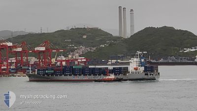
WAN HAI 232
Container Ship
Current Trip
| Trip Time | 4 days |
|---|---|
| Trip Distance | 1647.45 nm |
| AVG Speed | 15.6 Knots |
| MAX Speed | 19.2 Knots |
| Draught | 9.6 m |
| AVG Wind | 9.3 knots |
| MAX Wind | 18.9 knots |
| MIN Temp | 25.1°C / 77.18°F |
| MAX Temp | 31°C / 87.8°F |
| Position Received | 1 d ago |
Current Position
| Longitude | 103.45386° |
|---|---|
| Latitude | 1.22074° |
| Status | Under way using engine |
| Speed | 18.1 Knots |
| Course | 282.1° |
| Area | Malacca Strait |
| Station | T-AIS |
| Position Received | 1 d ago |
Info
Information
The current position of WAN HAI 232 is in Malacca Strait with coordinates 1.22074° / 103.45386° as reported on 2024-05-19 07:02 by AIS to our vessel tracker app. The vessel's current speed is 18.1 Knots and is currently inside the port of PORT KLANG.
The vessel WAN HAI 232 (IMO: 9208162, MMSI: 416047000) is a Container Ship that was built in 2000 ( 24 years old ). It's sailing under the flag of [TW] Taiwan.
In this page you can find informations about the vessels current position, last detected port calls, and current voyage information. If the vessels is not in coverage by AIS you will find the latest position.
The current position of WAN HAI 232 is detected by our AIS receivers and we are not responsible for the reliability of the data. The last position was recorded while the vessel was in Coverage by the Ais receivers of our vessel tracking app.
The current draught of WAN HAI 232 as reported by AIS is 9.6 meters
Weather
| Temperature | 29.5°C / 85.1°F |
|---|---|
| Wind Speed | 11 knots |
| Direction | 143° SE |
| Pressure | 1005.7 hPa |
| Humidity | 76.5 % |
| Cloud Coverage | 100 % |
Featured Company
Last Port Calls
| Port | Arrival | Departure | Time In Port |
|---|---|---|---|
| 2024-05-19 17:21 | |||
| 2024-05-15 00:50 | 2024-05-15 16:12 | 15 h | |
| 2024-05-13 03:47 | 2024-05-13 14:19 | 10 h | |
| 2024-05-12 08:47 | 2024-05-12 19:38 | 10 h | |
| 2024-05-11 16:58 | 2024-05-12 02:16 | 9 h | |
| 2024-05-11 00:28 | 2024-05-11 12:45 | 12 h | |
| 2024-05-09 06:28 | 2024-05-09 18:56 | 12 h | |
| 2024-04-30 15:16 | 2024-05-01 02:40 | 11 h | |
| 2024-04-29 19:23 | 2024-04-30 08:04 | 12 h | |
| 2024-04-29 00:34 | 2024-04-29 16:03 | 15 h |
Last Trips
| Origin | Departure | Destination | Arrival | Distance | |
|---|---|---|---|---|---|
| 2024-05-16 00:12 | 2024-05-20 01:21 | 1647.45 nm | |||
| 2024-05-13 22:19 | 2024-05-15 08:50 | 397.53 nm | |||
| 2024-05-13 03:38 | 2024-05-13 11:47 | 129.46 nm | |||
| 2024-05-12 10:16 | 2024-05-12 16:47 | 91.10 nm | |||
| 2024-05-11 20:45 | 2024-05-12 00:58 | 48.45 nm | |||
| 2024-05-10 02:56 | 2024-05-11 08:28 | 467.61 nm | |||
| 2024-05-01 10:40 | 2024-05-09 14:28 | 665.29 nm | |||
| 2024-04-30 16:04 | 2024-04-30 23:16 | 92.92 nm | |||
| 2024-04-30 00:03 | 2024-04-30 03:23 | 48.49 nm | |||
| 2024-04-28 02:39 | 2024-04-29 08:34 | 469.31 nm |
Events
| Time | Event | Details | Position / Dest | Info |
|---|---|---|---|---|
| 2024-05-19 17:21 | PORT ARRIVAL |
|
2.91125 / 101.27416
[MY] PORT KLANG
|
Speed: 13.6 kn Course: 25° |
| 2024-05-19 07:08 | Status Changed | Default Under way using engine |
1.22717 / 103.42490
MY PKG
|
Speed: 18.1 kn Course: 282.1° |
| 2024-05-19 07:02 | OUT of Coverage |
1.22074 / 103.45386
Malacca Strait
MY PKG
|
Speed: 18.1 kn Course: 282.1° |
|
| 2024-05-19 07:02 | Change Sea Area | Malaysian part of the Malacca Strait Malaysian part of the Singapore Strait |
1.21978 / 103.45817
Malacca Strait
MY PKG
|
Speed: 18.1 kn Course: 282.5° |
| 2024-05-19 06:36 | ETA Changed | 2024/05/20 00:45 2024/05/20 02:00 |
1.19443 / 103.58271
MY PKG
|
Speed: 16.3 kn Course: 281.7° |
| 2024-05-19 06:35 | Change Sea Area | Malaysian part of the Singapore Strait Indonesian part of the Singapore Strait |
1.19334 / 103.58801
Singapore Strait
MY PKG
|
Speed: 16.1 kn Course: 281.4° |
| 2024-05-19 06:08 | Change Sea Area | Indonesian part of the Singapore Strait Singaporean part of the Singapore Strait |
1.16003 / 103.69713
Singapore Strait
MY PKG
|
Speed: 14.3 kn Course: 297.7° |
| 2024-05-19 04:20 | Change Sea Area | Singaporean part of the Singapore Strait Indonesian part of the Singapore Strait |
1.26137 / 104.01146
Singapore Strait
MY PKG
|
Speed: 13 kn Course: 256.8° |
| 2024-05-19 04:05 | Change Sea Area | Indonesian part of the Singapore Strait Malaysian part of the Singapore Strait |
1.26953 / 104.06857
Singapore Strait
MY PKG
|
Speed: 14.9 kn Course: 258.4° |
| 2024-05-19 03:06 | Draught Changed | 9.6 9.7 |
1.30897 / 104.30512
MY PKG
|
Speed: 14.5 kn Course: 260.1° |