
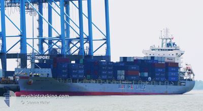
WAN HAI 277
Cargo
Current Trip
| Time Travelled | 3 days |
|---|---|
| Remaining Time | --- |
| Distance Travelled | 1211.33 nm |
| Remaining Distance | 421.96 nm |
| AVG Speed | 15.9 Knots |
| MAX Speed | 21.4 Knots |
| AVG Wind | 13.5 knots |
| MAX Wind | 27.9 knots |
| MIN Temp | 24.2°C / 75.56°F |
| MAX Temp | 28.7°C / 83.66°F |
| Draught | 7.4 m |
| Position Received | 1 d ago |
Current Position
| Longitude | 121.57128° |
|---|---|
| Latitude | 25.79419° |
| Status | Under way using engine |
| Speed | 20.3 Knots |
| Course | 58.8° |
| Area | Eastern China Sea |
| Station | T-AIS |
| Position Received | 1 d ago |
Info
Information
The current position of WAN HAI 277 is in Eastern China Sea with coordinates 25.79419° / 121.57128° as reported on 2024-06-13 23:25 by AIS to our vessel tracker app. The vessel's current speed is 20.3 Knots and is heading at the port of TOKYO. The estimated time of arrival as calculated by vessel tracking app is 2024-06-16 21:00 LT
The vessel WAN HAI 277 (IMO: 9833383, MMSI: 563121900) is a Cargo It's sailing under the flag of [SG] Singapore.
In this page you can find informations about the vessels current position, last detected port calls, and current voyage information. If the vessels is not in coverage by AIS you will find the latest position.
The current position of WAN HAI 277 is detected by our AIS receivers and we are not responsible for the reliability of the data. The last position was recorded while the vessel was in Coverage by the Ais receivers of our vessel tracking app.
The current draught of WAN HAI 277 as reported by AIS is 7.4 meters
Weather
| Temperature | 24.8°C / 76.64°F |
|---|---|
| Wind Speed | 6 knots |
| Direction | 294° WNW |
| Pressure | 1005.4 hPa |
| Humidity | 84 % |
| Cloud Coverage | 65 % |
Featured Company
Last Port Calls
| Port | Arrival | Departure | Time In Port |
|---|---|---|---|
| 2024-06-12 00:47 | 2024-06-12 21:13 | 20 h | |
| 2024-06-05 13:12 | 2024-06-07 03:57 | 1 d | |
| 2024-06-04 02:11 | 2024-06-04 23:59 | 21 h | |
| 2024-05-27 23:18 | 2024-05-28 08:49 | 9 h | |
| 2024-05-27 05:45 | 2024-05-27 17:03 | 11 h | |
| 2024-05-23 22:56 | 2024-05-24 08:22 | 9 h | |
| 2024-05-23 01:38 | 2024-05-23 21:23 | 19 h | |
| 2024-05-22 08:05 | 2024-05-23 00:57 | 16 h | |
| 2024-05-17 17:16 | 2024-05-18 08:16 | 15 h | |
| 2024-05-09 03:56 | 2024-05-10 01:06 | 21 h |
Last Trips
| Origin | Departure | Destination | Arrival | Distance | |
|---|---|---|---|---|---|
| 2024-06-07 11:57 | 2024-06-12 08:47 | 1893.57 nm | |||
| 2024-06-05 07:59 | 2024-06-05 21:12 | 197.05 nm | |||
| 2024-05-28 16:49 | 2024-06-04 10:11 | 2084.39 nm | |||
| 2024-05-28 01:03 | 2024-05-28 07:18 | 91.21 nm | |||
| 2024-05-24 17:22 | 2024-05-27 13:45 | 1159.58 nm | |||
| 2024-05-24 06:23 | 2024-05-24 07:56 | 10.61 nm | |||
| 2024-05-23 09:57 | 2024-05-23 10:38 | 7.28 nm | |||
| 2024-05-18 16:16 | 2024-05-22 17:05 | 1630.09 nm | |||
| 2024-05-10 09:06 | 2024-05-18 01:16 | 2057.83 nm | |||
| 2024-05-08 17:52 | 2024-05-09 11:56 | 204.16 nm |
Events
| Time | Event | Details | Position / Dest | Info |
|---|---|---|---|---|
| 2024-06-13 23:37 | Status Changed | Default Under way using engine |
25.83084 / 121.63849
JPTYO_O
|
Speed: 20.3 kn Course: 58.8° |
| 2024-06-13 23:25 | OUT of Coverage |
25.79419 / 121.57128
Eastern China Sea
JPTYO_O
|
Speed: 20.3 kn Course: 58.8° |
|
| 2024-06-13 23:13 | Status Changed | Under way using engine Default |
25.75742 / 121.50477
JPTYO_O
|
Speed: 21.2 kn Course: 55° |
| 2024-06-13 23:13 | IN Coverage |
25.75894 / 121.50759
Eastern China Sea
JPTYO_O
|
Speed: 21.3 kn Course: 59.8° |
|
| 2024-06-13 21:41 | Status Changed | Default Under way using engine |
25.43955 / 121.02173
JPTYO_O
|
Speed: 20.7 kn Course: 53.5° |
| 2024-06-13 21:36 | Change Sea Area | Taiwanese part of the Eastern China Sea Chinese part of the South China Sea |
25.42415 / 121.00016
Eastern China Sea
JPTYO_O
|
Speed: 20.7 kn Course: 53.5° |
| 2024-06-13 21:36 | OUT of Coverage |
25.42415 / 121.00016
Eastern China Sea
JPTYO_O
|
Speed: 20.7 kn Course: 53.5° |
|
| 2024-06-13 21:36 | Status Changed | Under way using engine Default |
25.42375 / 120.99957
JPTYO_O
|
Speed: 20.9 kn Course: 53° |
| 2024-06-13 21:25 | IN Coverage |
25.42415 / 121.00016
Eastern China Sea
JPTYO_O
|
Speed: 20.7 kn Course: 53.5° |
|
| 2024-06-13 01:06 | OUT of Coverage |
22.11796 / 114.66618
South China Sea
JPTYO_O
|
Speed: 19.5 kn Course: 87.1° |