
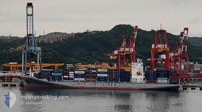
WAN HAI 323
Cargo
Current Trip
| Trip Time | 21 h, 9 mins |
|---|---|
| Trip Distance | 176.87 nm |
| AVG Speed | 15.6 Knots |
| MAX Speed | 18.8 Knots |
| Draught | 11.1 m |
| AVG Wind | 4.6 knots |
| MAX Wind | 8 knots |
| MIN Temp | 25.4°C / 77.72°F |
| MAX Temp | 30.1°C / 86.18°F |
| Position Received | 3 d ago |
Current Position
| Longitude | 103.49080° |
|---|---|
| Latitude | 1.22068° |
| Status | Under way using engine |
| Speed | 18.5 Knots |
| Course | 283.9° |
| Area | Singapore Strait |
| Station | T-AIS |
| Position Received | 3 d ago |
Info
Information
The current position of WAN HAI 323 is in Singapore Strait with coordinates 1.22068° / 103.49080° as reported on 2024-06-09 13:41 by AIS to our vessel tracker app. The vessel's current speed is 18.5 Knots and is currently inside the port of BELAWAN.
The vessel WAN HAI 323 (IMO: 9871464, MMSI: 563118300) is a Cargo It's sailing under the flag of [SG] Singapore.
In this page you can find informations about the vessels current position, last detected port calls, and current voyage information. If the vessels is not in coverage by AIS you will find the latest position.
The current position of WAN HAI 323 is detected by our AIS receivers and we are not responsible for the reliability of the data. The last position was recorded while the vessel was in Coverage by the Ais receivers of our vessel tracking app.
The current draught of WAN HAI 323 as reported by AIS is 11.1 meters
Weather
| Temperature | 29.7°C / 85.46°F |
|---|---|
| Wind Speed | 3 knots |
| Direction | 330° NNW |
| Pressure | 1012 hPa |
| Humidity | 69.5 % |
| Cloud Coverage | 86 % |
Featured Company
Last Port Calls
| Port | Arrival | Departure | Time In Port |
|---|---|---|---|
| 2024-06-13 01:34 | |||
| 2024-06-10 21:17 | 2024-06-12 04:25 | 1 d | |
| 2024-06-08 16:34 | 2024-06-09 11:32 | 18 h | |
| 2024-06-02 06:06 | 2024-06-02 20:06 | 13 h | |
| 2024-06-01 10:10 | 2024-06-02 00:42 | 14 h | |
| 2024-05-30 12:15 | 2024-05-31 05:35 | 17 h | |
| 2024-05-29 18:54 | 2024-05-30 03:18 | 8 h | |
| 2024-05-28 22:30 | 2024-05-29 11:16 | 12 h | |
| 2024-05-25 23:00 | 2024-05-26 08:59 | 9 h | |
| 2024-05-25 11:45 | 2024-05-25 22:28 | 10 h |
Last Trips
| Origin | Departure | Destination | Arrival | Distance | |
|---|---|---|---|---|---|
| 2024-06-12 12:25 | 2024-06-13 08:34 | 176.87 nm | |||
| 2024-06-09 19:32 | 2024-06-11 05:17 | 210.99 nm | |||
| 2024-06-03 04:06 | 2024-06-09 00:34 | 1567.02 nm | |||
| 2024-06-02 08:42 | 2024-06-02 14:06 | 74.56 nm | |||
| 2024-05-31 13:35 | 2024-06-01 18:10 | 363.94 nm | |||
| 2024-05-30 11:18 | 2024-05-30 20:15 | 136.34 nm | |||
| 2024-05-29 19:16 | 2024-05-30 02:54 | 120.88 nm | |||
| 2024-05-26 17:59 | 2024-05-29 06:30 | 1043.60 nm | |||
| 2024-05-26 07:28 | 2024-05-26 08:00 | 4.96 nm | |||
| 2024-05-25 11:31 | 2024-05-25 20:45 | 131.53 nm |
Events
| Time | Event | Details | Position / Dest | Info |
|---|---|---|---|---|
| 2024-06-13 01:34 | STOP Moving |
3.79526 / 98.71674
[ID] BELAWAN
|
Speed: Course: 228° |
|
| 2024-06-13 01:34 | PORT ARRIVAL |
|
3.79526 / 98.71674
[ID] BELAWAN
|
Speed: 1.4 kn Course: 217° |
| 2024-06-12 23:53 | START Moving | 8.72 nm, North East of BELAWAN |
3.92303 / 98.77706
MY PKG
|
Speed: 3.2 kn Course: 255° |
| 2024-06-12 14:41 | STOP Moving | 8.82 nm, North East of BELAWAN |
3.92539 / 98.77608
MY PKG
|
Speed: Course: 124° |
| 2024-06-12 04:25 | PORT DEPARTURE |
|
3.07397 / 101.33278
MY PKG
|
Speed: 12.5 kn Course: 327° |
| 2024-06-12 04:09 | START Moving |
3.03029 / 101.35464
[MY] PORT KLANG
|
Speed: 6 kn Course: 345° |
|
| 2024-06-10 22:17 | STOP Moving |
3.02522 / 101.35687
[MY] PORT KLANG
|
Speed: Course: 3° |
|
| 2024-06-10 21:17 | PORT ARRIVAL |
|
2.91420 / 101.27676
[MY] PORT KLANG
|
Speed: 13.5 kn Course: 32° |
| 2024-06-10 20:33 | START Moving | 12.41 nm, South of PORT KLANG |
2.80496 / 101.27254
MY PKG
|
Speed: 3.5 kn Course: 317° |
| 2024-06-10 01:45 | STOP Moving | 12.75 nm, South of PORT KLANG |
2.79722 / 101.27698
MY PKG
|
Speed: 0.3 kn Course: 327° |