
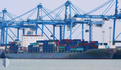
WAN HAI 505
Container Ship
Aktuelle Reise
| Bisherige Reisezeit | 2 Tage |
|---|---|
| Verbleibende Reisezeit | 1 h, 1 Minuten |
| Zurückgelegte Distanz | 887.35 nm |
| Verbleibende Distanz | 18.73 nm |
| Durchschnittliche Geschwindigkeit | 14.2 Knoten |
| Maximale Geschwindigkeit | 16.4 Knoten |
| Durchschnittliche Windgeschwindigkeit | 16.1 Knoten |
| Maximale Windgeschwindigkeit | 30.2 Knoten |
| Minimale Temperatur | 19.8°C / 67.64°F |
| Maximale Temperatur | 25.5°C / 77.9°F |
| Tiefgang | 10.9 m |
| Position erhalten | 1 m alt |
Aktuelle Position
| Länge | --- |
|---|---|
| Breite | --- |
| Zustand | Under way using engine |
| Geschwindigkeit | 13.8 Knoten |
| Kurs | 269° |
| Gebiet | South China Sea |
| Station | T-AIS |
| Position erhalten | 1 m alt |
Schiffsdetails
Information
Die WAN HAI 505 befindet sich derzeit in South China Sea mit den Koordinaten 22.13667° / 114.50898°, Diese Position wurde am 2024-11-16 15:27 von unserer Schiffsverfolgungs-App über AIS erfasst. Das Schiff fährt momentan mit einer Geschwindigkeit von 13.8 Knoten und fahrt in den Hafen von HONG KONG. Die geschatzte Ankunftszeit, berechnet von der -App zur Schiffsverfolgung, ist 2024-11-16 16:29 LT
Das Schiff WAN HAI 505 (IMO: 9294874, MMSI: 565004000) ist Container Ship das wurde im Jahr 2005 ( 19 Jahre alt ) gebaut. und fährt unter der Flagge von [SG] Singapore.
Auf dieser Seite erhalten Sie Informationen zur aktuellen Position des Schiffes, zu den letzten bekannten Hafenanläufen und zu den aktuellen Reiseinformationen. Sollte das Schiff nicht durch AIS abgedeckt sein, wird die zuletzt erfasste Position angezeigt.
Die WAN HAI 505 wird durch unsere AIS-Empfänger ermittelt. Wir übernehmen keine Gewähr für die Richtigkeit der Daten. Die letzte Position wurde von unseren AIS-Empfängern aufgezeichnet, während das Schiff in Reichweite war.
Der aktuelle Entwurf von WAN HAI 505, wie von AIS gemeldet, betragt 10.9 meter
Wetter
| Temperatur | 24.2°C / 75.56°F |
|---|---|
| Windgeschwindigkeit | 11 Knoten |
| Windrichtung | 95° E |
| Luftdruck | 1013.1 hPa |
| Luftfeuchtigkeit | 91.8 % |
| Wolken | 24 % |
Featured Company
Letzte Hafenanläufe
| Hafen | Ankunft | Abfahrt | Time In Port |
|---|---|---|---|
| 2024-11-13 16:04 | 2024-11-14 00:41 | 8 h | |
| 2024-11-07 13:42 | 2024-11-08 12:25 | 22 h | |
| 2024-11-05 01:36 | 2024-11-05 19:44 | 18 h | |
| 2024-10-26 02:35 | 2024-10-26 18:35 | 16 h | |
| 2024-10-23 15:10 | 2024-10-24 10:47 | 19 h | |
| 2024-10-18 07:37 | 2024-10-19 10:20 | 1 d | |
| 2024-10-16 11:53 | 2024-10-18 05:25 | 1 d | |
| 2024-10-10 14:29 | 2024-10-11 12:21 | 21 h | |
| 2024-10-09 15:17 | 2024-10-09 22:47 | 7 h | |
| 2024-10-05 06:41 | 2024-10-05 20:25 | 13 h |
Meistbesuchte Häfen (Letztes Jahr)
| Hafen | Ankünfte | |
|---|---|---|
| 18 | ||
| 11 | ||
| 8 | ||
| 4 | ||
| 4 | ||
| 4 |
Letzte Reisen
| Herkunft | Abfahrt | Ziel | Ankunft | Distanz | |
|---|---|---|---|---|---|
| 2024-11-08 21:25 | 2024-11-14 00:04 | 489.30 nm | |||
| 2024-11-06 03:44 | 2024-11-07 22:42 | 496.71 nm | |||
| 2024-10-27 02:35 | 2024-11-05 09:36 | 2659.94 nm | |||
| 2024-10-24 18:47 | 2024-10-26 10:35 | 243.42 nm | |||
| 2024-10-19 15:50 | 2024-10-23 23:10 | 1423.86 nm | |||
| 2024-10-18 10:55 | 2024-10-18 13:07 | 23.60 nm | |||
| 2024-10-11 20:21 | 2024-10-16 17:23 | 1422.34 nm | |||
| 2024-10-10 06:47 | 2024-10-10 22:29 | 193.82 nm | |||
| 2024-10-06 04:25 | 2024-10-09 23:17 | 1478.73 nm | |||
| 2024-10-01 22:53 | 2024-10-05 14:41 | 1365.79 nm |
Events
| Zeit | Ereignis | Details | Position / Ziel | Information |
|---|---|---|---|---|
| 2024-11-16 15:06 | geänderter Status | Under way using engine Default |
22.13493 / 114.56797
HONG KONG
|
Geschwindigkeit: 8 kn Kurs: 288° |
| 2024-11-16 15:04 | geänderter Status | Default Under way using engine |
22.13386 / 114.57151
HONG KONG
|
Geschwindigkeit: 11.5 kn Kurs: 284.1° |
| 2024-11-16 14:26 | geänderter Tiefgang | 10.9 10.7 |
22.12848 / 114.72767
HONG KONG
|
Geschwindigkeit: 14.5 kn Kurs: 260.4° |
| 2024-11-16 14:26 | geändertes Ziel | HONG KONG CNSHA |
22.12848 / 114.72767
HONG KONG
|
Geschwindigkeit: 14.5 kn Kurs: 260.4° |
| 2024-11-16 14:26 | geänderte voraussichtliche Ankunftszeit | 2024/11/16 18:30 2024/11/07 13:00 |
22.12848 / 114.72767
HONG KONG
|
Geschwindigkeit: 14.5 kn Kurs: 260.4° |
| 2024-11-16 13:54 | geänderter Status | Under way using engine Default |
22.14792 / 114.86217
CNSHA
|
Geschwindigkeit: 14.6 kn Kurs: 266° |
| 2024-11-16 13:44 | geänderter Status | Default Under way using engine |
22.15090 / 114.90540
CNSHA
|
Geschwindigkeit: 14.7 kn Kurs: 258.6° |
| 2024-11-16 13:37 | geänderter Status | Under way using engine Default |
22.15478 / 114.93873
CNSHA
|
Geschwindigkeit: 14.8 kn Kurs: 260° |
| 2024-11-16 13:32 | geänderter Status | Default Under way using engine |
22.15788 / 114.95750
CNSHA
|
Geschwindigkeit: 14.9 kn Kurs: 259.8° |
| 2024-11-16 13:27 | Ändere Seegebiet | Chinese part of the South China Sea South Korean part of the Japan Sea |
22.16137 / 114.97896
South China Sea
|
Geschwindigkeit: 14.9 kn Kurs: 259.8° |