
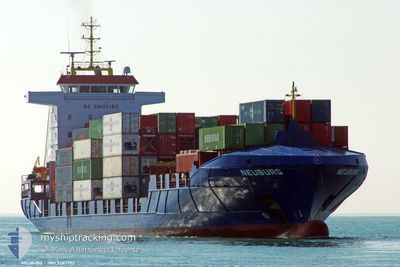
WEC VAN RUYSDAEL
Container Ship
Current Trip
| Time Travelled | 1 day |
|---|---|
| Remaining Time | 19 h, 2 mins |
| Distance Travelled | 429.29 nm |
| Remaining Distance | 300.38 nm |
| AVG Speed | 14.9 Knots |
| MAX Speed | 16.4 Knots |
| AVG Wind | 11.8 knots |
| MAX Wind | 19 knots |
| MIN Temp | 14°C / 57.2°F |
| MAX Temp | 16°C / 60.8°F |
| Draught | 6.8 m |
| Position Received | 16 m ago |
Current Position
| Longitude | -3.93135° |
|---|---|
| Latitude | 49.42102° |
| Status | Under way using engine |
| Speed | 15.2 Knots |
| Course | 60.9° |
| Area | English Channel |
| Station | T-AIS |
| Position Received | 16 m ago |
Info
Information
The current position of WEC VAN RUYSDAEL is in English Channel with coordinates 49.42102° / -3.93135° as reported on 2024-06-02 04:20 by AIS to our vessel tracker app. The vessel's current speed is 15.2 Knots and is heading at the port of THAMESPORT. The estimated time of arrival as calculated by vessel tracking app is 2024-06-02 23:39 LT
The vessel WEC VAN RUYSDAEL (IMO: 9287792, MMSI: 255806327) is a Container Ship that was built in 2004 ( 20 years old ). It's sailing under the flag of [PT] Portugal.
In this page you can find informations about the vessels current position, last detected port calls, and current voyage information. If the vessels is not in coverage by AIS you will find the latest position.
The current position of WEC VAN RUYSDAEL is detected by our AIS receivers and we are not responsible for the reliability of the data. The last position was recorded while the vessel was in Coverage by the Ais receivers of our vessel tracking app.
The current draught of WEC VAN RUYSDAEL as reported by AIS is 6.8 meters
Weather
| Temperature | 14.2°C / 57.56°F |
|---|---|
| Wind Speed | 8 knots |
| Direction | 36° NE |
| Pressure | 1027.9 hPa |
| Humidity | 87.6 % |
| Cloud Coverage | 53 % |
Featured Company
Last Port Calls
| Port | Arrival | Departure | Time In Port |
|---|---|---|---|
| 2024-05-31 10:04 | 2024-05-31 23:36 | 13 h | |
| 2024-05-28 19:10 | 2024-05-29 04:59 | 9 h | |
| 2024-05-28 03:59 | 2024-05-28 17:35 | 13 h | |
| 2024-05-27 03:05 | 2024-05-27 15:25 | 12 h | |
| 2024-05-27 02:45 | 2024-05-27 02:51 | 5 m | |
| 2024-05-24 04:18 | 2024-05-24 22:43 | 18 h | |
| 2024-05-21 13:11 | 2024-05-21 19:21 | 6 h | |
| 2024-05-21 06:11 | 2024-05-21 13:00 | 6 h | |
| 2024-05-20 02:27 | 2024-05-21 03:37 | 1 d | |
| 2024-05-18 16:01 | 2024-05-19 15:16 | 23 h |
Most Visited Ports (Last year)
| Port | Arrivals | |
|---|---|---|
| 29 | ||
| 20 | ||
| 19 | ||
| 18 | ||
| 16 | ||
| 15 |
Last Trips
| Origin | Departure | Destination | Arrival | Distance | |
|---|---|---|---|---|---|
| 2024-05-29 06:59 | 2024-05-31 12:04 | 798.40 nm | |||
| 2024-05-28 19:35 | 2024-05-28 21:10 | 16.41 nm | |||
| 2024-05-27 16:25 | 2024-05-28 05:59 | 156.18 nm | |||
| 2024-05-27 03:51 | 2024-05-27 04:05 | 0.71 nm | |||
| 2024-05-25 00:43 | 2024-05-27 03:45 | 758.21 nm | |||
| 2024-05-21 21:21 | 2024-05-24 06:18 | 803.48 nm | |||
| 2024-05-21 15:00 | 2024-05-21 15:11 | 0.83 nm | |||
| 2024-05-21 05:37 | 2024-05-21 08:11 | 22.87 nm | |||
| 2024-05-19 16:16 | 2024-05-20 04:27 | 159.89 nm | |||
| 2024-05-15 23:06 | 2024-05-18 17:01 | 784.17 nm |
Events
| Time | Event | Details | Position / Dest | Info |
|---|---|---|---|---|
| 2024-06-02 04:28 | Status Changed | Default Under way using engine |
49.43741 / -3.88694
GBTHP
|
Speed: 15.2 kn Course: 60.9° |
| 2024-06-02 03:04 | Status Changed | Under way using engine Default |
49.25301 / -4.36374
GBTHP
|
Speed: 15.6 kn Course: 62° |
| 2024-06-02 02:56 | Status Changed | Default Under way using engine |
49.23788 / -4.40806
GBTHP
|
Speed: 15.7 kn Course: 62.4° |
| 2024-06-02 01:32 | Change Sea Area | French part of the English Channel French part of the Celtic Sea |
49.04780 / -4.89804
English Channel
GBTHP
|
Speed: 16.1 kn Course: 59.8° |
| 2024-06-02 01:09 | ETA Changed | 2024/06/03 02:00 2024/06/03 03:00 |
48.99641 / -5.04038
GBTHP
|
Speed: 16.4 kn Course: 60.7° |
| 2024-06-02 00:54 | Status Changed | Under way using engine Default |
48.96463 / -5.12723
GBTHP
|
Speed: 16.3 kn Course: 60° |
| 2024-06-02 00:44 | IN Coverage |
48.96838 / -5.11695
Celtic Sea
GBTHP
|
Speed: 16.4 kn Course: 60.4° |
|
| 2024-06-02 00:01 | Status Changed | Default Under way using engine |
48.84667 / -5.44833
GBTHP
|
Speed: 15.7 kn Course: 49.9° |
| 2024-06-01 23:36 | Status Changed | Under way using engine Default |
48.79304 / -5.59424
GBTHP
|
Speed: 16 kn Course: 31° |
| 2024-06-01 23:36 | OUT of Coverage |
48.79304 / -5.59424
Celtic Sea
GBTHP
|
Speed: 15.7 kn Course: 49.9° |