
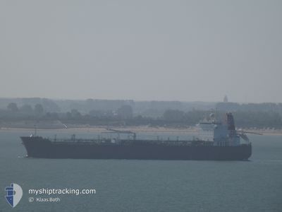
WENCHE VICTORY
Crude Oil Tanker
Current Trip
ANTIGU
| Time Travelled | 20 days |
|---|---|
| Remaining Time | --- |
| Distance Travelled | 4011.32 nm |
| Remaining Distance | --- |
| AVG Speed | 12.5 Knots |
| MAX Speed | 16.9 Knots |
| AVG Wind | 9.7 knots |
| MAX Wind | 19 knots |
| MIN Temp | 10.8°C / 51.44°F |
| MAX Temp | 29.1°C / 84.38°F |
| Draught | 9.1 m |
| Position Received | 5 h, 21 m ago |
Current Position
| Longitude | -62.85617° |
|---|---|
| Latitude | 18.35469° |
| Status | Under way using engine |
| Speed | 13.8 Knots |
| Course | 302.3° |
| Area | Caribbean Sea |
| Station | T-AIS |
| Position Received | 5 h, 21 m ago |
Info
Information
The current position of WENCHE VICTORY is in Caribbean Sea with coordinates 18.35469° / -62.85617° as reported on 2024-05-25 18:48 by AIS to our vessel tracker app. The vessel's current speed is 13.8 Knots
The vessel WENCHE VICTORY (IMO: 9288825, MMSI: 257351000) is a Crude Oil Tanker that was built in 2005 ( 19 years old ). It's sailing under the flag of [NO] Norway.
In this page you can find informations about the vessels current position, last detected port calls, and current voyage information. If the vessels is not in coverage by AIS you will find the latest position.
The current position of WENCHE VICTORY is detected by our AIS receivers and we are not responsible for the reliability of the data. The last position was recorded while the vessel was in Coverage by the Ais receivers of our vessel tracking app.
The current draught of WENCHE VICTORY as reported by AIS is 9.1 meters
Weather
| Temperature | 28.3°C / 82.94°F |
|---|---|
| Wind Speed | 11 knots |
| Direction | 101° E |
| Pressure | 1014.8 hPa |
| Humidity | 77.6 % |
| Cloud Coverage | 100 % |
Featured Company
Last Port Calls
| Port | Arrival | Departure | Time In Port |
|---|---|---|---|
| 2024-05-02 11:33 | 2024-05-05 08:32 | 2 d | |
| 2024-04-30 05:56 | 2024-04-30 06:57 | 1 h | |
| 2024-04-28 10:28 | 2024-04-29 14:51 | 1 d | |
| 2024-04-20 11:59 | 2024-04-24 14:42 | 4 d | |
| 2024-04-14 05:13 | 2024-04-16 10:15 | 2 d | |
| 2024-04-03 08:11 | 2024-04-04 20:37 | 1 d | |
| 2024-03-28 11:53 | 2024-03-29 15:39 | 1 d | |
| 2024-03-20 13:27 | 2024-03-23 11:51 | 2 d | |
| 2024-03-14 08:45 | 2024-03-18 15:25 | 4 d |
Last Trips
| Origin | Departure | Destination | Arrival | Distance | |
|---|---|---|---|---|---|
| 2024-04-30 08:57 | 2024-05-02 13:33 | 470.92 nm | |||
| 2024-04-29 16:51 | 2024-04-30 07:56 | 195.52 nm | |||
| 2024-04-24 16:42 | 2024-04-28 12:28 | 964.06 nm | |||
| 2024-04-16 11:15 | 2024-04-20 13:59 | 232.51 nm | |||
| 2024-04-04 22:37 | 2024-04-14 06:13 | 2481.57 nm | |||
| 2024-03-29 18:39 | 2024-04-03 10:11 | 857.81 nm | |||
| 2024-03-23 14:51 | 2024-03-28 14:53 | 322.13 nm | |||
| 2024-03-18 18:25 | 2024-03-20 16:27 | 656.24 nm | |||
| 2024-01-23 11:52 | 2024-03-14 11:45 | 10863.87 nm |
Events
| Time | Event | Details | Position / Dest | Info |
|---|---|---|---|---|
| 2024-05-25 18:53 | Status Changed | Default Under way using engine |
18.36333 / -62.87167
ANTIGU
|
Speed: 13.8 kn Course: 302.3° |
| 2024-05-25 18:48 | Status Changed | Under way using engine Default |
18.35469 / -62.85617
ANTIGU
|
Speed: 14 kn Course: 306° |
| 2024-05-25 18:48 | OUT of Coverage |
18.35469 / -62.85617
Caribbean Sea
|
Speed: 13.8 kn Course: 302.3° |
|
| 2024-05-25 18:32 | Status Changed | Default Under way using engine |
18.31333 / -62.80333
ANTIGU
|
Speed: 14.4 kn Course: 321.8° |
| 2024-05-25 18:27 | Status Changed | Under way using engine Default |
18.29897 / -62.79276
ANTIGU
|
Speed: 14.3 kn Course: 321° |
| 2024-05-25 18:05 | Status Changed | Default Under way using engine |
18.22833 / -62.73333
ANTIGU
|
Speed: 14.4 kn Course: 321° |
| 2024-05-25 17:57 | Change Sea Area | Anguilla part of the Caribbean Sea Saint-Martin part of the Caribbean Sea |
18.20601 / -62.71516
Caribbean Sea
|
Speed: 14.4 kn Course: 321° |
| 2024-05-25 17:57 | Status Changed | Under way using engine Default |
18.20601 / -62.71516
ANTIGU
|
Speed: 14 kn Course: 321° |
| 2024-05-25 17:38 | Status Changed | Default Under way using engine |
18.14333 / -62.66333
ANTIGU
|
Speed: 14.3 kn Course: 324° |
| 2024-05-25 16:34 | Detected in Sea | Saint-Martin part of the Caribbean Sea |
17.93809 / -62.51270
Caribbean Sea
|
Speed: 14.1 kn Course: 324.4° |