
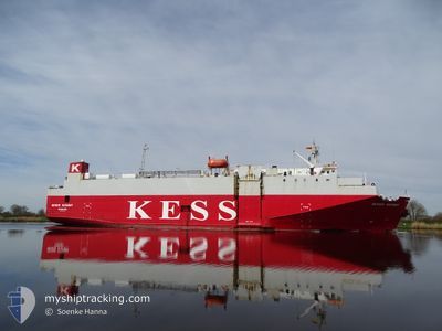
WESER HIGHWAY
Vehicles Carrier
Current Trip
| Time Travelled | 1 day |
|---|---|
| Remaining Time | 2 h, 56 mins |
| Distance Travelled | 358.31 nm |
| Remaining Distance | 41.61 nm |
| AVG Speed | 12.4 Knots |
| MAX Speed | 13.8 Knots |
| AVG Wind | 11.7 knots |
| MAX Wind | 17.6 knots |
| MIN Temp | 8.7°C / 47.66°F |
| MAX Temp | 16.9°C / 62.42°F |
| Draught | 5.5 m |
| Position Received | 1 m ago |
Current Position
| Longitude | 17.87387° |
|---|---|
| Latitude | 58.54323° |
| Status | Under way using engine |
| Speed | 13.7 Knots |
| Course | 10.9° |
| Area | Baltic Sea |
| Station | T-AIS |
| Position Received | 1 m ago |
Info
Information
The current position of WESER HIGHWAY is in Baltic Sea with coordinates 58.54323° / 17.87387° as reported on 2024-05-16 00:45 by AIS to our vessel tracker app. The vessel's current speed is 13.7 Knots and is heading at the port of SODERTALJE. The estimated time of arrival as calculated by vessel tracking app is 2024-05-16 03:42 LT
The vessel WESER HIGHWAY (IMO: 9065417, MMSI: 355390000) is a Vehicles Carrier that was built in 1994 ( 30 years old ). It's sailing under the flag of [PA] Panama.
In this page you can find informations about the vessels current position, last detected port calls, and current voyage information. If the vessels is not in coverage by AIS you will find the latest position.
The current position of WESER HIGHWAY is detected by our AIS receivers and we are not responsible for the reliability of the data. The last position was recorded while the vessel was in Coverage by the Ais receivers of our vessel tracking app.
The current draught of WESER HIGHWAY as reported by AIS is 5.5 meters
Weather
| Temperature | 8.7°C / 47.66°F |
|---|---|
| Wind Speed | 7 knots |
| Direction | 191° S |
| Pressure | 1023.6 hPa |
| Humidity | 79.5 % |
| Cloud Coverage | 21 % |
Featured Company
Last Port Calls
| Port | Arrival | Departure | Time In Port |
|---|---|---|---|
| 2024-05-14 09:08 | 2024-05-14 16:17 | 7 h | |
| 2024-05-14 02:55 | 2024-05-14 02:57 | 2 m | |
| 2024-05-13 11:18 | 2024-05-13 15:06 | 3 h | |
| 2024-05-11 20:04 | 2024-05-12 05:12 | 9 h | |
| 2024-05-10 01:01 | 2024-05-10 18:16 | 17 h | |
| 2024-05-09 04:18 | 2024-05-09 04:54 | 36 m | |
| 2024-05-08 16:19 | 2024-05-08 16:46 | 26 m | |
| 2024-05-06 21:46 | 2024-05-07 14:42 | 16 h | |
| 2024-05-06 01:42 | 2024-05-06 02:42 | 59 m | |
| 2024-05-05 13:58 | 2024-05-05 14:23 | 24 m |
Last Trips
| Origin | Departure | Destination | Arrival | Distance | |
|---|---|---|---|---|---|
| 2024-05-14 04:57 | 2024-05-14 11:08 | 80.37 nm | |||
| 2024-05-13 17:06 | 2024-05-14 04:55 | 69.09 nm | |||
| 2024-05-12 06:12 | 2024-05-13 13:18 | 376.97 nm | |||
| 2024-05-10 20:16 | 2024-05-11 21:04 | 338.69 nm | |||
| 2024-05-09 05:54 | 2024-05-10 03:01 | 272.70 nm | |||
| 2024-05-08 17:46 | 2024-05-09 05:18 | 0.83 nm | |||
| 2024-05-07 16:42 | 2024-05-08 17:19 | 277.30 nm | |||
| 2024-05-06 03:42 | 2024-05-06 23:46 | 273.32 nm | |||
| 2024-05-05 15:23 | 2024-05-06 02:42 | 0.77 nm | |||
| 2024-05-04 16:56 | 2024-05-05 14:58 | 274.96 nm |
Events
| Time | Event | Details | Position / Dest | Info |
|---|---|---|---|---|
| 2024-05-15 22:13 | START Moving |
58.00550 / 17.66051
SESOE
|
Speed: 5.8 kn Course: 276.9° |
|
| 2024-05-15 22:09 | STOP Moving |
58.00517 / 17.66581
SESOE
|
Speed: 0.3 kn Course: 283° |
|
| 2024-05-15 20:18 | ETA Changed | 2024/05/15 02:00 2024/05/15 22:30 |
58.00653 / 17.62599
SESOE
|
Speed: 0.7 kn Course: 285° |
| 2024-05-15 17:20 | Status Changed | Under way using engine Default |
57.86065 / 17.55787
SESOE
|
Speed: 12.7 kn Course: 12° |
| 2024-05-15 17:17 | IN Coverage |
57.86065 / 17.55787
Baltic Sea
SESOE
|
Speed: 13 kn Course: 13.1° |
|
| 2024-05-15 15:53 | Status Changed | Default Under way using engine |
57.55357 / 17.42687
SESOE
|
Speed: 12.9 kn Course: 11.4° |
| 2024-05-15 15:47 | OUT of Coverage |
57.53299 / 17.41859
Baltic Sea
SESOE
|
Speed: 12.9 kn Course: 11.4° |
|
| 2024-05-15 13:01 | Status Changed | Under way using engine Default |
56.94842 / 17.18311
SESOE
|
Speed: 13.2 kn Course: 10° |
| 2024-05-15 12:20 | Status Changed | Default Under way using engine |
56.80418 / 17.12378
SESOE
|
Speed: 13 kn Course: 13° |
| 2024-05-15 12:05 | Status Changed | Under way using engine Default |
56.74973 / 17.10039
SESOE
|
Speed: 12.9 kn Course: 13° |