
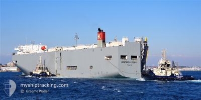
WESTERN HIGHWAY
Vehicles Carrier
Current Trip
| Time Travelled | 11 days |
|---|---|
| Remaining Time | 17 h, 56 mins |
| Distance Travelled | 4759.60 nm |
| Remaining Distance | 312.72 nm |
| AVG Speed | 16.8 Knots |
| MAX Speed | 19.4 Knots |
| AVG Wind | 8.6 knots |
| MAX Wind | 23.9 knots |
| MIN Temp | 8.5°C / 47.3°F |
| MAX Temp | 21°C / 69.8°F |
| Draught | 8 m |
| Position Received | 3 h, 39 m ago |
Current Position
| Longitude | -123.69118° |
|---|---|
| Latitude | 31.30095° |
| Status | Under way using engine |
| Speed | 17 Knots |
| Course | 121° |
| Area | North Pacific Ocean |
| Station | T-AIS |
| Position Received | 3 h, 39 m ago |
Info
Information
The current position of WESTERN HIGHWAY is in North Pacific Ocean with coordinates 31.30095° / -123.69118° as reported on 2024-05-31 23:22 by AIS to our vessel tracker app. The vessel's current speed is 17 Knots and is heading at the port of SAN DIEGO. The estimated time of arrival as calculated by vessel tracking app is 2024-06-01 20:57 LT
The vessel WESTERN HIGHWAY (IMO: 9325776, MMSI: 372548000) is a Vehicles Carrier that was built in 2007 ( 17 years old ). It's sailing under the flag of [PA] Panama.
In this page you can find informations about the vessels current position, last detected port calls, and current voyage information. If the vessels is not in coverage by AIS you will find the latest position.
The current position of WESTERN HIGHWAY is detected by our AIS receivers and we are not responsible for the reliability of the data. The last position was recorded while the vessel was in Coverage by the Ais receivers of our vessel tracking app.
The current draught of WESTERN HIGHWAY as reported by AIS is 8 meters
Weather
| Temperature | 15.7°C / 60.26°F |
|---|---|
| Wind Speed | 17 knots |
| Direction | 329° NNW |
| Pressure | 1016.1 hPa |
| Humidity | 82.9 % |
| Cloud Coverage | 98 % |
Featured Company
Last Trips
| Origin | Departure | Destination | Arrival | Distance | |
|---|---|---|---|---|---|
| 2024-05-18 13:08 | 2024-05-20 12:25 | 709.90 nm | |||
| 2024-04-13 17:54 | 2024-05-17 11:11 | 10720.18 nm | |||
| 2024-04-11 17:13 | 2024-04-12 19:20 | 413.24 nm | |||
| 2024-04-08 15:02 | 2024-04-11 07:02 | 758.58 nm | |||
| 2024-03-23 17:07 | 2024-04-08 07:05 | 5378.75 nm |
Events
| Time | Event | Details | Position / Dest | Info |
|---|---|---|---|---|
| 2024-05-31 23:27 | Status Changed | Default Under way using engine |
31.28942 / -123.66983
US SAN
|
Speed: 17 kn Course: 121° |
| 2024-05-31 23:22 | OUT of Coverage |
31.30095 / -123.69118
North Pacific Ocean
US SAN
|
Speed: 17 kn Course: 121° |
|
| 2024-05-31 23:17 | Status Changed | Under way using engine Default |
31.31438 / -123.71633
US SAN
|
Speed: 16.8 kn Course: 122° |
| 2024-05-31 22:57 | IN Coverage |
31.31438 / -123.71633
North Pacific Ocean
US SAN
|
Speed: 16.8 kn Course: 122° |
|
| 2024-05-31 08:22 | Status Changed | Default Under way using engine |
33.43948 / -127.96340
US SAN
|
Speed: 16.9 kn Course: 119° |
| 2024-05-31 08:16 | OUT of Coverage |
33.45422 / -127.99407
North Pacific Ocean
US SAN
|
Speed: 16.9 kn Course: 119° |
|
| 2024-05-31 08:06 | Status Changed | Under way using engine Default |
33.47715 / -128.04173
US SAN
|
Speed: 16.8 kn Course: 119° |
| 2024-05-31 08:03 | Status Changed | Default Under way using engine |
33.48395 / -128.05574
US SAN
|
Speed: 16.7 kn Course: 119° |
| 2024-05-31 07:57 | Status Changed | Under way using engine Default |
33.49863 / -128.08627
US SAN
|
Speed: 16.6 kn Course: 119° |
| 2024-05-31 07:53 | Status Changed | Default Under way using engine |
33.50818 / -128.10660
US SAN
|
Speed: 16.7 kn Course: 118° |