
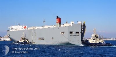
WESTERN HIGHWAY
Vehicles Carrier
Current Trip
| Time Travelled | 2 days |
|---|---|
| Remaining Time | --- |
| Distance Travelled | 774.51 nm |
| Remaining Distance | --- |
| AVG Speed | 12.3 Knots |
| MAX Speed | 17.7 Knots |
| AVG Wind | 10.7 knots |
| MAX Wind | 21 knots |
| MIN Temp | 9.8°C / 49.64°F |
| MAX Temp | 16.8°C / 62.24°F |
| Draught | 7 m |
| Position Received | 1 d ago |
Current Position
| Longitude | -128.51137° |
|---|---|
| Latitude | 38.50250° |
| Status | Under way using engine |
| Speed | 17.2 Knots |
| Course | 303° |
| Area | North Pacific Ocean |
| Station | T-AIS |
| Position Received | 1 d ago |
Info
Information
The current position of WESTERN HIGHWAY is in North Pacific Ocean with coordinates 38.50250° / -128.51137° as reported on 2024-06-08 06:29 by AIS to our vessel tracker app. The vessel's current speed is 17.2 Knots and is heading at the port of MASAN. The estimated time of arrival as calculated by vessel tracking app is 2024-06-19 23:00 LT
The vessel WESTERN HIGHWAY (IMO: 9325776, MMSI: 372548000) is a Vehicles Carrier that was built in 2007 ( 17 years old ). It's sailing under the flag of [PA] Panama.
In this page you can find informations about the vessels current position, last detected port calls, and current voyage information. If the vessels is not in coverage by AIS you will find the latest position.
The current position of WESTERN HIGHWAY is detected by our AIS receivers and we are not responsible for the reliability of the data. The last position was recorded while the vessel was in Coverage by the Ais receivers of our vessel tracking app.
The current draught of WESTERN HIGHWAY as reported by AIS is 7 meters
Weather
| Temperature | 13.6°C / 56.48°F |
|---|---|
| Wind Speed | 12 knots |
| Direction | 198° SSW |
| Pressure | 1022.5 hPa |
| Humidity | 74 % |
| Cloud Coverage | 84 % |
Featured Company
Last Port Calls
| Port | Arrival | Departure | Time In Port |
|---|---|---|---|
| 2024-06-06 04:34 | 2024-06-07 05:15 | 1 d | |
| 2024-06-03 23:37 | 2024-06-04 07:14 | 7 h | |
| 2024-06-02 12:19 | 2024-06-02 22:04 | 9 h | |
| 2024-05-20 03:25 | 2024-05-20 09:00 | 5 h | |
| 2024-05-17 02:11 | 2024-05-18 04:08 | 1 d | |
| 2024-04-12 10:20 | 2024-04-13 08:54 | 22 h | |
| 2024-04-10 22:02 | 2024-04-11 08:13 | 10 h | |
| 2024-04-07 22:05 | 2024-04-08 06:02 | 7 h |
Last Trips
| Origin | Departure | Destination | Arrival | Distance | |
|---|---|---|---|---|---|
| 2024-06-04 00:14 | 2024-06-05 21:34 | 381.96 nm | |||
| 2024-06-02 15:04 | 2024-06-03 16:37 | 166.57 nm | |||
| 2024-05-20 18:00 | 2024-06-02 05:19 | 5123.97 nm | |||
| 2024-05-18 13:08 | 2024-05-20 12:25 | 709.90 nm | |||
| 2024-04-13 17:54 | 2024-05-17 11:11 | 10720.18 nm | |||
| 2024-04-11 17:13 | 2024-04-12 19:20 | 413.24 nm | |||
| 2024-04-08 15:02 | 2024-04-11 07:02 | 758.58 nm | |||
| 2024-03-23 17:07 | 2024-04-08 07:05 | 5378.75 nm |
Events
| Time | Event | Details | Position / Dest | Info |
|---|---|---|---|---|
| 2024-06-08 06:35 | Status Changed | Default Under way using engine |
38.51985 / -128.54465
KR MAS
|
Speed: 17.2 kn Course: 303° |
| 2024-06-08 06:29 | Status Changed | Under way using engine Default |
38.50250 / -128.51137
KR MAS
|
Speed: 17.2 kn Course: 304° |
| 2024-06-08 06:29 | OUT of Coverage |
38.50250 / -128.51137
North Pacific Ocean
KR MAS
|
Speed: 17.2 kn Course: 303° |
|
| 2024-06-08 06:22 | Status Changed | Default Under way using engine |
38.48445 / -128.47766
KR MAS
|
Speed: 17.3 kn Course: 303° |
| 2024-06-08 05:52 | Status Changed | Under way using engine Default |
38.40082 / -128.32403
KR MAS
|
Speed: 17.4 kn Course: 305° |
| 2024-06-08 05:50 | Status Changed | Default Under way using engine |
38.39720 / -128.31744
KR MAS
|
Speed: 17.4 kn Course: 304° |
| 2024-06-08 05:30 | Status Changed | Under way using engine Default |
38.34243 / -128.21515
KR MAS
|
Speed: 17.1 kn Course: 303° |
| 2024-06-08 05:23 | Status Changed | Default Under way using engine |
38.32347 / -128.17897
KR MAS
|
Speed: 17.3 kn Course: 304° |
| 2024-06-08 04:59 | Change Sea Area | High seas of the North Pacific Ocean United States part of the North Pacific Ocean |
38.25680 / -128.05953
North Pacific Ocean
KR MAS
|
Speed: 16.7 kn Course: 305° |
| 2024-06-08 04:57 | Status Changed | Under way using engine Default |
38.25168 / -128.05042
KR MAS
|
Speed: 16.1 kn Course: 305° |