
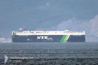
WILD ROSE LEADER
Cargo
Current Trip
| Time Travelled | 23 days |
|---|---|
| Remaining Time | --- |
| Distance Travelled | 5495.08 nm |
| Remaining Distance | 35.28 nm |
| AVG Speed | 11.9 Knots |
| MAX Speed | 18.4 Knots |
| AVG Wind | 11.5 knots |
| MAX Wind | 34.2 knots |
| MIN Temp | 6.6°C / 43.88°F |
| MAX Temp | 29.4°C / 84.92°F |
| Draught | 9.7 m |
| Position Received | 4 d ago |
Current Position
| Longitude | -62.47559° |
|---|---|
| Latitude | 16.43970° |
| Status | Under way using engine |
| Speed | 12.7 Knots |
| Course | 256.8° |
| Area | Caribbean Sea |
| Station | T-AIS |
| Position Received | 4 d ago |
Info
Information
The current position of WILD ROSE LEADER is in Caribbean Sea with coordinates 16.43970° / -62.47559° as reported on 2024-05-14 16:01 by AIS to our vessel tracker app. The vessel's current speed is 12.7 Knots and is heading at the port of CRISTOBAL. The estimated time of arrival as calculated by vessel tracking app is 2024-05-18 16:00 LT
The vessel WILD ROSE LEADER (IMO: 9925370, MMSI: 636022333) is a Cargo It's sailing under the flag of [LR] Liberia.
In this page you can find informations about the vessels current position, last detected port calls, and current voyage information. If the vessels is not in coverage by AIS you will find the latest position.
The current position of WILD ROSE LEADER is detected by our AIS receivers and we are not responsible for the reliability of the data. The last position was recorded while the vessel was in Coverage by the Ais receivers of our vessel tracking app.
The current draught of WILD ROSE LEADER as reported by AIS is 9.7 meters
Weather
| Temperature | 28.8°C / 83.84°F |
|---|---|
| Wind Speed | 14 knots |
| Direction | 56° NE |
| Pressure | 1007.5 hPa |
| Humidity | 83 % |
| Cloud Coverage | 29 % |
Featured Company
Last Port Calls
| Port | Arrival | Departure | Time In Port |
|---|---|---|---|
| 2024-04-24 00:22 | 2024-04-25 22:12 | 1 d | |
| 2024-04-21 21:45 | 2024-04-23 02:01 | 1 d | |
| 2024-04-18 15:14 | 2024-04-21 00:59 | 2 d | |
| 2024-03-16 10:39 | 2024-03-16 17:24 | 6 h |
Most Visited Ports (Last year)
| Port | Arrivals | |
|---|---|---|
| 7 | ||
| 4 | ||
| 3 | ||
| 3 | ||
| 2 | ||
| 2 |
Last Trips
| Origin | Departure | Destination | Arrival | Distance | |
|---|---|---|---|---|---|
| 2024-04-23 04:01 | 2024-04-24 02:22 | 331.35 nm | |||
| 2024-04-21 02:59 | 2024-04-21 23:45 | 312.34 nm | |||
| 2024-03-17 00:24 | 2024-04-18 17:14 | 12717.73 nm | |||
| 2024-02-28 20:25 | 2024-03-16 17:39 | 3745.24 nm |
Events
| Time | Event | Details | Position / Dest | Info |
|---|---|---|---|---|
| 2024-05-18 23:01 | STOP Moving |
9.97704 / -79.92851
PA CTB
|
Speed: 0.3 kn Course: 90° |
|
| 2024-05-18 22:25 | START Moving |
9.97674 / -79.94946
PA CTB
|
Speed: 4.9 kn Course: 119° |
|
| 2024-05-18 18:50 | STOP Moving |
9.94638 / -79.87498
PA CTB
|
Speed: 0.3 kn Course: 103° |
|
| 2024-05-14 16:24 | Status Changed | Default Under way using engine |
16.41808 / -62.55606
PA CTB
|
Speed: 12.7 kn Course: 256.8° |
| 2024-05-14 16:01 | OUT of Coverage |
16.43970 / -62.47559
Caribbean Sea
PA CTB
|
Speed: 12.7 kn Course: 256.8° |
|
| 2024-05-14 15:43 | Status Changed | Under way using engine Default |
16.45497 / -62.41087
PA CTB
|
Speed: 12.5 kn Course: 257° |
| 2024-05-14 15:34 | Status Changed | Default Under way using engine |
16.46223 / -62.37774
PA CTB
|
Speed: 12.7 kn Course: 256.4° |
| 2024-05-14 15:28 | Status Changed | Under way using engine Default |
16.46693 / -62.35694
PA CTB
|
Speed: 12.7 kn Course: 256° |
| 2024-05-14 15:12 | IN Coverage |
16.46693 / -62.35694
Caribbean Sea
PA CTB
|
Speed: 12.7 kn Course: 256.4° |
|
| 2024-05-14 13:28 | OUT of Coverage |
16.61554 / -61.95876
Caribbean Sea
PA CTB
|
Speed: 12.1 kn Course: 233.1° |