
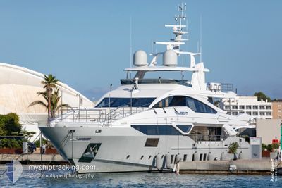
WILDCAT
Pleasure Craft
Current Trip
TR TURGUTREIS
| Time Travelled | 15 days |
|---|---|
| Remaining Time | --- |
| Distance Travelled | 253.74 nm |
| Remaining Distance | --- |
| AVG Speed | 13.7 Knots |
| MAX Speed | 19.3 Knots |
| AVG Wind | 11 knots |
| MAX Wind | 17.9 knots |
| MIN Temp | 16.6°C / 61.88°F |
| MAX Temp | 22.8°C / 73.04°F |
| Draught | 2.3 m |
| Position Received | 6 d ago |
Current Position
| Longitude | 28.30791° |
|---|---|
| Latitude | 36.73036° |
| Status | Under way using engine |
| Speed | 18.6 Knots |
| Course | 2.1° |
| Area | Mediterranean Sea - Eastern Basin |
| Station | T-AIS |
| Position Received | 6 d ago |
Info
Information
The current position of WILDCAT is in Mediterranean Sea - Eastern Basin with coordinates 36.73036° / 28.30791° as reported on 2024-05-10 16:26 by AIS to our vessel tracker app. The vessel's current speed is 18.6 Knots
The vessel WILDCAT (IMO: 9829289, MMSI: 319099800) is a Pleasure Craft It's sailing under the flag of [KY] Cayman Is.
In this page you can find informations about the vessels current position, last detected port calls, and current voyage information. If the vessels is not in coverage by AIS you will find the latest position.
The current position of WILDCAT is detected by our AIS receivers and we are not responsible for the reliability of the data. The last position was recorded while the vessel was in Coverage by the Ais receivers of our vessel tracking app.
The current draught of WILDCAT as reported by AIS is 2.3 meters
Weather
| Temperature | 18.9°C / 66.02°F |
|---|---|
| Wind Speed | 9 knots |
| Direction | 164° SSE |
| Pressure | 1002.7 hPa |
| Humidity | 78.9 % |
| Cloud Coverage | 99 % |
Featured Company
Most Visited Ports (Last year)
| Port | Arrivals | |
|---|---|---|
| 4 | ||
| 3 | ||
| 2 | ||
| 2 |
Events
| Time | Event | Details | Position / Dest | Info |
|---|---|---|---|---|
| 2024-05-10 16:26 | OUT of Coverage |
36.73036 / 28.30791
Mediterranean Sea - Eastern Basin
|
Speed: 18.6 kn Course: 2.1° |
|
| 2024-05-10 16:14 | Change Sea Area | Turkish part of the Mediterranean Sea - Eastern Basin Turkish part of the Aegean Sea |
36.68365 / 28.26538
Mediterranean Sea - Eastern Basin
|
Speed: 18.4 kn Course: 44.9° |
| 2024-05-10 15:02 | IN Coverage |
36.55051 / 27.98869
Aegean Sea
|
Speed: 15 kn Course: 85.6° |
|
| 2024-05-10 13:59 | OUT of Coverage |
36.65588 / 27.72848
Aegean Sea
|
Speed: 15 kn Course: 80.9° |
|
| 2024-05-10 12:36 | IN Coverage |
36.70010 / 27.35759
Aegean Sea
|
Speed: 14.5 kn Course: 178.3° |
|
| 2024-05-10 01:05 | OUT of Coverage |
37.10690 / 27.28261
Aegean Sea
|
Speed: Course: 303.2° |
|
| 2024-05-09 23:48 | IN Coverage |
37.10693 / 27.28262
Aegean Sea
|
Speed: Course: 303.2° |
|
| 2024-05-09 22:04 | OUT of Coverage |
37.10690 / 27.28264
Aegean Sea
|
Speed: Course: 303.2° |
|
| 2024-05-09 21:13 | IN Coverage |
37.10687 / 27.28264
Aegean Sea
|
Speed: Course: 303.2° |
|
| 2024-05-09 06:30 | OUT of Coverage |
37.13705 / 27.47145
Aegean Sea
|
Speed: 14 kn Course: 89° |