
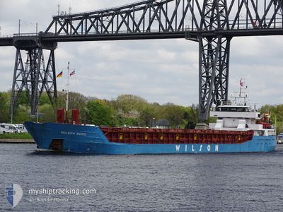
WILSON BORG
General Cargo
Current Trip
| Time Travelled | 4 days |
|---|---|
| Remaining Time | 2 days |
| Distance Travelled | 1088.84 nm |
| Remaining Distance | 617.72 nm |
| AVG Speed | 9.4 Knots |
| MAX Speed | 13.4 Knots |
| AVG Wind | 11.7 knots |
| MAX Wind | 25 knots |
| MIN Temp | 15°C / 59°F |
| MAX Temp | 21.8°C / 71.24°F |
| Draught | 5.8 m |
| Position Received | 1 h, 48 m ago |
Current Position
| Longitude | 16.91565° |
|---|---|
| Latitude | 36.51481° |
| Status | Under way using engine |
| Speed | 9.8 Knots |
| Course | 93.1° |
| Area | Mediterranean Sea - Eastern Basin |
| Station | T-AIS |
| Position Received | 1 h, 48 m ago |
Info
Information
The current position of WILSON BORG is in Mediterranean Sea - Eastern Basin with coordinates 36.51481° / 16.91565° as reported on 2024-05-23 12:46 by AIS to our vessel tracker app. The vessel's current speed is 9.8 Knots and is heading at the port of NEA KARVALI. The estimated time of arrival as calculated by vessel tracking app is 2024-05-26 08:42 LT
The vessel WILSON BORG (IMO: 9106924, MMSI: 314545000) is a General Cargo that was built in 1994 ( 30 years old ). It's sailing under the flag of [BB] Barbados.
In this page you can find informations about the vessels current position, last detected port calls, and current voyage information. If the vessels is not in coverage by AIS you will find the latest position.
The current position of WILSON BORG is detected by our AIS receivers and we are not responsible for the reliability of the data. The last position was recorded while the vessel was in Coverage by the Ais receivers of our vessel tracking app.
The current draught of WILSON BORG as reported by AIS is 5.8 meters
Weather
| Temperature | 21.9°C / 71.42°F |
|---|---|
| Wind Speed | 3 knots |
| Direction | 347° NNW |
| Pressure | 1018.2 hPa |
| Humidity | 56.6 % |
| Cloud Coverage | 6 % |
Featured Company
Last Port Calls
| Port | Arrival | Departure | Time In Port |
|---|---|---|---|
| 2024-05-13 15:22 | 2024-05-18 19:33 | 5 d | |
| 2024-05-01 02:06 | 2024-05-02 12:59 | 1 d | |
| 2024-04-28 18:37 | 2024-04-29 15:17 | 20 h | |
| 2024-04-24 23:41 | 2024-04-25 20:48 | 21 h | |
| 2024-04-21 23:41 | 2024-04-23 13:15 | 1 d | |
| 2024-04-19 03:14 | 2024-04-19 19:41 | 16 h | |
| 2024-04-08 18:35 | 2024-04-16 10:37 | 7 d | |
| 2024-03-18 04:01 | 2024-03-22 06:24 | 4 d | |
| 2024-03-11 09:27 | 2024-03-13 16:42 | 2 d | |
| 2024-03-06 11:57 | 2024-03-07 23:03 | 1 d |
Most Visited Ports (Last year)
| Port | Arrivals | |
|---|---|---|
| 3 | ||
| 3 | ||
| 2 | ||
| 2 | ||
| 2 | ||
| 2 |
Last Trips
| Origin | Departure | Destination | Arrival | Distance | |
|---|---|---|---|---|---|
| 2024-05-02 14:59 | 2024-05-13 17:22 | 1937.29 nm | |||
| 2024-04-29 17:17 | 2024-05-01 04:06 | 311.87 nm | |||
| 2024-04-25 21:48 | 2024-04-28 20:37 | 207.60 nm | |||
| 2024-04-23 14:15 | 2024-04-25 00:41 | 243.70 nm | |||
| 2024-04-19 21:41 | 2024-04-22 00:41 | 418.35 nm | |||
| 2024-04-16 11:37 | 2024-04-19 05:14 | 411.85 nm | |||
| 2024-03-22 09:24 | 2024-04-08 19:35 | 3364.61 nm | |||
| 2024-03-13 17:42 | 2024-03-18 07:01 | 814.51 nm | |||
| 2024-03-08 00:03 | 2024-03-11 10:27 | 764.84 nm | |||
| 2024-03-05 18:40 | 2024-03-06 12:57 | 50.34 nm |
Events
| Time | Event | Details | Position / Dest | Info |
|---|---|---|---|---|
| 2024-05-23 12:56 | Status Changed | Default Under way using engine |
36.51340 / 16.94908
GRNKV
|
Speed: 9.8 kn Course: 93.1° |
| 2024-05-23 12:46 | OUT of Coverage |
36.51481 / 16.91565
Mediterranean Sea - Eastern Basin
GRNKV
|
Speed: 9.8 kn Course: 93.1° |
|
| 2024-05-23 12:22 | Status Changed | Under way using engine Default |
36.51714 / 16.83646
GRNKV
|
Speed: 9.6 kn Course: 94° |
| 2024-05-23 12:11 | IN Coverage |
36.51711 / 16.83723
Mediterranean Sea - Eastern Basin
GRNKV
|
Speed: 9.5 kn Course: 92.3° |
|
| 2024-05-23 10:59 | Status Changed | Default Under way using engine |
36.52703 / 16.56449
GRNKV
|
Speed: 9.3 kn Course: 91.4° |
| 2024-05-23 10:56 | OUT of Coverage |
36.52714 / 16.55484
Mediterranean Sea - Eastern Basin
GRNKV
|
Speed: 9.3 kn Course: 91.4° |
|
| 2024-05-23 10:34 | Status Changed | Under way using engine Default |
36.52852 / 16.48594
GRNKV
|
Speed: 9.1 kn Course: 91° |
| 2024-05-23 10:03 | Status Changed | Default Under way using engine |
36.52816 / 16.38658
GRNKV
|
Speed: 9.2 kn Course: 91.5° |
| 2024-05-23 09:57 | Status Changed | Under way using engine Default |
36.52871 / 16.36708
GRNKV
|
Speed: 9.2 kn Course: 94° |
| 2024-05-23 09:12 | Status Changed | Default Under way using engine |
36.53580 / 16.22735
GRNKV
|
Speed: 9 kn Course: 92.1° |