
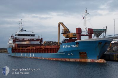
WILSON HOOK
General Cargo
Current Trip
| Time Travelled | 21 h, 22 mins |
|---|---|
| Remaining Time | --- |
| Distance Travelled | 184.93 nm |
| Remaining Distance | --- |
| AVG Speed | 9.2 Knots |
| MAX Speed | 11.9 Knots |
| AVG Wind | 13.7 knots |
| MAX Wind | 16.9 knots |
| MIN Temp | 17.1°C / 62.78°F |
| MAX Temp | 18°C / 64.4°F |
| Draught | 5.5 m |
| Position Received | 6 h, 45 m ago |
Current Position
| Longitude | -9.81163° |
|---|---|
| Latitude | 40.14844° |
| Status | Under way using engine |
| Speed | 10.7 Knots |
| Course | 0.2° |
| Area | North Atlantic Ocean |
| Station | T-AIS |
| Position Received | 6 h, 45 m ago |
Info
Information
The current position of WILSON HOOK is in North Atlantic Ocean with coordinates 40.14844° / -9.81163° as reported on 2024-06-29 20:00 by AIS to our vessel tracker app. The vessel's current speed is 10.7 Knots and is heading at the port of HORTEN. The estimated time of arrival as calculated by vessel tracking app is 2024-07-05 16:00 LT
The vessel WILSON HOOK (IMO: 9017434, MMSI: 257077560) is a General Cargo that was built in 2003 ( 21 years old ). It's sailing under the flag of [NO] Norway.
In this page you can find informations about the vessels current position, last detected port calls, and current voyage information. If the vessels is not in coverage by AIS you will find the latest position.
The current position of WILSON HOOK is detected by our AIS receivers and we are not responsible for the reliability of the data. The last position was recorded while the vessel was in Coverage by the Ais receivers of our vessel tracking app.
The current draught of WILSON HOOK as reported by AIS is 5.5 meters
Weather
| Temperature | 17.6°C / 63.68°F |
|---|---|
| Wind Speed | 8 knots |
| Direction | 279° W |
| Pressure | 1017.5 hPa |
| Humidity | 93.1 % |
| Cloud Coverage | 78 % |
Featured Company
Last Port Calls
| Port | Arrival | Departure | Time In Port |
|---|---|---|---|
| 2024-06-27 18:02 | 2024-06-29 05:24 | 1 d | |
| 2024-06-23 13:09 | 2024-06-26 22:22 | 3 d | |
| 2024-05-30 16:12 | 2024-06-01 07:46 | 1 d | |
| 2024-05-24 20:20 | 2024-05-29 17:23 | 4 d | |
| 2024-05-11 00:30 | 2024-05-17 18:31 | 6 d | |
| 2024-05-08 09:10 | 2024-05-10 14:13 | 2 d | |
| 2024-05-06 22:57 | 2024-05-07 17:53 | 18 h | |
| 2024-05-06 22:33 | 2024-05-06 22:51 | 18 m | |
| 2024-04-25 14:53 | 2024-04-26 16:27 | 1 d | |
| 2024-04-18 09:48 | 2024-04-19 13:26 | 1 d |
Last Trips
| Origin | Departure | Destination | Arrival | Distance | |
|---|---|---|---|---|---|
| 2024-06-26 23:22 | 2024-06-27 19:02 | 235.41 nm | |||
| 2024-06-01 08:46 | 2024-06-23 14:09 | 1874.06 nm | |||
| 2024-05-29 18:23 | 2024-05-30 17:12 | 215.84 nm | |||
| 2024-05-17 19:31 | 2024-05-24 21:20 | 1084.67 nm | |||
| 2024-05-10 15:13 | 2024-05-11 01:30 | 107.52 nm | |||
| 2024-05-07 18:53 | 2024-05-08 10:10 | 171.12 nm | |||
| 2024-05-06 23:51 | 2024-05-06 23:57 | 0.96 nm | |||
| 2024-04-26 18:27 | 2024-05-06 23:33 | 1638.65 nm | |||
| 2024-04-17 13:44 | 2024-04-18 11:48 | 248.79 nm | |||
| 2024-04-12 19:10 | 2024-04-13 23:38 | 318.03 nm |
Events
| Time | Event | Details | Position / Dest | Info |
|---|---|---|---|---|
| 2024-06-29 20:08 | Status Changed | Default Under way using engine |
40.17081 / -9.81142
PT SET > NO HOR
|
Speed: 10.7 kn Course: 0.2° |
| 2024-06-29 20:00 | OUT of Coverage |
40.14844 / -9.81163
North Atlantic Ocean
PT SET > NO HOR
|
Speed: 10.7 kn Course: 0.2° |
|
| 2024-06-29 19:57 | Status Changed | Under way using engine Default |
40.13797 / -9.81167
PT SET > NO HOR
|
Speed: 10.7 kn Course: 360° |
| 2024-06-29 19:56 | IN Coverage |
40.14146 / -9.81166
North Atlantic Ocean
PT SET > NO HOR
|
Speed: 10.7 kn Course: 0.1° |
|
| 2024-06-29 19:00 | Status Changed | Default Under way using engine |
39.96776 / -9.81503
PT SET > NO HOR
|
Speed: 10.7 kn Course: 3.3° |
| 2024-06-29 18:53 | OUT of Coverage |
39.94645 / -9.81703
North Atlantic Ocean
PT SET > NO HOR
|
Speed: 10.7 kn Course: 3.3° |
|
| 2024-06-29 18:52 | Status Changed | Under way using engine Default |
39.94590 / -9.81708
PT SET > NO HOR
|
Speed: 10.5 kn Course: 5° |
| 2024-06-29 18:48 | Status Changed | Default Under way using engine |
39.93206 / -9.81823
PT SET > NO HOR
|
Speed: 11 kn Course: 0.6° |
| 2024-06-29 18:41 | Status Changed | Under way using engine Default |
39.91161 / -9.81937
PT SET > NO HOR
|
Speed: 10.8 kn Course: 2° |
| 2024-06-29 18:36 | Status Changed | Default Under way using engine |
39.89570 / -9.82001
PT SET > NO HOR
|
Speed: 10.4 kn Course: 1.9° |