
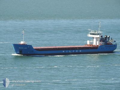
WILSON LAHN
General Cargo
Current Trip
| Time Travelled | 1 day |
|---|---|
| Remaining Time | 1 day |
| Distance Travelled | 275.55 nm |
| Remaining Distance | 375.28 nm |
| AVG Speed | 9.9 Knots |
| MAX Speed | 11.4 Knots |
| AVG Wind | 14.2 knots |
| MAX Wind | 27.4 knots |
| MIN Temp | 11.7°C / 53.06°F |
| MAX Temp | 13.3°C / 55.94°F |
| Draught | 3.4 m |
| Position Received | 18 h, 30 m ago |
Current Position
| Longitude | 22.02201° |
|---|---|
| Latitude | 59.25643° |
| Status | Under way using engine |
| Speed | 7.9 Knots |
| Course | 253.1° |
| Area | Baltic Sea |
| Station | T-AIS |
| Position Received | 18 h, 30 m ago |
Info
Information
The current position of WILSON LAHN is in Baltic Sea with coordinates 59.25643° / 22.02201° as reported on 2024-06-11 00:04 by AIS to our vessel tracker app. The vessel's current speed is 7.9 Knots and is heading at the port of AALBORG. The estimated time of arrival as calculated by vessel tracking app is 2024-06-13 03:34 LT
The vessel WILSON LAHN (IMO: 9198458, MMSI: 314259000) is a General Cargo that was built in 2001 ( 23 years old ). It's sailing under the flag of [BB] Barbados.
In this page you can find informations about the vessels current position, last detected port calls, and current voyage information. If the vessels is not in coverage by AIS you will find the latest position.
The current position of WILSON LAHN is detected by our AIS receivers and we are not responsible for the reliability of the data. The last position was recorded while the vessel was in Coverage by the Ais receivers of our vessel tracking app.
The current draught of WILSON LAHN as reported by AIS is 3.4 meters
Weather
| Temperature | 12.4°C / 54.32°F |
|---|---|
| Wind Speed | 11 knots |
| Direction | 256° WSW |
| Pressure | 1004.3 hPa |
| Humidity | 82.5 % |
| Cloud Coverage | 100 % |
Featured Company
Last Port Calls
| Port | Arrival | Departure | Time In Port |
|---|---|---|---|
| 2024-06-07 20:59 | 2024-06-10 13:09 | 2 d | |
| 2024-06-03 16:40 | 2024-06-03 18:46 | 2 h | |
| 2024-05-30 13:56 | 2024-06-02 06:52 | 2 d | |
| 2024-05-30 11:24 | 2024-05-30 12:59 | 1 h | |
| 2024-05-23 21:09 | 2024-05-24 00:07 | 2 h | |
| 2024-05-22 03:05 | 2024-05-22 13:23 | 10 h | |
| 2024-05-19 22:06 | 2024-05-20 03:27 | 5 h | |
| 2024-05-17 17:13 | 2024-05-17 18:52 | 1 h | |
| 2024-05-15 21:06 | 2024-05-17 15:58 | 1 d | |
| 2024-05-15 19:26 | 2024-05-15 20:43 | 1 h |
Last Trips
| Origin | Departure | Destination | Arrival | Distance | |
|---|---|---|---|---|---|
| 2024-06-03 20:46 | 2024-06-07 23:59 | 990.91 nm | |||
| 2024-06-02 08:52 | 2024-06-03 18:40 | 27.95 nm | |||
| 2024-05-30 14:59 | 2024-05-30 15:56 | 7.34 nm | |||
| 2024-05-24 02:07 | 2024-05-30 13:24 | 826.05 nm | |||
| 2024-05-22 15:23 | 2024-05-23 23:09 | 101.18 nm | |||
| 2024-05-20 05:27 | 2024-05-22 05:05 | 331.46 nm | |||
| 2024-05-17 20:52 | 2024-05-20 00:06 | 517.09 nm | |||
| 2024-05-17 17:58 | 2024-05-17 19:13 | 6.05 nm | |||
| 2024-05-15 22:43 | 2024-05-15 23:06 | 2.29 nm | |||
| 2024-05-14 16:38 | 2024-05-15 21:26 | 110.10 nm |
Events
| Time | Event | Details | Position / Dest | Info |
|---|---|---|---|---|
| 2024-06-11 00:27 | Status Changed | Default Under way using engine |
59.23817 / 21.91981
EEMUG>DKAAL
|
Speed: 7.9 kn Course: 253.1° |
| 2024-06-11 00:04 | OUT of Coverage |
59.25643 / 22.02201
Baltic Sea
EEMUG>DKAAL
|
Speed: 7.9 kn Course: 253.1° |
|
| 2024-06-10 23:40 | IN Coverage |
59.27250 / 22.12567
Baltic Sea
EEMUG>DKAAL
|
Speed: 8.7 kn Course: 254° |
|
| 2024-06-10 21:11 | Status Changed | Default Under way using engine |
59.37598 / 22.76670
EEMUG>DKAAL
|
Speed: 8.7 kn Course: 251.1° |
| 2024-06-10 21:02 | OUT of Coverage |
59.38186 / 22.80243
Baltic Sea
EEMUG>DKAAL
|
Speed: 8.7 kn Course: 251.1° |
|
| 2024-06-10 19:23 | Change Sea Area | Estonian part of the Baltic Sea Estonian part of the Gulf of Finland |
59.44784 / 23.22074
Baltic Sea
EEMUG>DKAAL
|
Speed: 6.5 kn Course: 254.1° |
| 2024-06-10 18:11 | Status Changed | Under way using engine Default |
59.49608 / 23.53256
EEMUG>DKAAL
|
Speed: 9.2 kn Course: 252° |
| 2024-06-10 18:01 | IN Coverage |
59.49493 / 23.52539
Gulf of Finland
EEMUG>DKAAL
|
Speed: 7.6 kn Course: 253.9° |
|
| 2024-06-10 16:54 | Status Changed | Default Under way using engine |
59.55425 / 23.89478
EEMUG>DKAAL
|
Speed: 9 kn Course: 252.6° |
| 2024-06-10 16:50 | OUT of Coverage |
59.55772 / 23.91621
Gulf of Finland
EEMUG>DKAAL
|
Speed: 9 kn Course: 252.6° |