
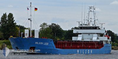
WILSON LEER
General Cargo
Current Trip
NO THA
| Time Travelled | 5 days |
|---|---|
| Remaining Time | --- |
| Distance Travelled | 506.09 nm |
| Remaining Distance | --- |
| AVG Speed | 9.3 Knots |
| MAX Speed | 11 Knots |
| AVG Wind | 11.9 knots |
| MAX Wind | 29.9 knots |
| MIN Temp | 11.1°C / 51.98°F |
| MAX Temp | 22.4°C / 72.32°F |
| Draught | 4.8 m |
| Position Received | 1 m ago |
Current Position
| Longitude | 5.27487° |
|---|---|
| Latitude | 58.78872° |
| Status | Under way using engine |
| Speed | 9 Knots |
| Course | 325.2° |
| Area | North Sea |
| Station | T-AIS |
| Position Received | 1 m ago |
Info
Information
The current position of WILSON LEER is in North Sea with coordinates 58.78872° / 5.27487° as reported on 2024-06-19 21:58 by AIS to our vessel tracker app. The vessel's current speed is 9 Knots
The vessel WILSON LEER (IMO: 9150482, MMSI: 314552000) is a General Cargo that was built in 1996 ( 28 years old ). It's sailing under the flag of [BB] Barbados.
In this page you can find informations about the vessels current position, last detected port calls, and current voyage information. If the vessels is not in coverage by AIS you will find the latest position.
The current position of WILSON LEER is detected by our AIS receivers and we are not responsible for the reliability of the data. The last position was recorded while the vessel was in Coverage by the Ais receivers of our vessel tracking app.
The current draught of WILSON LEER as reported by AIS is 4.8 meters
Weather
| Temperature | 11.4°C / 52.52°F |
|---|---|
| Wind Speed | 11 knots |
| Direction | 298° WNW |
| Pressure | 1018.7 hPa |
| Humidity | 71.3 % |
| Cloud Coverage | 100 % |
Featured Company
Last Port Calls
| Port | Arrival | Departure | Time In Port |
|---|---|---|---|
| 2024-06-11 19:09 | 2024-06-14 06:40 | 2 d | |
| 2024-06-05 02:56 | 2024-06-10 00:09 | 4 d | |
| 2024-06-04 05:04 | 2024-06-04 18:24 | 13 h | |
| 2024-05-31 15:44 | 2024-06-01 14:26 | 22 h | |
| 2024-05-31 05:37 | 2024-05-31 12:27 | 6 h | |
| 2024-05-29 07:23 | 2024-05-29 10:44 | 3 h | |
| 2024-05-28 07:10 | 2024-05-28 16:18 | 9 h | |
| 2024-05-24 06:22 | 2024-05-24 18:24 | 12 h | |
| 2024-05-12 14:17 | 2024-05-13 14:14 | 23 h | |
| 2024-05-08 19:31 | 2024-05-10 14:13 | 1 d |
Most Visited Ports (Last year)
| Port | Arrivals | |
|---|---|---|
| 4 | ||
| 4 | ||
| 3 | ||
| 2 | ||
| 2 | ||
| 2 |
Last Trips
| Origin | Departure | Destination | Arrival | Distance | |
|---|---|---|---|---|---|
| 2024-06-10 02:09 | 2024-06-11 21:09 | 392.49 nm | |||
| 2024-06-04 20:24 | 2024-06-05 04:56 | 66.79 nm | |||
| 2024-06-01 16:26 | 2024-06-04 07:04 | 452.02 nm | |||
| 2024-05-31 14:27 | 2024-05-31 17:44 | 30.78 nm | |||
| 2024-05-29 11:44 | 2024-05-31 07:37 | 305.47 nm | |||
| 2024-05-28 17:18 | 2024-05-29 08:23 | 12.99 nm | |||
| 2024-05-24 20:24 | 2024-05-28 08:10 | 251.55 nm | |||
| 2024-05-13 16:14 | 2024-05-24 08:22 | 2159.25 nm | |||
| 2024-05-10 16:13 | 2024-05-12 16:17 | 414.82 nm | |||
| 2024-05-03 07:04 | 2024-05-08 21:31 | 368.94 nm |
Events
| Time | Event | Details | Position / Dest | Info |
|---|---|---|---|---|
| 2024-06-19 12:07 | Change Sea Area | Norwegian part of the North Sea Norwegian part of the Skaggerak |
57.95628 / 7.05612
North Sea
NO THA
|
Speed: 8.3 kn Course: 282.1° |
| 2024-06-19 04:16 | Detected in Sea | Norwegian part of the Skaggerak |
57.87120 / 9.17860
Skaggerak
NO THA
|
Speed: 8.4 kn Course: 267.7° |
| 2024-06-18 20:20 | Change Sea Area | Danish part of the Skaggerak Danish part of the Kattegat |
57.80606 / 10.94606
Skaggerak
NO THA
|
Speed: 9.2 kn Course: 322.3° |
| 2024-06-18 18:56 | Change Sea Area | Danish part of the Kattegat Swedish part of the Kattegat |
57.64637 / 11.21007
Kattegat
NO THA
|
Speed: 9.3 kn Course: 318.7° |
| 2024-06-18 06:17 | Change Sea Area | Swedish part of the Kattegat Danish part of the Kattegat |
55.82117 / 12.72047
Kattegat
NO THA
|
Speed: 10.2 kn Course: 6.5° |
| 2024-06-18 04:17 | Detected in Sea | Danish part of the Kattegat |
55.49036 / 12.71465
Kattegat
NO THA
|
Speed: 9.9 kn Course: 7.7° |
| 2024-06-18 03:23 | Change Sea Area | Swedish part of the Kattegat Swedish part of the Baltic Sea |
55.34054 / 12.67605
Kattegat
NO THA
|
Speed: 10.2 kn Course: 9.5° |
| 2024-06-18 00:26 | Change Sea Area | Swedish part of the Baltic Sea German part of the Baltic Sea |
55.01539 / 13.26329
Baltic Sea
NO THA
|
Speed: 9.7 kn Course: 319.7° |
| 2024-06-17 19:29 | Draught Changed | 4.8 4.9 |
54.29643 / 14.01371
NO THA
|
Speed: 10.2 kn Course: 335.1° |
| 2024-06-17 19:00 | Status Changed | Under way using engine Default |
54.22307 / 14.07096
NO THA
|
Speed: 10 kn Course: 336° |