
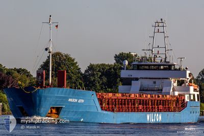
WILSON LEITH
General Cargo
Current Trip
| Trip Time | 11 days |
|---|---|
| Trip Distance | 1306.17 nm |
| AVG Speed | 9 Knots |
| MAX Speed | 13.8 Knots |
| Draught | 5.2 m |
| AVG Wind | 9.6 knots |
| MAX Wind | 31 knots |
| MIN Temp | 7.8°C / 46.04°F |
| MAX Temp | 16.9°C / 62.42°F |
| Position Received | Now |
Current Position
| Longitude | -3.82261° |
|---|---|
| Latitude | 43.44859° |
| Status | Moored |
| Speed | |
| Course | 96° |
| Area | Bay of Biscay |
| Station | T-AIS |
| Position Received | Now |
Info
Information
The current position of WILSON LEITH is in Bay of Biscay with coordinates 43.44859° / -3.82261° as reported on 2024-05-28 20:51 by AIS to our vessel tracker app. The vessel's current speed is 0 Knots and is currently inside the port of SANTANDER.
The vessel WILSON LEITH (IMO: 9150509, MMSI: 314553000) is a General Cargo that was built in 1997 ( 27 years old ). It's sailing under the flag of [BB] Barbados.
In this page you can find informations about the vessels current position, last detected port calls, and current voyage information. If the vessels is not in coverage by AIS you will find the latest position.
The current position of WILSON LEITH is detected by our AIS receivers and we are not responsible for the reliability of the data. The last position was recorded while the vessel was in Coverage by the Ais receivers of our vessel tracking app.
The current draught of WILSON LEITH as reported by AIS is 5.2 meters
Weather
| Temperature | 15.2°C / 59.36°F |
|---|---|
| Wind Speed | 4 knots |
| Direction | 98° E |
| Pressure | 1021.3 hPa |
| Humidity | 75.9 % |
| Cloud Coverage | 99 % |
Featured Company
Last Port Calls
| Port | Arrival | Departure | Time In Port |
|---|---|---|---|
| 2024-05-28 13:53 | |||
| 2024-05-15 10:10 | 2024-05-16 16:55 | 1 d | |
| 2024-05-13 22:32 | 2024-05-13 23:20 | 47 m | |
| 2024-05-07 17:16 | 2024-05-10 19:40 | 3 d | |
| 2024-04-30 19:49 | 2024-05-03 00:27 | 2 d | |
| 2024-04-23 02:30 | 2024-04-24 15:34 | 1 d | |
| 2024-04-18 17:42 | 2024-04-19 16:22 | 22 h | |
| 2024-04-13 09:32 | 2024-04-15 23:17 | 2 d | |
| 2024-04-09 06:39 | 2024-04-12 18:31 | 3 d | |
| 2024-04-06 00:15 | 2024-04-06 14:26 | 14 h |
Most Visited Ports (Last year)
| Port | Arrivals | |
|---|---|---|
| 5 | ||
| 3 | ||
| 3 | ||
| 2 | ||
| 2 | ||
| 2 |
Last Trips
| Origin | Departure | Destination | Arrival | Distance | |
|---|---|---|---|---|---|
| 2024-05-16 17:55 | 2024-05-28 15:53 | 1306.17 nm | |||
| 2024-05-14 01:20 | 2024-05-15 11:10 | 350.44 nm | |||
| 2024-05-10 22:40 | 2024-05-14 00:32 | 751.96 nm | |||
| 2024-05-03 02:27 | 2024-05-07 20:16 | 1079.77 nm | |||
| 2024-04-24 17:34 | 2024-04-30 21:49 | 764.33 nm | |||
| 2024-04-19 18:22 | 2024-04-23 04:30 | 72.05 nm | |||
| 2024-04-16 00:17 | 2024-04-18 19:42 | 607.55 nm | |||
| 2024-04-12 19:31 | 2024-04-13 10:32 | 60.39 nm | |||
| 2024-04-06 16:26 | 2024-04-09 07:39 | 564.57 nm | |||
| 2024-04-06 02:07 | 2024-04-06 02:15 | 0.54 nm |
Events
| Time | Event | Details | Position / Dest | Info |
|---|---|---|---|---|
| 2024-05-28 16:21 | Status Changed | Moored Default |
43.44859 / -3.82261
[ES] SANTANDER
|
Speed: Course: 96° |
| 2024-05-28 16:18 | Status Changed | Default Moored |
43.44861 / -3.82261
[ES] SANTANDER
|
Speed: 0.1 kn Course: 96° |
| 2024-05-28 14:43 | Status Changed | Moored Under way using engine |
43.44856 / -3.82262
[ES] SANTANDER
|
Speed: Course: 96° |
| 2024-05-28 14:14 | STOP Moving |
43.44877 / -3.81877
[ES] SANTANDER
|
Speed: 0.3 kn Course: 65° |
|
| 2024-05-28 13:53 | PORT ARRIVAL |
|
43.45788 / -3.79253
[ES] SANTANDER
|
Speed: 8.9 kn Course: 259.8° |
| 2024-05-28 13:32 | START Moving | 3.05 nm, North East of SANTANDER |
43.48855 / -3.74863
ESSDR
|
Speed: 3.2 kn Course: 174° |
| 2024-05-28 13:13 | STOP Moving | 3.16 nm, North East of SANTANDER |
43.49170 / -3.74902
ESSDR
|
Speed: 0.3 kn Course: 50° |
| 2024-05-28 12:54 | START Moving | 2.51 nm, North East of SANTANDER |
43.48228 / -3.75758
ESSDR
|
Speed: 3.4 kn Course: 89° |
| 2024-05-28 12:49 | Status Changed | Under way using engine At anchor |
43.48233 / -3.76080
ESSDR
|
Speed: 1.1 kn Course: 53° |
| 2024-05-28 12:38 | Status Changed | At anchor Default |
43.48216 / -3.76152
ESSDR
|
Speed: 0.5 kn Course: 45° |