
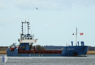
WILSON MAAS
General Cargo
Current Trip
| Time Travelled | 15 h, 26 mins |
|---|---|
| Remaining Time | 1 day |
| Distance Travelled | 140.80 nm |
| Remaining Distance | 353.48 nm |
| AVG Speed | 9.9 Knots |
| MAX Speed | 11.6 Knots |
| AVG Wind | 22.4 knots |
| MAX Wind | 25.8 knots |
| MIN Temp | 13°C / 55.4°F |
| MAX Temp | 15°C / 59°F |
| Draught | 4 m |
| Position Received | 46 m ago |
Current Position
| Longitude | 4.67113° |
|---|---|
| Latitude | 53.34625° |
| Status | Under way using engine |
| Speed | 11.6 Knots |
| Course | 22.1° |
| Area | North Sea |
| Station | T-AIS |
| Position Received | 46 m ago |
Info
Information
The current position of WILSON MAAS is in North Sea with coordinates 53.34625° / 4.67113° as reported on 2024-05-29 07:59 by AIS to our vessel tracker app. The vessel's current speed is 11.6 Knots and is heading at the port of STAVANGER. The estimated time of arrival as calculated by vessel tracking app is 2024-05-30 18:35 LT
The vessel WILSON MAAS (IMO: 9145554, MMSI: 314217000) is a General Cargo that was built in 1997 ( 27 years old ). It's sailing under the flag of [BB] Barbados.
In this page you can find informations about the vessels current position, last detected port calls, and current voyage information. If the vessels is not in coverage by AIS you will find the latest position.
The current position of WILSON MAAS is detected by our AIS receivers and we are not responsible for the reliability of the data. The last position was recorded while the vessel was in Coverage by the Ais receivers of our vessel tracking app.
The current draught of WILSON MAAS as reported by AIS is 4 meters
Weather
| Temperature | 13.3°C / 55.94°F |
|---|---|
| Wind Speed | 17 knots |
| Direction | 252° WSW |
| Pressure | 1005.7 hPa |
| Humidity | 89.7 % |
| Cloud Coverage | 100 % |
Featured Company
Last Port Calls
| Port | Arrival | Departure | Time In Port |
|---|---|---|---|
| 2024-05-28 15:31 | 2024-05-28 17:20 | 1 h | |
| 2024-05-27 04:28 | 2024-05-28 14:13 | 1 d | |
| 2024-05-27 01:36 | 2024-05-27 03:51 | 2 h | |
| 2024-05-25 02:31 | 2024-05-25 11:12 | 8 h | |
| 2024-05-21 19:36 | 2024-05-22 11:20 | 15 h | |
| 2024-05-21 11:52 | 2024-05-21 15:29 | 3 h | |
| 2024-05-18 17:11 | 2024-05-21 08:51 | 2 d | |
| 2024-05-12 06:48 | 2024-05-15 14:22 | 3 d | |
| 2024-05-06 16:23 | 2024-05-08 12:57 | 1 d | |
| 2024-05-05 05:17 | 2024-05-06 01:53 | 20 h |
Last Trips
| Origin | Departure | Destination | Arrival | Distance | |
|---|---|---|---|---|---|
| 2024-05-28 16:13 | 2024-05-28 17:31 | 4.98 nm | |||
| 2024-05-27 05:51 | 2024-05-27 06:28 | 2.41 nm | |||
| 2024-05-25 13:12 | 2024-05-27 03:36 | 355.07 nm | |||
| 2024-05-22 13:20 | 2024-05-25 04:31 | 520.64 nm | |||
| 2024-05-21 17:29 | 2024-05-21 21:36 | 42.35 nm | |||
| 2024-05-21 10:51 | 2024-05-21 13:52 | 27.79 nm | |||
| 2024-05-15 16:22 | 2024-05-18 19:11 | 631.36 nm | |||
| 2024-05-08 14:57 | 2024-05-12 08:48 | 755.16 nm | |||
| 2024-05-06 03:53 | 2024-05-06 18:23 | 151.24 nm | |||
| 2024-04-30 15:38 | 2024-05-05 07:17 | 599.42 nm |
Events
| Time | Event | Details | Position / Dest | Info |
|---|---|---|---|---|
| 2024-05-29 07:59 | Status Changed | Under way using engine Default |
53.34625 / 4.67113
NOSVG
|
Speed: 11.1 kn Course: 17° |
| 2024-05-29 07:59 | IN Coverage |
53.34625 / 4.67113
North Sea
NOSVG
|
Speed: 11.6 kn Course: 22.1° |
|
| 2024-05-29 07:17 | Status Changed | Default Under way using engine |
53.22116 / 4.58865
NOSVG
|
Speed: 11.5 kn Course: 27.4° |
| 2024-05-29 06:31 | OUT of Coverage |
53.09138 / 4.46664
North Sea
NOSVG
|
Speed: 11.5 kn Course: 27.4° |
|
| 2024-05-29 06:02 | Status Changed | Under way using engine Default |
53.01452 / 4.39172
NOSVG
|
Speed: 10.2 kn Course: 30° |
| 2024-05-29 06:02 | IN Coverage |
53.01906 / 4.39579
North Sea
NOSVG
|
Speed: 11 kn Course: 30.6° |
|
| 2024-05-28 21:23 | Status Changed | Default Under way using engine |
51.89941 / 3.37260
NOSVG
|
Speed: 9 kn Course: 8.3° |
| 2024-05-28 21:21 | Status Changed | Under way using engine Default |
51.89520 / 3.37063
NOSVG
|
Speed: 9.8 kn Course: 31° |
| 2024-05-28 21:21 | OUT of Coverage |
51.89520 / 3.37063
North Sea
NOSVG
|
Speed: 9 kn Course: 8.3° |
|
| 2024-05-28 21:16 | Status Changed | Default Under way using engine |
51.88419 / 3.36229
NOSVG
|
Speed: 9.7 kn Course: 23.2° |