
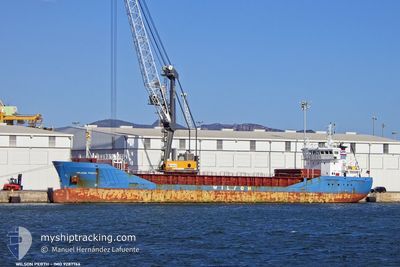
WILSON PERTH
General Cargo
Current Trip
| Time Travelled | 14 days |
|---|---|
| Remaining Time | --- |
| Distance Travelled | 983.92 nm |
| Remaining Distance | --- |
| AVG Speed | 10.2 Knots |
| MAX Speed | 14.6 Knots |
| AVG Wind | 10.4 knots |
| MAX Wind | 23 knots |
| MIN Temp | 9.7°C / 49.46°F |
| MAX Temp | 22.3°C / 72.14°F |
| Draught | 5.5 m |
| Position Received | 2 m ago |
Current Position
| Longitude | -8.77296° |
|---|---|
| Latitude | 41.12938° |
| Status | At anchor |
| Speed | |
| Course | 54° |
| Area | North Atlantic Ocean |
| Station | T-AIS |
| Position Received | 2 m ago |
Info
Information
The current position of WILSON PERTH is in North Atlantic Ocean with coordinates 41.12938° / -8.77296° as reported on 2024-06-01 05:00 by AIS to our vessel tracker app. The vessel's current speed is 0 Knots
The vessel WILSON PERTH (IMO: 9287766, MMSI: 257540000) is a General Cargo that was built in 2004 ( 20 years old ). It's sailing under the flag of [NO] Norway.
In this page you can find informations about the vessels current position, last detected port calls, and current voyage information. If the vessels is not in coverage by AIS you will find the latest position.
The current position of WILSON PERTH is detected by our AIS receivers and we are not responsible for the reliability of the data. The last position was recorded while the vessel was in Coverage by the Ais receivers of our vessel tracking app.
The current draught of WILSON PERTH as reported by AIS is 5.5 meters
Weather
| Temperature | 18.6°C / 65.48°F |
|---|---|
| Wind Speed | 15 knots |
| Direction | 71° ENE |
| Pressure | 1010.9 hPa |
| Humidity | 51.2 % |
| Cloud Coverage | --- |
Featured Company
Last Port Calls
| Port | Arrival | Departure | Time In Port |
|---|---|---|---|
| 2024-05-15 02:46 | 2024-05-17 11:04 | 2 d | |
| 2024-05-12 17:57 | 2024-05-13 10:24 | 16 h | |
| 2024-05-06 19:58 | 2024-05-07 18:32 | 22 h | |
| 2024-04-30 04:16 | 2024-05-04 11:44 | 4 d | |
| 2024-04-24 18:41 | 2024-04-26 11:33 | 1 d | |
| 2024-04-23 05:48 | 2024-04-23 22:12 | 16 h | |
| 2024-04-21 05:48 | 2024-04-22 14:20 | 1 d | |
| 2024-04-11 07:46 | 2024-04-13 05:26 | 1 d | |
| 2024-04-04 10:25 | 2024-04-10 02:08 | 5 d |
Last Trips
| Origin | Departure | Destination | Arrival | Distance | |
|---|---|---|---|---|---|
| 2024-05-13 12:24 | 2024-05-15 03:46 | 406.58 nm | |||
| 2024-05-07 20:32 | 2024-05-12 19:57 | 522.35 nm | |||
| 2024-05-04 13:44 | 2024-05-06 21:58 | 421.06 nm | |||
| 2024-04-26 14:33 | 2024-04-30 06:16 | 965.81 nm | |||
| 2024-04-24 01:12 | 2024-04-24 21:41 | 63.32 nm | |||
| 2024-04-22 17:20 | 2024-04-23 08:48 | 6.71 nm | |||
| 2024-04-13 06:26 | 2024-04-21 08:48 | 1863.16 nm | |||
| 2024-04-10 03:08 | 2024-04-11 08:46 | 218.77 nm | |||
| 2024-03-29 16:48 | 2024-04-04 11:25 | 1166.52 nm |
Events
| Time | Event | Details | Position / Dest | Info |
|---|---|---|---|---|
| 2024-06-01 00:03 | ETA Changed | 2025/05/27 13:00 2024/05/27 13:00 |
41.12887 / -8.77131
GBBAW - PTLEI
|
Speed: 0.1 kn Course: 9° |
| 2024-05-27 12:50 | Status Changed | At anchor Under way using engine |
41.12964 / -8.77174
GBBAW - PTLEI
|
Speed: 0.2 kn Course: 342° |
| 2024-05-27 12:50 | STOP Moving | 4.37 nm, South West of LEIXOES |
41.12962 / -8.77174
GBBAW - PTLEI
|
Speed: 0.2 kn Course: 342° |
| 2024-05-27 11:45 | ETA Changed | 2024/05/27 13:00 2024/05/27 14:30 |
41.23213 / -8.89256
GBBAW - PTLEI
|
Speed: 11.6 kn Course: 126° |
| 2024-05-27 11:12 | Status Changed | Under way using engine Default |
41.29359 / -9.00468
GBBAW - PTLEI
|
Speed: 11 kn Course: 127° |
| 2024-05-27 10:57 | Status Changed | Default Under way using engine |
41.32908 / -9.04470
GBBAW - PTLEI
|
Speed: 11.4 kn Course: 153.7° |
| 2024-05-27 10:52 | Change Sea Area | Portuguese part of the North Atlantic Ocean French part of the Celtic Sea |
41.34180 / -9.05321
North Atlantic Ocean
GBBAW - PTLEI
|
Speed: 11.4 kn Course: 153.7° |
| 2024-05-27 10:52 | Status Changed | Under way using engine Default |
41.34284 / -9.05389
GBBAW - PTLEI
|
Speed: 11 kn Course: 152° |
| 2024-05-27 10:39 | IN Coverage |
41.34180 / -9.05321
North Atlantic Ocean
GBBAW - PTLEI
|
Speed: 11.4 kn Course: 153.7° |
|
| 2024-05-25 07:42 | OUT of Coverage |
49.12658 / -5.12064
Celtic Sea
GBBAW - PTLEI
|
Speed: 10.7 kn Course: 239.6° |