
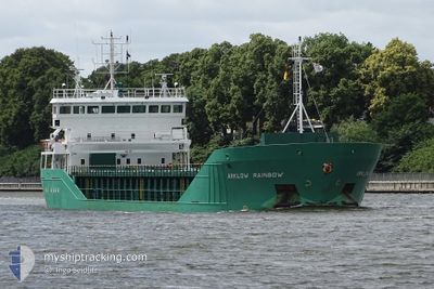
WILSON PLYMOUTH
General Cargo
Current Trip
| Time Travelled | 18 h, 30 mins |
|---|---|
| Remaining Time | --- |
| Distance Travelled | 122.92 nm |
| Remaining Distance | 4.12 nm |
| AVG Speed | 10.4 Knots |
| MAX Speed | 13.1 Knots |
| AVG Wind | 5.8 knots |
| MAX Wind | 13 knots |
| MIN Temp | 10.8°C / 51.44°F |
| MAX Temp | 13°C / 55.4°F |
| Draught | 4 m |
| Position Received | 2 m ago |
Current Position
| Longitude | -6.07811° |
|---|---|
| Latitude | 53.31543° |
| Status | At anchor |
| Speed | |
| Course | 49° |
| Area | Irish Sea and St. George's Channel |
| Station | T-AIS |
| Position Received | 2 m ago |
Info
Information
The current position of WILSON PLYMOUTH is in Irish Sea and St. George's Channel with coordinates 53.31543° / -6.07811° as reported on 2024-06-02 00:01 by AIS to our vessel tracker app. The vessel's current speed is 0 Knots and is heading at the port of DUBLIN. The estimated time of arrival as calculated by vessel tracking app is 2024-06-01 17:00 LT
The vessel WILSON PLYMOUTH (IMO: 9344497, MMSI: 257314000) is a General Cargo that was built in 2006 ( 18 years old ). It's sailing under the flag of [NO] Norway.
In this page you can find informations about the vessels current position, last detected port calls, and current voyage information. If the vessels is not in coverage by AIS you will find the latest position.
The current position of WILSON PLYMOUTH is detected by our AIS receivers and we are not responsible for the reliability of the data. The last position was recorded while the vessel was in Coverage by the Ais receivers of our vessel tracking app.
The current draught of WILSON PLYMOUTH as reported by AIS is 4 meters
Weather
| Temperature | 12°C / 53.6°F |
|---|---|
| Wind Speed | 3 knots |
| Direction | 344° NNW |
| Pressure | 1031.2 hPa |
| Humidity | 83 % |
| Cloud Coverage | 11 % |
Featured Company
Last Port Calls
| Port | Arrival | Departure | Time In Port |
|---|---|---|---|
| 2024-05-29 01:56 | 2024-06-01 05:34 | 3 d | |
| 2024-05-28 11:29 | 2024-05-28 23:32 | 12 h | |
| 2024-05-17 12:25 | 2024-05-19 16:08 | 2 d | |
| 2024-05-10 16:23 | 2024-05-13 11:14 | 2 d | |
| 2024-05-06 17:26 | 2024-05-08 18:50 | 2 d | |
| 2024-04-29 05:19 | 2024-04-30 10:56 | 1 d | |
| 2024-04-24 18:47 | 2024-04-27 10:26 | 2 d | |
| 2024-04-24 10:56 | 2024-04-24 10:59 | 2 m | |
| 2024-04-21 20:29 | 2024-04-22 23:18 | 1 d | |
| 2024-04-18 07:54 | 2024-04-19 18:24 | 1 d |
Last Trips
| Origin | Departure | Destination | Arrival | Distance | |
|---|---|---|---|---|---|
| 2024-05-19 18:08 | 2024-05-29 02:56 | 1283.59 nm | |||
| 2024-05-19 18:08 | 2024-05-28 12:29 | 1257.91 nm | |||
| 2024-05-13 13:14 | 2024-05-17 14:25 | 842.30 nm | |||
| 2024-05-08 19:50 | 2024-05-10 18:23 | 351.31 nm | |||
| 2024-04-30 13:56 | 2024-05-06 18:26 | 1205.75 nm | |||
| 2024-04-27 12:26 | 2024-04-29 08:19 | 458.42 nm | |||
| 2024-04-24 12:59 | 2024-04-24 20:47 | 84.87 nm | |||
| 2024-04-23 01:18 | 2024-04-24 12:56 | 317.75 nm | |||
| 2024-04-19 20:24 | 2024-04-21 22:29 | 547.01 nm | |||
| 2024-04-12 17:42 | 2024-04-18 09:54 | 994.83 nm |
Events
| Time | Event | Details | Position / Dest | Info |
|---|---|---|---|---|
| 2024-06-02 00:01 | Status Changed | At anchor Default |
53.31543 / -6.07811
GBLIV>IEDUB
|
Speed: Course: 45° |
| 2024-06-01 23:58 | Status Changed | Default At anchor |
53.31540 / -6.07805
GBLIV>IEDUB
|
Speed: Course: 45° |
| 2024-06-01 16:10 | STOP Moving | 2.2 nm, North East of DUN LAOGHAIRE |
53.31686 / -6.07813
GBLIV>IEDUB
|
Speed: 0.3 kn Course: 154° |
| 2024-06-01 16:04 | Status Changed | At anchor Under way using engine |
53.31644 / -6.07714
GBLIV>IEDUB
|
Speed: 0.4 kn Course: 183° |
| 2024-06-01 13:23 | Status Changed | Under way using engine Default |
53.45776 / -5.37885
GBLIV>IEDUB
|
Speed: 11.9 kn Course: 254° |
| 2024-06-01 13:20 | Status Changed | Default Under way using engine |
53.46061 / -5.36129
GBLIV>IEDUB
|
Speed: 11.7 kn Course: 255.7° |
| 2024-06-01 13:12 | Change Sea Area | Irish part of the Irish Sea and St. George's Channel United Kingdom part of the Irish Sea and St. George's Channel |
53.46738 / -5.31942
Irish Sea and St. George's Channel
GBLIV>IEDUB
|
Speed: 11.7 kn Course: 255.7° |
| 2024-06-01 12:48 | Status Changed | Under way using engine Default |
53.48618 / -5.18670
GBLIV>IEDUB
|
Speed: 12.1 kn Course: 257° |
| 2024-06-01 12:40 | Status Changed | Default Under way using engine |
53.49300 / -5.14475
GBLIV>IEDUB
|
Speed: 11.9 kn Course: 251.8° |
| 2024-06-01 12:20 | Status Changed | Under way using engine Default |
53.51123 / -5.03786
GBLIV>IEDUB
|
Speed: 12.2 kn Course: 257° |