
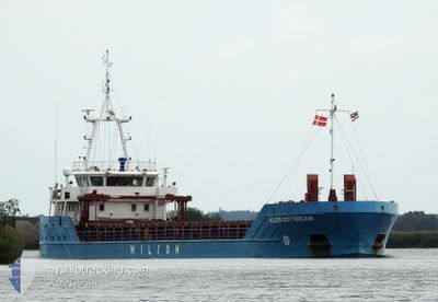
WILSON ROTTERDAM
Cargo
Current Trip
| Time Travelled | 3 days |
|---|---|
| Remaining Time | 2 h, 16 mins |
| Distance Travelled | 645.18 nm |
| Remaining Distance | 42.04 nm |
| AVG Speed | 8.1 Knots |
| MAX Speed | 11 Knots |
| AVG Wind | 9.9 knots |
| MAX Wind | 24 knots |
| MIN Temp | 9.9°C / 49.82°F |
| MAX Temp | 18.6°C / 65.48°F |
| Draught | 3.9 m |
| Position Received | 2 h, 28 m ago |
Current Position
| Longitude | 0.95763° |
|---|---|
| Latitude | 53.12295° |
| Status | Under way using engine |
| Speed | 8.8 Knots |
| Course | 310.2° |
| Area | North Sea |
| Station | T-AIS |
| Position Received | 2 h, 28 m ago |
Info
Information
The current position of WILSON ROTTERDAM is in North Sea with coordinates 53.12295° / 0.95763° as reported on 2024-05-31 16:29 by AIS to our vessel tracker app. The vessel's current speed is 8.8 Knots and is heading at the port of BOSTON. The estimated time of arrival as calculated by vessel tracking app is 2024-05-31 21:14 LT
The vessel WILSON ROTTERDAM (IMO: 9557381, MMSI: 314036000) is a Cargo It's sailing under the flag of [BB] Barbados.
In this page you can find informations about the vessels current position, last detected port calls, and current voyage information. If the vessels is not in coverage by AIS you will find the latest position.
The current position of WILSON ROTTERDAM is detected by our AIS receivers and we are not responsible for the reliability of the data. The last position was recorded while the vessel was in Coverage by the Ais receivers of our vessel tracking app.
The current draught of WILSON ROTTERDAM as reported by AIS is 3.9 meters
Weather
| Temperature | 11.7°C / 53.06°F |
|---|---|
| Wind Speed | 22 knots |
| Direction | 349° N |
| Pressure | 1021.4 hPa |
| Humidity | 89.1 % |
| Cloud Coverage | 39 % |
Featured Company
Last Port Calls
| Port | Arrival | Departure | Time In Port |
|---|---|---|---|
| 2024-05-24 18:43 | 2024-05-28 13:26 | 3 d | |
| 2024-04-19 23:19 | 2024-04-20 10:13 | 10 h | |
| 2024-04-19 01:33 | 2024-04-19 16:24 | 14 h | |
| 2024-04-13 13:16 | 2024-04-15 19:43 | 2 d | |
| 2024-04-11 16:28 | 2024-04-12 19:03 | 1 d | |
| 2024-04-10 15:41 | 2024-04-11 03:38 | 11 h | |
| 2024-04-08 04:19 | 2024-04-08 19:46 | 15 h | |
| 2024-04-05 03:19 | 2024-04-05 22:51 | 19 h | |
| 2024-04-02 17:26 | 2024-04-04 02:41 | 1 d | |
| 2024-03-25 11:06 | 2024-03-25 20:45 | 9 h |
Last Trips
| Origin | Departure | Destination | Arrival | Distance | |
|---|---|---|---|---|---|
| 2024-04-20 12:13 | 2024-05-24 20:43 | 2261.86 nm | |||
| 2024-04-19 18:24 | 2024-04-20 01:19 | 64.65 nm | |||
| 2024-04-15 21:43 | 2024-04-19 03:33 | 607.63 nm | |||
| 2024-04-12 21:03 | 2024-04-13 15:16 | 110.97 nm | |||
| 2024-04-11 05:38 | 2024-04-11 18:28 | 93.98 nm | |||
| 2024-04-08 20:46 | 2024-04-10 17:41 | 384.20 nm | |||
| 2024-04-05 23:51 | 2024-04-08 05:19 | 239.76 nm | |||
| 2024-04-04 04:41 | 2024-04-05 04:19 | 212.30 nm | |||
| 2024-03-25 21:45 | 2024-04-02 19:26 | 940.65 nm | |||
| 2024-03-15 15:24 | 2024-03-25 12:06 | 1161.85 nm |
Events
| Time | Event | Details | Position / Dest | Info |
|---|---|---|---|---|
| 2024-05-31 17:01 | Status Changed | Default Under way using engine |
53.17500 / .85500
BOSTON UK
|
Speed: 8.8 kn Course: 310.2° |
| 2024-05-31 16:29 | OUT of Coverage |
53.12295 / .95763
North Sea
BOSTON UK
|
Speed: 8.8 kn Course: 310.2° |
|
| 2024-05-31 16:23 | Status Changed | Under way using engine Default |
53.11368 / .97477
BOSTON UK
|
Speed: 9 kn Course: 216° |
| 2024-05-31 16:10 | IN Coverage |
53.11400 / .97456
North Sea
BOSTON UK
|
Speed: 5 kn Course: 331.6° |
|
| 2024-05-31 07:20 | Status Changed | Default Under way using engine |
53.82851 / 2.37872
BOSTON UK
|
Speed: 9.2 kn Course: 211.1° |
| 2024-05-31 07:18 | OUT of Coverage |
53.83312 / 2.38306
North Sea
BOSTON UK
|
Speed: 9.2 kn Course: 211.1° |
|
| 2024-05-31 06:30 | Destination Changed | BOSTON UK BOSTON UK VIA KIEL |
53.94564 / 2.48558
BOSTON UK
|
Speed: 9.6 kn Course: 206.9° |
| 2024-05-31 05:47 | Detected in Sea | United Kingdom part of the North Sea |
53.99116 / 2.58700
North Sea
BOSTON UK VIA KIEL
|
Speed: 6.2 kn Course: 277° |
| 2024-05-31 05:47 | Status Changed | Under way using engine Default |
53.99116 / 2.58700
BOSTON UK VIA KIEL
|
Speed: 7 kn Course: 273° |
| 2024-05-31 05:47 | IN Coverage |
53.99116 / 2.58700
North Sea
BOSTON UK VIA KIEL
|
Speed: 6.2 kn Course: 277° |