
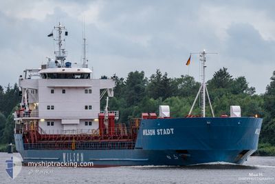
WILSON STADT
General Cargo
Current Trip
| Time Travelled | 3 days |
|---|---|
| Remaining Time | 2 days |
| Distance Travelled | 720.14 nm |
| Remaining Distance | 526.24 nm |
| AVG Speed | 8.3 Knots |
| MAX Speed | 12.4 Knots |
| AVG Wind | 13.8 knots |
| MAX Wind | 29.8 knots |
| MIN Temp | 11.7°C / 53.06°F |
| MAX Temp | 18.2°C / 64.76°F |
| Draught | 5.8 m |
| Position Received | 3 h, 42 m ago |
Current Position
| Longitude | 4.26797° |
|---|---|
| Latitude | 53.10650° |
| Status | Under way using engine |
| Speed | 8.1 Knots |
| Course | 231.8° |
| Area | North Sea |
| Station | T-AIS |
| Position Received | 3 h, 42 m ago |
Info
Information
The current position of WILSON STADT is in North Sea with coordinates 53.10650° / 4.26797° as reported on 2024-06-16 02:45 by AIS to our vessel tracker app. The vessel's current speed is 8.1 Knots and is heading at the port of WATERFORD. The estimated time of arrival as calculated by vessel tracking app is 2024-06-18 21:34 LT
The vessel WILSON STADT (IMO: 8918485, MMSI: 257683000) is a General Cargo that was built in 2000 ( 24 years old ). It's sailing under the flag of [NO] Norway.
In this page you can find informations about the vessels current position, last detected port calls, and current voyage information. If the vessels is not in coverage by AIS you will find the latest position.
The current position of WILSON STADT is detected by our AIS receivers and we are not responsible for the reliability of the data. The last position was recorded while the vessel was in Coverage by the Ais receivers of our vessel tracking app.
The current draught of WILSON STADT as reported by AIS is 5.8 meters
Weather
| Temperature | 13.6°C / 56.48°F |
|---|---|
| Wind Speed | 22 knots |
| Direction | 212° SSW |
| Pressure | 1001.4 hPa |
| Humidity | 86.6 % |
| Cloud Coverage | 27 % |
Featured Company
Last Port Calls
| Port | Arrival | Departure | Time In Port |
|---|---|---|---|
| 2024-06-10 11:01 | 2024-06-12 10:17 | 1 d | |
| 2024-05-30 08:37 | 2024-05-31 11:46 | 1 d | |
| 2024-05-26 03:37 | 2024-05-26 16:05 | 12 h | |
| 2024-05-23 03:20 | 2024-05-24 09:14 | 1 d | |
| 2024-05-14 04:07 | 2024-05-15 10:30 | 1 d | |
| 2024-05-06 16:31 | 2024-05-07 19:19 | 1 d | |
| 2024-04-24 19:49 | 2024-04-26 12:20 | 1 d | |
| 2024-04-04 06:01 | 2024-04-05 22:19 | 1 d |
Most Visited Ports (Last year)
| Port | Arrivals | |
|---|---|---|
| 5 | ||
| 3 | ||
| 3 | ||
| 3 | ||
| 2 | ||
| 2 |
Last Trips
| Origin | Departure | Destination | Arrival | Distance | |
|---|---|---|---|---|---|
| 2024-05-31 14:46 | 2024-06-10 14:01 | 149.33 nm | |||
| 2024-05-26 18:05 | 2024-05-30 11:37 | 818.27 nm | |||
| 2024-05-24 11:14 | 2024-05-26 05:37 | 106.98 nm | |||
| 2024-05-15 12:30 | 2024-05-23 05:20 | 1520.12 nm | |||
| 2024-05-07 21:19 | 2024-05-14 06:07 | 1233.44 nm | |||
| 2024-04-26 12:20 | 2024-05-06 18:31 | 2027.44 nm | |||
| 2024-04-06 00:19 | 2024-04-24 19:49 | 3165.60 nm | |||
| 2024-03-25 17:03 | 2024-04-04 08:01 | 1582.91 nm |
Events
| Time | Event | Details | Position / Dest | Info |
|---|---|---|---|---|
| 2024-06-16 02:48 | Status Changed | Default Under way using engine |
53.10166 / 4.25833
LVVNT>IEWAT
|
Speed: 8.1 kn Course: 231.8° |
| 2024-06-16 02:45 | OUT of Coverage |
53.10650 / 4.26797
North Sea
LVVNT>IEWAT
|
Speed: 8.1 kn Course: 231.8° |
|
| 2024-06-16 02:00 | Status Changed | Under way using engine Default |
53.16060 / 4.38221
LVVNT>IEWAT
|
Speed: 6 kn Course: 215° |
| 2024-06-16 01:54 | Status Changed | Default Under way using engine |
53.16667 / 4.39500
LVVNT>IEWAT
|
Speed: 7.1 kn Course: 203.2° |
| 2024-06-16 01:46 | Status Changed | Under way using engine Default |
53.18042 / 4.40615
LVVNT>IEWAT
|
Speed: 7 kn Course: 205° |
| 2024-06-16 01:30 | Status Changed | Default Under way using engine |
53.20667 / 4.42833
LVVNT>IEWAT
|
Speed: 6.2 kn Course: 202.1° |
| 2024-06-16 00:57 | Status Changed | Under way using engine Default |
53.26121 / 4.47122
LVVNT>IEWAT
|
Speed: 6 kn Course: 209° |
| 2024-06-16 00:57 | IN Coverage |
53.26048 / 4.47044
North Sea
LVVNT>IEWAT
|
Speed: 6.5 kn Course: 212.4° |
|
| 2024-06-15 22:09 | Status Changed | Default Under way using engine |
53.48500 / 4.69833
LVVNT>IEWAT
|
Speed: 6.1 kn Course: 246° |
| 2024-06-15 22:04 | OUT of Coverage |
53.48746 / 4.70978
North Sea
LVVNT>IEWAT
|
Speed: 6.1 kn Course: 246° |