
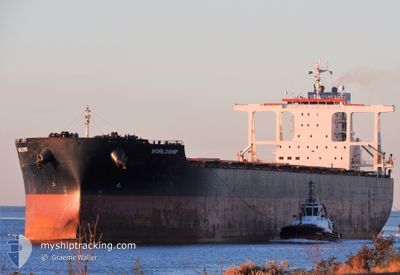
WORLDSHIP
Bulk Carrier
Current Trip
| Time Travelled | 16 days |
|---|---|
| Remaining Time | --- |
| Distance Travelled | 3887.62 nm |
| Remaining Distance | --- |
| AVG Speed | 9.8 Knots |
| MAX Speed | 11.8 Knots |
| AVG Wind | 11 knots |
| MAX Wind | 23 knots |
| MIN Temp | 19.8°C / 67.64°F |
| MAX Temp | 28.7°C / 83.66°F |
| Draught | 17.8 m |
| Position Received | 18 h, 51 m ago |
Current Position
| Longitude | -19.25106° |
|---|---|
| Latitude | 30.52696° |
| Status | Under way using engine |
| Speed | 10 Knots |
| Course | 25.8° |
| Area | North Atlantic Ocean |
| Station | T-AIS |
| Position Received | 18 h, 51 m ago |
Info
Information
The current position of WORLDSHIP is in North Atlantic Ocean with coordinates 30.52696° / -19.25106° as reported on 2024-06-03 04:49 by AIS to our vessel tracker app. The vessel's current speed is 10 Knots and is heading at the port of ROTTERDAM. The estimated time of arrival as calculated by vessel tracking app is 2024-06-09 17:00 LT
The vessel WORLDSHIP (IMO: 9624457, MMSI: 538009531) is a Bulk Carrier that was built in 2012 ( 12 years old ). It's sailing under the flag of [MH] Marshall Is.
In this page you can find informations about the vessels current position, last detected port calls, and current voyage information. If the vessels is not in coverage by AIS you will find the latest position.
The current position of WORLDSHIP is detected by our AIS receivers and we are not responsible for the reliability of the data. The last position was recorded while the vessel was in Coverage by the Ais receivers of our vessel tracking app.
The current draught of WORLDSHIP as reported by AIS is 17.8 meters
Weather
| Temperature | 19.9°C / 67.82°F |
|---|---|
| Wind Speed | 7 knots |
| Direction | 330° NNW |
| Pressure | 1019.8 hPa |
| Humidity | 78.8 % |
| Cloud Coverage | 3 % |
Featured Company
Most Visited Ports (Last year)
| Port | Arrivals | |
|---|---|---|
| 1 | ||
| 1 | ||
| 1 | ||
| 1 | ||
| 1 | ||
| 1 |
Events
| Time | Event | Details | Position / Dest | Info |
|---|---|---|---|---|
| 2024-06-03 04:54 | Status Changed | Default Under way using engine |
30.54022 / -19.24409
NLRTM
|
Speed: 10 kn Course: 25.8° |
| 2024-06-03 04:49 | Status Changed | Under way using engine Default |
30.52696 / -19.25106
NLRTM
|
Speed: 10.1 kn Course: 25° |
| 2024-06-03 04:49 | OUT of Coverage |
30.52696 / -19.25106
North Atlantic Ocean
NLRTM
|
Speed: 10 kn Course: 25.8° |
|
| 2024-06-03 04:38 | IN Coverage |
30.52696 / -19.25106
North Atlantic Ocean
NLRTM
|
Speed: 10 kn Course: 25.8° |
|
| 2024-06-03 01:36 | Status Changed | Default Under way using engine |
30.03637 / -19.50626
NLRTM
|
Speed: 9.7 kn Course: 24° |
| 2024-06-03 01:31 | OUT of Coverage |
30.02362 / -19.51293
North Atlantic Ocean
NLRTM
|
Speed: 9.7 kn Course: 24° |
|
| 2024-06-03 01:29 | Status Changed | Under way using engine Default |
30.01914 / -19.51531
NLRTM
|
Speed: 9.7 kn Course: 25° |
| 2024-06-03 01:23 | IN Coverage |
30.02362 / -19.51293
North Atlantic Ocean
NLRTM
|
Speed: 9.7 kn Course: 24° |
|
| 2024-06-02 23:36 | Status Changed | Default Under way using engine |
29.74343 / -19.66055
NLRTM
|
Speed: 9.8 kn Course: 24.1° |
| 2024-06-02 23:26 | OUT of Coverage |
29.71847 / -19.67289
North Atlantic Ocean
NLRTM
|
Speed: 9.8 kn Course: 24.1° |