
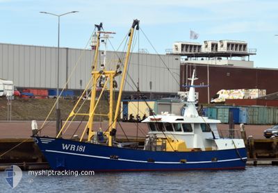
WR181 ELISABETH
Fishing
Current Trip
Unknown
| Time Travelled | 3 days |
|---|---|
| Remaining Time | --- |
| Distance Travelled | 256.49 nm |
| Remaining Distance | --- |
| AVG Speed | 3.8 Knots |
| MAX Speed | 11.4 Knots |
| AVG Wind | 13 knots |
| MAX Wind | 21.2 knots |
| MIN Temp | 11.6°C / 52.88°F |
| MAX Temp | 16.7°C / 62.06°F |
| Draught | 1.6 m |
| Position Received | Now |
Current Position
| Longitude | 4.69528° |
|---|---|
| Latitude | 52.94275° |
| Status | Under way using engine |
| Speed | 4 Knots |
| Course | 157° |
| Area | North Sea |
| Station | T-AIS |
| Position Received | Now |
Info
Information
The current position of WR181 ELISABETH is in North Sea with coordinates 52.94275° / 4.69528° as reported on 2024-06-06 12:30 by AIS to our vessel tracker app. The vessel's current speed is 4 Knots
The vessel WR181 ELISABETH (IMO: 9244025, MMSI: 244042000) is a Fishing It's sailing under the flag of [NL] Netherlands.
In this page you can find informations about the vessels current position, last detected port calls, and current voyage information. If the vessels is not in coverage by AIS you will find the latest position.
The current position of WR181 ELISABETH is detected by our AIS receivers and we are not responsible for the reliability of the data. The last position was recorded while the vessel was in Coverage by the Ais receivers of our vessel tracking app.
The current draught of WR181 ELISABETH as reported by AIS is 1.6 meters
Weather
| Temperature | 13.7°C / 56.66°F |
|---|---|
| Wind Speed | 10 knots |
| Direction | 283° WNW |
| Pressure | 1016.8 hPa |
| Humidity | 62 % |
| Cloud Coverage | 96 % |
Featured Company
Last Port Calls
| Port | Arrival | Departure | Time In Port |
|---|---|---|---|
| 2024-05-31 03:12 | 2024-06-02 23:58 | 2 d | |
| 2024-05-24 04:08 | 2024-05-26 23:54 | 2 d | |
| 2024-05-17 04:06 | 2024-05-19 23:52 | 2 d | |
| 2024-05-14 17:09 | 2024-05-14 18:05 | 55 m | |
| 2024-05-08 19:56 | 2024-05-12 23:48 | 4 d | |
| 2024-05-03 04:33 | 2024-05-05 23:51 | 2 d | |
| 2024-04-26 03:12 | 2024-04-28 23:57 | 2 d | |
| 2024-04-19 07:16 | 2024-04-22 00:04 | 2 d | |
| 2024-04-12 04:55 | 2024-04-16 17:06 | 4 d | |
| 2024-04-09 17:07 | 2024-04-10 04:48 | 11 h |
Most Visited Ports (Last year)
| Port | Arrivals | |
|---|---|---|
| 14 | ||
| 13 | ||
| 12 | ||
| 10 | ||
| 7 | ||
| 4 |
Last Trips
| Origin | Departure | Destination | Arrival | Distance | |
|---|---|---|---|---|---|
| 2024-05-27 01:54 | 2024-05-31 05:12 | 344.37 nm | |||
| 2024-05-20 01:52 | 2024-05-24 06:08 | 346.42 nm | |||
| 2024-05-14 20:05 | 2024-05-17 06:06 | 183.79 nm | |||
| 2024-05-13 01:48 | 2024-05-14 19:09 | 140.11 nm | |||
| 2024-05-06 01:51 | 2024-05-08 21:56 | 240.63 nm | |||
| 2024-04-29 01:57 | 2024-05-03 06:33 | 353.33 nm | |||
| 2024-04-22 02:04 | 2024-04-26 05:12 | 308.29 nm | |||
| 2024-04-16 19:06 | 2024-04-19 09:16 | 132.16 nm | |||
| 2024-04-10 06:48 | 2024-04-12 06:55 | 168.05 nm | |||
| 2024-04-08 02:34 | 2024-04-09 19:07 | 138.57 nm |
Events
| Time | Event | Details | Position / Dest | Info |
|---|---|---|---|---|
| 2024-06-06 02:55 | START Moving | 1.26 nm, East of TEXEL |
53.01015 / 4.83286
|
Speed: 6.5 kn Course: 254.7° |
| 2024-06-06 02:53 | STOP Moving | 1.43 nm, East of TEXEL |
53.01077 / 4.83736
|
Speed: 0.3 kn Course: 244° |
| 2024-06-05 18:09 | START Moving | 6.79 nm, East of OUDESCHILD |
53.05952 / 5.03983
|
Speed: 4.2 kn Course: 242° |
| 2024-06-05 17:57 | STOP Moving | 6.62 nm, East of OUDESCHILD |
53.05912 / 5.03508
|
Speed: 0.3 kn Course: 254° |
| 2024-06-05 13:36 | START Moving | 2.07 nm, North West of DEN HELDER |
52.97422 / 4.73565
|
Speed: 4.3 kn Course: 51° |
| 2024-06-05 13:32 | STOP Moving | 2.12 nm, North West of DEN HELDER |
52.97300 / 4.73308
|
Speed: 0.3 kn Course: 213° |
| 2024-06-05 12:33 | START Moving | 2.82 nm, West of DEN HELDER |
52.95992 / 4.70898
|
Speed: 3.4 kn Course: 46° |
| 2024-06-05 11:11 | STOP Moving | 4.7 nm, South West of DEN HELDER |
52.90402 / 4.69445
|
Speed: 0.2 kn Course: 353° |
| 2024-06-05 06:17 | IN Coverage |
53.06072 / 5.04462
North Sea
|
Speed: 2.8 kn Course: 306.4° |
|
| 2024-06-04 23:19 | OUT of Coverage |
53.07400 / 4.97105
North Sea
|
Speed: 2.8 kn Course: 104.5° |