
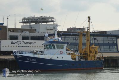
WR189 GRIETJE
Fishing
Current Trip
Unknown
| Time Travelled | 3 days |
|---|---|
| Remaining Time | --- |
| Distance Travelled | 178.72 nm |
| Remaining Distance | --- |
| AVG Speed | 7.1 Knots |
| MAX Speed | 9.6 Knots |
| AVG Wind | 12.5 knots |
| MAX Wind | 15.9 knots |
| MIN Temp | 13.6°C / 56.48°F |
| MAX Temp | 15.6°C / 60.08°F |
| Draught | 0 m |
| Position Received | 1 d ago |
Current Position
| Longitude | 5.96037° |
|---|---|
| Latitude | 55.58091° |
| Status | Under way using engine |
| Speed | 2.6 Knots |
| Course | 215° |
| Area | North Sea |
| Station | T-AIS |
| Position Received | 1 d ago |
Info
Information
The current position of WR189 GRIETJE is in North Sea with coordinates 55.58091° / 5.96037° as reported on 2024-05-27 18:25 by AIS to our vessel tracker app. The vessel's current speed is 2.6 Knots
The vessel WR189 GRIETJE (IMO: 8543369, MMSI: 245053000) is a Fishing It's sailing under the flag of [NL] Netherlands.
In this page you can find informations about the vessels current position, last detected port calls, and current voyage information. If the vessels is not in coverage by AIS you will find the latest position.
The current position of WR189 GRIETJE is detected by our AIS receivers and we are not responsible for the reliability of the data. The last position was recorded while the vessel was in Coverage by the Ais receivers of our vessel tracking app.
Weather
| Temperature | 13.6°C / 56.48°F |
|---|---|
| Wind Speed | 11 knots |
| Direction | 221° SW |
| Pressure | 1014.7 hPa |
| Humidity | 78.3 % |
| Cloud Coverage | 63 % |
Featured Company
Last Port Calls
| Port | Arrival | Departure | Time In Port |
|---|---|---|---|
| 2024-05-25 05:41 | 2024-05-25 07:57 | 2 h | |
| 2024-05-17 02:52 | 2024-05-19 17:55 | 2 d | |
| 2024-05-10 05:21 | 2024-05-12 18:55 | 2 d | |
| 2024-05-10 02:20 | 2024-05-10 04:14 | 1 h | |
| 2024-05-01 21:45 | 2024-05-05 18:11 | 3 d | |
| 2024-04-24 04:19 | 2024-04-24 20:15 | 15 h | |
| 2024-04-15 08:59 | 2024-04-21 14:12 | 6 d | |
| 2024-04-06 05:28 | 2024-04-10 11:11 | 4 d | |
| 2024-03-28 21:27 | 2024-04-01 19:08 | 3 d | |
| 2024-03-22 04:03 | 2024-03-24 21:18 | 2 d |
Most Visited Ports (Last year)
| Port | Arrivals | |
|---|---|---|
| 32 | ||
| 19 | ||
| 6 | ||
| 3 | ||
| 1 |
Last Trips
| Origin | Departure | Destination | Arrival | Distance | |
|---|---|---|---|---|---|
| 2024-05-19 19:55 | 2024-05-25 07:41 | 193.94 nm | |||
| 2024-05-12 20:55 | 2024-05-17 04:52 | 237.66 nm | |||
| 2024-05-10 06:14 | 2024-05-10 07:21 | 11.07 nm | |||
| 2024-05-05 20:11 | 2024-05-10 04:20 | 200.72 nm | |||
| 2024-04-24 22:15 | 2024-05-01 23:45 | 74.71 nm | |||
| 2024-04-21 16:12 | 2024-04-24 06:19 | 71.12 nm | |||
| 2024-04-10 13:11 | 2024-04-15 10:59 | 213.15 nm | |||
| 2024-04-01 21:08 | 2024-04-06 07:28 | 58.96 nm | |||
| 2024-03-24 22:18 | 2024-03-28 22:27 | 65.05 nm | |||
| 2024-03-17 22:10 | 2024-03-22 05:03 | 63.65 nm |
Events
| Time | Event | Details | Position / Dest | Info |
|---|---|---|---|---|
| 2024-05-27 18:25 | OUT of Coverage |
55.58091 / 5.96038
North Sea
|
Speed: 2.6 kn Course: 217.5° |
|
| 2024-05-27 18:08 | Detected in Sea | Danish part of the North Sea |
55.59005 / 5.97515
North Sea
|
Speed: 2.6 kn Course: 221.7° |
| 2024-05-27 18:08 | IN Coverage |
55.59005 / 5.97515
North Sea
|
Speed: 2.6 kn Course: 221.7° |
|
| 2024-05-27 00:44 | OUT of Coverage |
55.42097 / 6.17618
North Sea
|
Speed: 2.8 kn Course: 149° |
|
| 2024-05-27 00:44 | Detected in Sea | German part of the North Sea |
55.42097 / 6.17618
North Sea
|
Speed: 2.8 kn Course: 149° |
| 2024-05-27 00:44 | IN Coverage |
55.42097 / 6.17618
North Sea
|
Speed: 2.8 kn Course: 149° |
|
| 2024-05-26 14:56 | OUT of Coverage |
55.50695 / 6.06456
North Sea
|
Speed: 3 kn Course: 319.7° |
|
| 2024-05-26 13:53 | Change Sea Area | Danish part of the North Sea German part of the North Sea |
55.46668 / 6.12835
North Sea
|
Speed: 3 kn Course: 319.2° |
| 2024-05-26 13:50 | IN Coverage |
55.46668 / 6.12835
North Sea
|
Speed: 3 kn Course: 319.2° |
|
| 2024-05-25 23:34 | OUT of Coverage |
54.78693 / 6.11931
North Sea
|
Speed: 8.2 kn Course: 22° |