
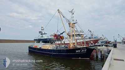
WR212 REIN WILLEM
Fishing
Aktuelle Reise
| Trip Time | 3 Tage |
|---|---|
| Trip Distanz | 278.80 nm |
| Durchschnittliche Geschwindigkeit | 4.6 Knoten |
| Maximale Geschwindigkeit | 10.8 Knoten |
| Tiefgang | 0 m |
| Durchschnittliche Windgeschwindigkeit | 10.8 Knoten |
| Maximale Windgeschwindigkeit | 23 Knoten |
| Minimale Temperatur | 11.8°C / 53.24°F |
| Maximale Temperatur | 14.5°C / 58.1°F |
| Position erhalten | 1 m alt |
Aktuelle Position
| Länge | --- |
|---|---|
| Breite | --- |
| Zustand | Engaged in Fishing |
| Geschwindigkeit | |
| Kurs | 318° |
| Gebiet | North Sea |
| Station | T-AIS |
| Position erhalten | 1 m alt |
Schiffsdetails
Information
Die WR212 REIN WILLEM befindet sich derzeit in North Sea mit den Koordinaten 52.93401° / 5.03723°, Diese Position wurde am 2024-10-31 23:53 von unserer Schiffsverfolgungs-App über AIS erfasst. Das Schiff fährt momentan mit einer Geschwindigkeit von 0 Knoten und liegt im Hafen von DEN OEVER .
Das Schiff WR212 REIN WILLEM (IMO: 9853802, MMSI: 244170098) ist Fishing und fährt unter der Flagge von [NL] Netherlands.
Auf dieser Seite erhalten Sie Informationen zur aktuellen Position des Schiffes, zu den letzten bekannten Hafenanläufen und zu den aktuellen Reiseinformationen. Sollte das Schiff nicht durch AIS abgedeckt sein, wird die zuletzt erfasste Position angezeigt.
Die WR212 REIN WILLEM wird durch unsere AIS-Empfänger ermittelt. Wir übernehmen keine Gewähr für die Richtigkeit der Daten. Die letzte Position wurde von unseren AIS-Empfängern aufgezeichnet, während das Schiff in Reichweite war.
Wetter
| Temperatur | 13.8°C / 56.84°F |
|---|---|
| Windgeschwindigkeit | 13 Knoten |
| Windrichtung | 245° WSW |
| Luftdruck | 1023.8 hPa |
| Luftfeuchtigkeit | 89.2 % |
| Wolken | --- |
Featured Company
Letzte Hafenanläufe
| Hafen | Ankunft | Abfahrt | Time In Port |
|---|---|---|---|
| 2024-10-31 08:29 | |||
| 2024-10-25 09:41 | 2024-10-27 22:59 | 2 d | |
| 2024-10-24 05:18 | 2024-10-25 08:38 | 1 d | |
| 2024-10-17 15:28 | 2024-10-20 21:54 | 3 d | |
| 2024-10-11 03:06 | 2024-10-13 21:23 | 2 d | |
| 2024-10-04 04:31 | 2024-10-06 21:45 | 2 d | |
| 2024-09-27 03:43 | 2024-09-29 22:04 | 2 d | |
| 2024-09-24 08:49 | 2024-09-24 10:52 | 2 h | |
| 2024-09-16 15:24 | 2024-09-24 07:11 | 7 d | |
| 2024-09-12 14:07 | 2024-09-16 06:33 | 3 d |
Meistbesuchte Häfen (Letztes Jahr)
| Hafen | Ankünfte | |
|---|---|---|
| 43 | ||
| 10 | ||
| 8 | ||
| 3 | ||
| 2 | ||
| 2 |
Letzte Reisen
| Herkunft | Abfahrt | Ziel | Ankunft | Distanz | |
|---|---|---|---|---|---|
| 2024-10-27 23:59 | 2024-10-31 09:29 | 278.80 nm | |||
| 2024-10-25 10:38 | 2024-10-25 11:41 | 4.75 nm | |||
| 2024-10-20 23:54 | 2024-10-24 07:18 | 293.92 nm | |||
| 2024-10-13 23:23 | 2024-10-17 17:28 | 306.15 nm | |||
| 2024-10-06 23:45 | 2024-10-11 05:06 | 350.07 nm | |||
| 2024-09-30 00:04 | 2024-10-04 06:31 | 380.33 nm | |||
| 2024-09-24 12:52 | 2024-09-27 05:43 | 219.31 nm | |||
| 2024-09-24 09:11 | 2024-09-24 10:49 | 7.73 nm | |||
| 2024-09-16 08:33 | 2024-09-16 17:24 | 58.01 nm | |||
| 2024-09-08 23:36 | 2024-09-12 16:07 | 255.68 nm |
Events
| Zeit | Ereignis | Details | Position / Ziel | Information |
|---|---|---|---|---|
| 2024-10-31 08:30 | STOP Bewegung |
52.93510 / 5.03594
[NL] DEN OEVER
|
Geschwindigkeit: 0.3 kn Kurs: 162° |
|
| 2024-10-31 08:29 | ZIELHAFEN |
|
52.93488 / 5.03633
[NL] DEN OEVER
|
Geschwindigkeit: 1.1 kn Kurs: 129° |
| 2024-10-31 08:16 | START Bewegung | 0.44 nm, North of DEN OEVER |
52.94473 / 5.03943
FISHING GROUND
|
Geschwindigkeit: 3.1 kn Kurs: 314° |
| 2024-10-31 08:04 | STOP Bewegung | 0.38 nm, North East of DEN OEVER |
52.94320 / 5.04211
FISHING GROUND
|
Geschwindigkeit: 0.3 kn Kurs: 162° |
| 2024-10-31 05:01 | in Abdeckung |
52.96005 / 5.08381
North Sea
|
Geschwindigkeit: 3 kn Kurs: 229.5° |
|
| 2024-10-30 18:03 | außerhalb Abdeckung |
52.95644 / 5.06734
North Sea
|
Geschwindigkeit: 3.3 kn Kurs: 22.4° |
|
| 2024-10-30 09:55 | in Abdeckung |
52.57014 / 4.60605
North Sea
|
Geschwindigkeit: 3.3 kn Kurs: 192.9° |
|
| 2024-10-30 08:04 | außerhalb Abdeckung |
52.66926 / 4.61390
North Sea
|
Geschwindigkeit: 9.4 kn Kurs: 186.1° |
|
| 2024-10-30 05:47 | in Abdeckung |
52.96773 / 4.79188
North Sea
|
Geschwindigkeit: 8.6 kn Kurs: 278.9° |
|
| 2024-10-30 00:21 | außerhalb Abdeckung |
53.01397 / 4.86608
North Sea
|
Geschwindigkeit: 8.9 kn Kurs: 230.4° |