
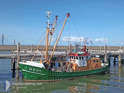
WR88 FIDES MAREM
Fishing
Current Trip
ZEROC
| Time Travelled | 3 days |
|---|---|
| Remaining Time | --- |
| Distance Travelled | 223.58 nm |
| Remaining Distance | --- |
| AVG Speed | 4.2 Knots |
| MAX Speed | 10.4 Knots |
| AVG Wind | 13.4 knots |
| MAX Wind | 22.6 knots |
| MIN Temp | 13.1°C / 55.58°F |
| MAX Temp | 14.8°C / 58.64°F |
| Draught | 3 m |
| Position Received | 1 h, 5 m ago |
Current Position
| Longitude | 5.47135° |
|---|---|
| Latitude | 53.44584° |
| Status | Under way using engine |
| Speed | 2.8 Knots |
| Course | --- |
| Area | North Sea |
| Station | T-AIS |
| Position Received | 1 h, 5 m ago |
Info
Information
The current position of WR88 FIDES MAREM is in North Sea with coordinates 53.44584° / 5.47135° as reported on 2024-05-30 13:34 by AIS to our vessel tracker app. The vessel's current speed is 2.8 Knots
The vessel WR88 FIDES MAREM (IMO: 8432807, MMSI: 246176000) is a Fishing It's sailing under the flag of [NL] Netherlands.
In this page you can find informations about the vessels current position, last detected port calls, and current voyage information. If the vessels is not in coverage by AIS you will find the latest position.
The current position of WR88 FIDES MAREM is detected by our AIS receivers and we are not responsible for the reliability of the data. The last position was recorded while the vessel was in Coverage by the Ais receivers of our vessel tracking app.
The current draught of WR88 FIDES MAREM as reported by AIS is 3 meters
Weather
| Temperature | 14.2°C / 57.56°F |
|---|---|
| Wind Speed | 10 knots |
| Direction | 273° W |
| Pressure | 1005.4 hPa |
| Humidity | 84.1 % |
| Cloud Coverage | 6 % |
Featured Company
Last Port Calls
| Port | Arrival | Departure | Time In Port |
|---|---|---|---|
| 2024-05-24 06:24 | 2024-05-26 22:16 | 2 d | |
| 2024-05-17 05:56 | 2024-05-20 15:31 | 3 d | |
| 2024-05-15 07:46 | 2024-05-15 15:40 | 7 h | |
| 2024-05-12 22:30 | 2024-05-13 07:34 | 9 h | |
| 2024-05-06 01:08 | 2024-05-12 22:18 | 6 d | |
| 2024-03-22 09:41 | 2024-03-25 10:44 | 3 d | |
| 2024-03-15 09:15 | 2024-03-17 23:09 | 2 d | |
| 2024-03-13 07:58 | 2024-03-13 15:33 | 7 h | |
| 2024-03-10 23:09 |
Last Trips
| Origin | Departure | Destination | Arrival | Distance | |
|---|---|---|---|---|---|
| 2024-05-20 17:31 | 2024-05-24 08:24 | 220.42 nm | |||
| 2024-05-15 17:40 | 2024-05-17 07:56 | 115.40 nm | |||
| 2024-05-13 09:34 | 2024-05-15 09:46 | 127.74 nm | |||
| 2024-05-13 00:18 | 2024-05-13 00:30 | 0.65 nm | |||
| 2024-03-25 11:44 | 2024-05-06 03:08 | 505.98 nm | |||
| 2024-03-18 00:09 | 2024-03-22 10:41 | 309.83 nm | |||
| 2024-03-13 16:33 | 2024-03-15 10:15 | 134.78 nm | |||
| 2024-03-11 00:09 | 2024-03-13 08:58 | 156.36 nm |
Events
| Time | Event | Details | Position / Dest | Info |
|---|---|---|---|---|
| 2024-05-30 13:34 | OUT of Coverage |
53.44584 / 5.47136
North Sea
|
Speed: 2.8 kn Course: 246.9° |
|
| 2024-05-30 09:58 | START Moving | 8.21 nm, West of AMELAND |
53.45206 / 5.51986
ZEROC
|
Speed: 5 kn Course: 301.7° |
| 2024-05-30 09:53 | STOP Moving | 8.09 nm, West of AMELAND |
53.45104 / 5.52301
ZEROC
|
Speed: 0.2 kn Course: 511° |
| 2024-05-29 20:53 | IN Coverage |
53.45148 / 5.46012
North Sea
|
Speed: 3.6 kn Course: 68.4° |
|
| 2024-05-29 19:43 | OUT of Coverage |
53.45082 / 5.45058
North Sea
|
Speed: 3.6 kn Course: 71° |
|
| 2024-05-29 19:43 | IN Coverage |
53.45082 / 5.45058
North Sea
|
Speed: 3.6 kn Course: 71° |
|
| 2024-05-29 18:27 | OUT of Coverage |
53.45139 / 5.46955
North Sea
|
Speed: 3.3 kn Course: 273.5° |
|
| 2024-05-29 17:58 | START Moving | 8.58 nm, West of AMELAND |
53.45750 / 5.51072
ZEROC
|
Speed: 3.5 kn Course: 216° |
| 2024-05-29 17:52 | STOP Moving | 8.73 nm, West of AMELAND |
53.45913 / 5.50680
ZEROC
|
Speed: 0.2 kn Course: 511° |
| 2024-05-29 16:00 | START Moving | 7.11 nm, West of AMELAND |
53.45663 / 5.55197
ZEROC
|
Speed: 3.3 kn Course: 6.7° |