
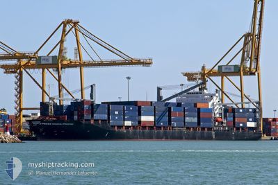
X-PRESS MACHU PICCHU
Container Ship
Current Trip
| Trip Time | 3 days |
|---|---|
| Trip Distance | 1101.49 nm |
| AVG Speed | 11.3 Knots |
| MAX Speed | 16.7 Knots |
| Draught | 11.4 m |
| AVG Wind | 6.4 knots |
| MAX Wind | 18 knots |
| MIN Temp | 26.3°C / 79.34°F |
| MAX Temp | 31.1°C / 87.98°F |
| Position Received | 2 d ago |
Current Position
| Longitude | -82.71328° |
|---|---|
| Latitude | 23.09848° |
| Status | Under way using engine |
| Speed | 10.4 Knots |
| Course | 212° |
| Area | North Atlantic Ocean |
| Station | T-AIS |
| Position Received | 2 d ago |
Info
Information
The current position of X-PRESS MACHU PICCHU is in North Atlantic Ocean with coordinates 23.09848° / -82.71328° as reported on 2024-06-27 12:13 by AIS to our vessel tracker app. The vessel's current speed is 10.4 Knots and is currently inside the port of MARIEL.
The vessel X-PRESS MACHU PICCHU (IMO: 9325441, MMSI: 563058900) is a Container Ship that was built in 2006 ( 18 years old ). It's sailing under the flag of [SG] Singapore.
In this page you can find informations about the vessels current position, last detected port calls, and current voyage information. If the vessels is not in coverage by AIS you will find the latest position.
The current position of X-PRESS MACHU PICCHU is detected by our AIS receivers and we are not responsible for the reliability of the data. The last position was recorded while the vessel was in Coverage by the Ais receivers of our vessel tracking app.
The current draught of X-PRESS MACHU PICCHU as reported by AIS is 11.4 meters
Weather
| Temperature | 31.5°C / 88.7°F |
|---|---|
| Wind Speed | 12 knots |
| Direction | 79° E |
| Pressure | 1016.3 hPa |
| Humidity | 67 % |
| Cloud Coverage | 98 % |
Featured Company
Last Port Calls
| Port | Arrival | Departure | Time In Port |
|---|---|---|---|
| 2024-06-27 14:02 | |||
| 2024-06-22 21:55 | 2024-06-23 14:31 | 16 h | |
| 2024-06-21 20:26 | 2024-06-22 21:42 | 1 d | |
| 2024-06-19 08:58 | 2024-06-20 10:39 | 1 d | |
| 2024-06-18 18:14 | 2024-06-18 23:21 | 5 h | |
| 2024-06-10 18:42 | 2024-06-14 22:56 | 4 d | |
| 2024-06-06 23:47 | 2024-06-07 23:21 | 23 h | |
| 2024-06-04 23:59 | 2024-06-05 21:57 | 21 h | |
| 2024-06-03 13:25 | 2024-06-03 20:41 | 7 h | |
| 2024-06-03 13:16 |
Most Visited Ports (Last year)
| Port | Arrivals | |
|---|---|---|
| 31 | ||
| 25 | ||
| 24 | ||
| 15 | ||
| 1 | ||
| 1 |
Last Trips
| Origin | Departure | Destination | Arrival | Distance | |
|---|---|---|---|---|---|
| 2024-06-23 09:31 | 2024-06-27 10:02 | 1101.49 nm | |||
| 2024-06-22 16:42 | 2024-06-22 16:55 | 2.23 nm | |||
| 2024-06-20 05:39 | 2024-06-21 15:26 | 307.28 nm | |||
| 2024-06-18 18:21 | 2024-06-19 03:58 | 15.62 nm | |||
| 2024-06-14 18:56 | 2024-06-18 13:14 | 1019.75 nm | |||
| 2024-06-07 18:21 | 2024-06-10 14:42 | 1053.38 nm | |||
| 2024-06-05 16:57 | 2024-06-06 18:47 | 290.25 nm | |||
| 2024-06-03 15:41 | 2024-06-04 18:59 | 33.01 nm | |||
| 2024-05-31 18:24 | 2024-06-03 08:25 | 1001.35 nm | |||
| 2024-05-31 18:24 | 2024-06-03 08:16 | 1001.11 nm |
Events
| Time | Event | Details | Position / Dest | Info |
|---|---|---|---|---|
| 2024-06-27 14:22 | STOP Moving |
23.00705 / -82.76054
[CU] MARIEL
|
Speed: 0.2 kn Course: 239° |
|
| 2024-06-27 14:02 | PORT ARRIVAL |
|
23.00960 / -82.75526
[CU] MARIEL
|
Speed: 9 kn Course: 182° |
| 2024-06-27 12:31 | Status Changed | Default Under way using engine |
23.07253 / -82.74274
CUMAR
|
Speed: 10.4 kn Course: 212° |
| 2024-06-27 12:13 | OUT of Coverage |
23.09848 / -82.71328
North Atlantic Ocean
|
Speed: 10.4 kn Course: 212° |
|
| 2024-06-27 10:37 | Status Changed | Under way using engine Default |
23.25137 / -82.64311
CUMAR
|
Speed: 1.5 kn Course: 14° |
| 2024-06-27 10:15 | Status Changed | Default Under way using engine |
23.24907 / -82.65272
CUMAR
|
Speed: 1.5 kn Course: 13° |
| 2024-06-27 10:09 | Status Changed | Under way using engine Default |
23.24852 / -82.65540
CUMAR
|
Speed: 1.5 kn Course: 15° |
| 2024-06-27 09:57 | Status Changed | Default Under way using engine |
23.24730 / -82.66098
CUMAR
|
Speed: 1.5 kn Course: 29° |
| 2024-06-27 09:37 | Status Changed | Under way using engine Default |
23.24497 / -82.66998
CUMAR
|
Speed: 1.5 kn Course: 27° |
| 2024-06-27 09:30 | IN Coverage |
23.24503 / -82.66973
North Atlantic Ocean
|
Speed: 1.4 kn Course: 73° |