
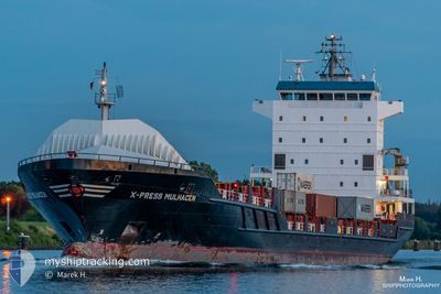
X-PRESS MULHACEN
Container Ship
Current Trip
| Time Travelled | 2 days |
|---|---|
| Remaining Time | 23 h, 23 mins |
| Distance Travelled | 684.10 nm |
| Remaining Distance | 323.81 nm |
| AVG Speed | 10.2 Knots |
| MAX Speed | 15.6 Knots |
| AVG Wind | 10.2 knots |
| MAX Wind | 22 knots |
| MIN Temp | 11.6°C / 52.88°F |
| MAX Temp | 17.1°C / 62.78°F |
| Draught | 6.1 m |
| Position Received | 1 m ago |
Current Position
| Longitude | 19.08065° |
|---|---|
| Latitude | 60.20705° |
| Status | Under way using engine |
| Speed | 13.3 Knots |
| Course | 337.5° |
| Area | Gulf of Bothnia |
| Station | T-AIS |
| Position Received | 1 m ago |
Info
Information
The current position of X-PRESS MULHACEN is in Gulf of Bothnia with coordinates 60.20705° / 19.08065° as reported on 2024-06-23 02:41 by AIS to our vessel tracker app. The vessel's current speed is 13.3 Knots and is heading at the port of HARAHOLMEN. The estimated time of arrival as calculated by vessel tracking app is 2024-06-24 02:06 LT
The vessel X-PRESS MULHACEN (IMO: 9365960, MMSI: 229630000) is a Container Ship that was built in 2008 ( 16 years old ). It's sailing under the flag of [MT] Malta.
In this page you can find informations about the vessels current position, last detected port calls, and current voyage information. If the vessels is not in coverage by AIS you will find the latest position.
The current position of X-PRESS MULHACEN is detected by our AIS receivers and we are not responsible for the reliability of the data. The last position was recorded while the vessel was in Coverage by the Ais receivers of our vessel tracking app.
The current draught of X-PRESS MULHACEN as reported by AIS is 6.1 meters
Weather
| Temperature | 14°C / 57.2°F |
|---|---|
| Wind Speed | 12 knots |
| Direction | 48° NE |
| Pressure | 1008.5 hPa |
| Humidity | 80.2 % |
| Cloud Coverage | 100 % |
Featured Company
Last Port Calls
| Port | Arrival | Departure | Time In Port |
|---|---|---|---|
| 2024-06-20 04:24 | 2024-06-20 14:48 | 10 h | |
| 2024-06-17 18:53 | 2024-06-19 19:29 | 2 d | |
| 2024-06-17 14:28 | 2024-06-17 15:41 | 1 h | |
| 2024-06-13 09:53 | 2024-06-14 14:21 | 1 d | |
| 2024-06-11 07:29 | 2024-06-12 09:09 | 1 d | |
| 2024-06-10 03:53 | 2024-06-10 23:53 | 19 h | |
| 2024-06-06 14:48 | 2024-06-06 14:51 | 2 m | |
| 2024-06-05 16:21 | 2024-06-05 21:31 | 5 h | |
| 2024-06-04 20:27 | 2024-06-05 07:52 | 11 h | |
| 2024-06-02 23:52 | 2024-06-03 16:36 | 16 h |
Most Visited Ports (Last year)
| Port | Arrivals | |
|---|---|---|
| 44 | ||
| 38 | ||
| 17 | ||
| 17 | ||
| 9 | ||
| 8 |
Last Trips
| Origin | Departure | Destination | Arrival | Distance | |
|---|---|---|---|---|---|
| 2024-06-19 21:29 | 2024-06-20 06:24 | 107.67 nm | |||
| 2024-06-17 17:41 | 2024-06-17 20:53 | 37.01 nm | |||
| 2024-06-14 16:21 | 2024-06-17 16:28 | 748.67 nm | |||
| 2024-06-12 12:09 | 2024-06-13 11:53 | 295.68 nm | |||
| 2024-06-11 01:53 | 2024-06-11 10:29 | 106.62 nm | |||
| 2024-06-06 16:51 | 2024-06-10 05:53 | 881.29 nm | |||
| 2024-06-05 23:31 | 2024-06-06 16:48 | 125.41 nm | |||
| 2024-06-05 09:52 | 2024-06-05 18:21 | 107.44 nm | |||
| 2024-06-03 18:36 | 2024-06-04 22:27 | 300.91 nm | |||
| 2024-05-26 16:20 | 2024-06-03 01:52 | 995.46 nm |
Events
| Time | Event | Details | Position / Dest | Info |
|---|---|---|---|---|
| 2024-06-23 02:41 | Change Sea Area | Swedish part of the Gulf of Bothnia Finnish part of the Gulf of Bothnia |
60.20705 / 19.08065
Gulf of Bothnia
SEPIT
|
Speed: 13.3 kn Course: 337.5° |
| 2024-06-23 00:22 | Change Sea Area | Finnish part of the Gulf of Bothnia Finnish part of the Baltic Sea |
59.79147 / 19.74218
Gulf of Bothnia
SEPIT
|
Speed: 13.6 kn Course: 317.6° |
| 2024-06-22 22:32 | Detected in Sea | Finnish part of the Baltic Sea |
59.48050 / 20.12749
Baltic Sea
SEPIT
|
Speed: 12.9 kn Course: 40.5° |
| 2024-06-22 19:07 | Status Changed | Under way using engine Default |
58.88732 / 19.26346
SEPIT
|
Speed: 13.3 kn Course: 34° |
| 2024-06-22 19:05 | Status Changed | Default Under way using engine |
58.88187 / 19.25616
SEPIT
|
Speed: 13.3 kn Course: 34° |
| 2024-06-22 12:42 | Status Changed | Under way using engine Default |
57.68379 / 18.01648
SEPIT
|
Speed: 12.8 kn Course: 30° |
| 2024-06-22 12:41 | Status Changed | Default Under way using engine |
57.68132 / 18.01378
SEPIT
|
Speed: 12.8 kn Course: 29.1° |
| 2024-06-22 12:30 | Status Changed | Under way using engine Default |
57.64605 / 17.97676
SEPIT
|
Speed: 12.7 kn Course: 29° |
| 2024-06-22 12:29 | Status Changed | Default Under way using engine |
57.64398 / 17.97464
SEPIT
|
Speed: 12.7 kn Course: 27.8° |
| 2024-06-22 12:22 | Status Changed | Under way using engine Default |
57.61977 / 17.95010
SEPIT
|
Speed: 12.6 kn Course: 28° |