
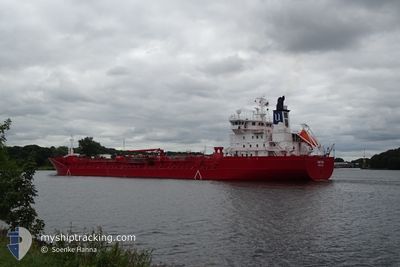
XANTHIA
Oil/Chemical Tanker
Current Trip
FI FOR
| Time Travelled | 3 days |
|---|---|
| Remaining Time | --- |
| Distance Travelled | 956.36 nm |
| Remaining Distance | --- |
| AVG Speed | 12.8 Knots |
| MAX Speed | 15.8 Knots |
| AVG Wind | 10.2 knots |
| MAX Wind | 20.6 knots |
| MIN Temp | 10.1°C / 50.18°F |
| MAX Temp | 16.8°C / 62.24°F |
| Draught | 8.6 m |
| Position Received | 1 m ago |
Current Position
| Longitude | 15.59060° |
|---|---|
| Latitude | 55.67618° |
| Status | Under way using engine |
| Speed | 12.9 Knots |
| Course | 67.5° |
| Area | Baltic Sea |
| Station | T-AIS |
| Position Received | 1 m ago |
Info
Information
The current position of XANTHIA is in Baltic Sea with coordinates 55.67618° / 15.59060° as reported on 2024-05-31 23:36 by AIS to our vessel tracker app. The vessel's current speed is 12.9 Knots
The vessel XANTHIA (IMO: 9246152, MMSI: 257970000) is a Oil/Chemical Tanker that was built in 2003 ( 21 years old ). It's sailing under the flag of [NO] Norway.
In this page you can find informations about the vessels current position, last detected port calls, and current voyage information. If the vessels is not in coverage by AIS you will find the latest position.
The current position of XANTHIA is detected by our AIS receivers and we are not responsible for the reliability of the data. The last position was recorded while the vessel was in Coverage by the Ais receivers of our vessel tracking app.
The current draught of XANTHIA as reported by AIS is 8.6 meters
Weather
| Temperature | 12.6°C / 54.68°F |
|---|---|
| Wind Speed | 12 knots |
| Direction | 52° NE |
| Pressure | 1012.7 hPa |
| Humidity | 93.8 % |
| Cloud Coverage | 9 % |
Featured Company
Last Port Calls
| Port | Arrival | Departure | Time In Port |
|---|---|---|---|
| 2024-05-27 10:37 | 2024-05-28 20:21 | 1 d | |
| 2024-05-16 06:13 | 2024-05-17 00:15 | 18 h | |
| 2024-05-09 16:11 | 2024-05-10 05:36 | 13 h | |
| 2024-05-07 22:54 | 2024-05-08 19:42 | 20 h | |
| 2024-05-03 16:54 | 2024-05-05 12:01 | 1 d | |
| 2024-05-03 09:55 | 2024-05-03 14:01 | 4 h | |
| 2024-04-20 03:25 | 2024-04-21 11:09 | 1 d | |
| 2024-04-10 16:09 | 2024-04-11 19:21 | 1 d | |
| 2024-04-08 12:21 | 2024-04-08 12:26 | 4 m | |
| 2024-04-01 07:50 | 2024-04-02 11:34 | 1 d |
Most Visited Ports (Last year)
| Port | Arrivals | |
|---|---|---|
| 5 | ||
| 5 | ||
| 4 | ||
| 4 | ||
| 4 | ||
| 3 |
Last Trips
| Origin | Departure | Destination | Arrival | Distance | |
|---|---|---|---|---|---|
| 2024-05-17 02:15 | 2024-05-27 12:37 | 2533.91 nm | |||
| 2024-05-10 07:36 | 2024-05-16 08:13 | 772.16 nm | |||
| 2024-05-08 21:42 | 2024-05-09 18:11 | 253.46 nm | |||
| 2024-05-05 14:01 | 2024-05-08 00:54 | 684.35 nm | |||
| 2024-05-03 16:01 | 2024-05-03 18:54 | 0.70 nm | |||
| 2024-04-21 12:09 | 2024-05-03 11:55 | 2159.22 nm | |||
| 2024-04-11 22:21 | 2024-04-20 04:25 | 2430.56 nm | |||
| 2024-04-08 14:26 | 2024-04-10 19:09 | 675.32 nm | |||
| 2024-04-02 11:34 | 2024-04-08 14:21 | 1720.13 nm | |||
| 2024-03-28 08:50 | 2024-04-01 07:50 | 123.13 nm |
Events
| Time | Event | Details | Position / Dest | Info |
|---|---|---|---|---|
| 2024-05-31 22:59 | Change Sea Area | Swedish part of the Baltic Sea Danish part of the Kattegat |
55.61820 / 15.38149
Baltic Sea
FI FOR
|
Speed: 12.9 kn Course: 61.8° |
| 2024-05-31 18:28 | Detected in Sea | Danish part of the Kattegat |
55.01737 / 14.07876
Kattegat
FI FOR
|
Speed: 12.9 kn Course: 68° |
| 2024-05-31 18:04 | Detected in Sea | Swedish part of the Baltic Sea |
54.98625 / 13.93837
Baltic Sea
FI FOR
|
Speed: 13 kn Course: 70° |
| 2024-05-31 13:25 | Change Sea Area | German part of the Baltic Sea Danish part of the Baltic Sea |
54.60325 / 12.35499
Baltic Sea
FI FOR
|
Speed: 12.9 kn Course: 56° |
| 2024-05-31 13:10 | Change Sea Area | Danish part of the Baltic Sea German part of the Baltic Sea |
54.56630 / 12.29472
Baltic Sea
FI FOR
|
Speed: 12.6 kn Course: 17.5° |
| 2024-05-31 12:15 | Detected in Sea | German part of the Baltic Sea |
54.41290 / 12.12700
Baltic Sea
FI FOR
|
Speed: 13.1 kn Course: 89.5° |
| 2024-05-31 10:52 | ETA Changed | 2024/06/02 03:00 2024/06/02 02:00 |
54.45134 / 11.63171
FI FOR
|
Speed: 13 kn Course: 117.5° |
| 2024-05-31 10:19 | Detected in Sea | Danish part of the Baltic Sea |
54.49840 / 11.44915
Baltic Sea
FI FOR
|
Speed: 12.7 kn Course: 112.1° |
| 2024-05-31 09:11 | Change Sea Area | German part of the Baltic Sea Danish part of the Baltic Sea |
54.63247 / 11.03027
Baltic Sea
FI FOR
|
Speed: 15.3 kn Course: 123.4° |
| 2024-05-31 08:28 | Change Sea Area | Danish part of the Baltic Sea Danish part of the Kattegat |
54.74212 / 10.86011
Baltic Sea
FI FOR
|
Speed: 13.1 kn Course: 180.6° |