
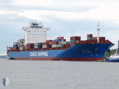
XIN CHANG SHA
Container Ship
Current Trip
| Time Travelled | 3 days |
|---|---|
| Remaining Time | --- |
| Distance Travelled | 1204.49 nm |
| Remaining Distance | --- |
| AVG Speed | 15.5 Knots |
| MAX Speed | 19.3 Knots |
| AVG Wind | 10.7 knots |
| MAX Wind | 19 knots |
| MIN Temp | 20.8°C / 69.44°F |
| MAX Temp | 28.2°C / 82.76°F |
| Draught | 12.3 m |
| Position Received | 2 d ago |
Current Position
| Longitude | -42.31133° |
|---|---|
| Latitude | -23.10533° |
| Status | Under way using engine |
| Speed | 16.6 Knots |
| Course | 90° |
| Area | South Atlantic Ocean |
| Station | T-AIS |
| Position Received | 2 d ago |
Info
Information
The current position of XIN CHANG SHA is in South Atlantic Ocean with coordinates -23.10533° / -42.31133° as reported on 2024-05-29 08:59 by AIS to our vessel tracker app. The vessel's current speed is 16.6 Knots and is heading at the port of ALGECIRAS. The estimated time of arrival as calculated by vessel tracking app is 2024-06-08 08:00 LT
The vessel XIN CHANG SHA (IMO: 9312559, MMSI: 413146000) is a Container Ship that was built in 2005 ( 19 years old ). It's sailing under the flag of [CN] China.
In this page you can find informations about the vessels current position, last detected port calls, and current voyage information. If the vessels is not in coverage by AIS you will find the latest position.
The current position of XIN CHANG SHA is detected by our AIS receivers and we are not responsible for the reliability of the data. The last position was recorded while the vessel was in Coverage by the Ais receivers of our vessel tracking app.
The current draught of XIN CHANG SHA as reported by AIS is 12.3 meters
Weather
| Temperature | 27.8°C / 82.04°F |
|---|---|
| Wind Speed | 10 knots |
| Direction | 125° SE |
| Pressure | 1014.5 hPa |
| Humidity | 76.4 % |
| Cloud Coverage | 27 % |
Featured Company
Last Port Calls
| Port | Arrival | Departure | Time In Port |
|---|---|---|---|
| 2024-05-28 19:18 | 2024-05-28 19:23 | 5 m | |
| 2024-05-27 02:35 | 2024-05-28 03:16 | 1 d | |
| 2024-05-23 20:57 | 2024-05-24 08:44 | 11 h | |
| 2024-05-23 01:45 | 2024-05-23 15:38 | 13 h | |
| 2024-05-19 22:23 | 2024-05-20 13:30 | 15 h | |
| 2024-05-18 19:17 | 2024-05-19 05:29 | 10 h | |
| 2024-05-15 16:40 | 2024-05-16 13:45 | 21 h | |
| 2024-05-01 06:40 | 2024-05-01 19:23 | 12 h | |
| 2024-04-28 14:32 | 2024-04-29 01:34 | 11 h | |
| 2024-04-24 18:13 | 2024-04-25 12:00 | 17 h |
Most Visited Ports (Last year)
| Port | Arrivals | |
|---|---|---|
| 10 | ||
| 9 | ||
| 7 | ||
| 5 | ||
| 4 | ||
| 4 |
Last Trips
| Origin | Departure | Destination | Arrival | Distance | |
|---|---|---|---|---|---|
| 2024-05-28 00:16 | 2024-05-28 16:18 | 232.83 nm | |||
| 2024-05-24 05:44 | 2024-05-26 23:35 | 182.04 nm | |||
| 2024-05-23 12:38 | 2024-05-23 17:57 | 68.09 nm | |||
| 2024-05-20 10:30 | 2024-05-22 22:45 | 863.85 nm | |||
| 2024-05-19 02:29 | 2024-05-19 19:23 | 147.89 nm | |||
| 2024-05-16 10:45 | 2024-05-18 16:17 | 890.10 nm | |||
| 2024-05-01 21:23 | 2024-05-15 13:40 | 4420.54 nm | |||
| 2024-04-29 02:34 | 2024-05-01 08:40 | 442.47 nm | |||
| 2024-04-25 14:00 | 2024-04-28 15:32 | 1159.20 nm | |||
| 2024-04-22 17:33 | 2024-04-24 20:13 | 446.07 nm |
Events
| Time | Event | Details | Position / Dest | Info |
|---|---|---|---|---|
| 2024-05-29 09:03 | Status Changed | Default Under way using engine |
-23.10550 / -42.28933
ESALG
|
Speed: 16.6 kn Course: 90° |
| 2024-05-29 08:59 | OUT of Coverage |
-23.10533 / -42.31133
South Atlantic Ocean
ESALG
|
Speed: 16.6 kn Course: 90° |
|
| 2024-05-29 08:54 | Status Changed | Under way using engine Default |
-23.10533 / -42.33183
ESALG
|
Speed: 16.6 kn Course: 91° |
| 2024-05-29 08:50 | Status Changed | Default Under way using engine |
-23.10533 / -42.35583
ESALG
|
Speed: 16.6 kn Course: 90° |
| 2024-05-29 08:45 | Status Changed | Under way using engine Default |
-23.10567 / -42.37750
ESALG
|
Speed: 16.6 kn Course: 88° |
| 2024-05-29 08:33 | Status Changed | Default Under way using engine |
-23.10717 / -42.44083
ESALG
|
Speed: 16.9 kn Course: 89° |
| 2024-05-29 08:26 | Status Changed | Under way using engine Default |
-23.10850 / -42.47583
ESALG
|
Speed: 17 kn Course: 88° |
| 2024-05-29 08:22 | Status Changed | Default Under way using engine |
-23.10967 / -42.49667
ESALG
|
Speed: 17 kn Course: 86° |
| 2024-05-29 08:07 | Status Changed | Under way using engine Default |
-23.10850 / -42.57317
ESALG
|
Speed: 17.2 kn Course: 101° |
| 2024-05-29 08:02 | Status Changed | Default Under way using engine |
-23.10300 / -42.59850
ESALG
|
Speed: 16.9 kn Course: 105° |