
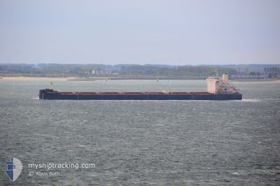
XIN QI XING
Bulk Carrier
Current Trip
| Time Travelled | --- |
|---|---|
| Remaining Time | 7 h, 59 mins |
| Distance Travelled | 5186.24 nm |
| Remaining Distance | 133.20 nm |
| AVG Speed | 10.1 Knots |
| MAX Speed | 14 Knots |
| AVG Wind | 7.2 knots |
| MAX Wind | 24 knots |
| MIN Temp | 21.4°C / 70.52°F |
| MAX Temp | 31.9°C / 89.42°F |
| Draught | 7.1 m |
| Position Received | 9 d ago |
Current Position
| Longitude | 113.79385° |
|---|---|
| Latitude | 22.15048° |
| Status | Under way using engine |
| Speed | 7.3 Knots |
| Course | 162.3° |
| Area | South China Sea |
| Station | T-AIS |
| Position Received | 9 d ago |
Info
Information
The current position of XIN QI XING is in South China Sea with coordinates 22.15048° / 113.79385° as reported on 2024-05-23 12:36 by AIS to our vessel tracker app. The vessel's current speed is 7.3 Knots and is heading at the port of BALIKPAPAN. The estimated time of arrival as calculated by vessel tracking app is 2024-06-02 05:24 LT
The vessel XIN QI XING (IMO: 9592056, MMSI: 414627000) is a Bulk Carrier that was built in 2012 ( 12 years old ). It's sailing under the flag of [CN] China.
In this page you can find informations about the vessels current position, last detected port calls, and current voyage information. If the vessels is not in coverage by AIS you will find the latest position.
The current position of XIN QI XING is detected by our AIS receivers and we are not responsible for the reliability of the data. The last position was recorded while the vessel was in Coverage by the Ais receivers of our vessel tracking app.
The current draught of XIN QI XING as reported by AIS is 7.1 meters
Weather
| Temperature | 28.3°C / 82.94°F |
|---|---|
| Wind Speed | 4 knots |
| Direction | 256° WSW |
| Pressure | 1009.4 hPa |
| Humidity | 76.4 % |
| Cloud Coverage | 100 % |
Featured Company
Last Port Calls
Last Trips
| Origin | Departure | Destination | Arrival | Distance |
|---|
Events
| Time | Event | Details | Position / Dest | Info |
|---|---|---|---|---|
| 2024-06-01 02:05 | START Moving | 1.01 nm, North West of BALIKPAPAN |
-1.26527 / 116.78976
BALIKPAPAN
|
Speed: 5.7 kn Course: 149° |
| 2024-05-31 06:53 | STOP Moving | 1.37 nm, North West of BALIKPAPAN |
-1.25912 / 116.78690
BALIKPAPAN
|
Speed: 0.3 kn Course: 337° |
| 2024-05-31 05:49 | START Moving | 2.27 nm, West of KARIANGAU |
-1.19993 / 116.77968
BALIKPAPAN
|
Speed: 4.3 kn Course: 183° |
| 2024-05-30 13:16 | STOP Moving | 2.13 nm, West of KARIANGAU |
-1.19553 / 116.78230
BALIKPAPAN
|
Speed: 0.1 kn Course: 3° |
| 2024-05-30 12:09 | START Moving | 1.28 nm, North West of BALIKPAPAN |
-1.26022 / 116.78790
BALIKPAPAN
|
Speed: 3.7 kn Course: 349° |
| 2024-05-30 03:41 | STOP Moving | 1.26 nm, North West of BALIKPAPAN |
-1.26548 / 116.78497
BALIKPAPAN
|
Speed: 0.3 kn Course: 45° |
| 2024-05-30 01:47 | START Moving | 11.97 nm, South East of BALIKPAPAN |
-1.36500 / 116.98167
BALIKPAPAN
|
Speed: 4 kn Course: -1° |
| 2024-05-28 21:19 | STOP Moving | 11.91 nm, South East of BALIKPAPAN |
-1.36094 / 116.98248
BALIKPAPAN
|
Speed: Course: 267° |
| 2024-05-23 12:40 | Status Changed | Default Under way using engine |
22.14143 / 113.79699
BALIKPAPAN
|
Speed: 7.3 kn Course: 162.3° |
| 2024-05-23 12:36 | OUT of Coverage |
22.15048 / 113.79385
South China Sea
BALIKPAPAN
|
Speed: 7.3 kn Course: 162.3° |