
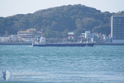
YAHATA_MARU
Cargo
Current Trip
| Trip Time | 6 h, 28 mins |
|---|---|
| Trip Distance | 78.57 nm |
| AVG Speed | 11.9 Knots |
| MAX Speed | 14.1 Knots |
| Draught | 3.9 m |
| AVG Wind | 4.1 knots |
| MAX Wind | 9 knots |
| MIN Temp | 11.8°C / 53.24°F |
| MAX Temp | 16.7°C / 62.06°F |
| Position Received | 2 d ago |
Current Position
| Longitude | 134.14088° |
|---|---|
| Latitude | 34.43517° |
| Status | Under way using engine |
| Speed | 11.4 Knots |
| Course | 281.9° |
| Area | Inland Sea |
| Station | T-AIS |
| Position Received | 2 d ago |
Info
Information
The current position of YAHATA_MARU is in Inland Sea with coordinates 34.43517° / 134.14088° as reported on 2024-05-08 14:41 by AIS to our vessel tracker app. The vessel's current speed is 11.4 Knots and is currently inside the port of YAWATA.
The vessel YAHATA_MARU (IMO: 9566019, MMSI: 431001106) is a Cargo It's sailing under the flag of [JP] Japan.
In this page you can find informations about the vessels current position, last detected port calls, and current voyage information. If the vessels is not in coverage by AIS you will find the latest position.
The current position of YAHATA_MARU is detected by our AIS receivers and we are not responsible for the reliability of the data. The last position was recorded while the vessel was in Coverage by the Ais receivers of our vessel tracking app.
The current draught of YAHATA_MARU as reported by AIS is 3.9 meters
Weather
| Temperature | 16.6°C / 61.88°F |
|---|---|
| Wind Speed | 8 knots |
| Direction | 123° ESE |
| Pressure | 1020.6 hPa |
| Humidity | 81.7 % |
| Cloud Coverage | 14 % |
Featured Company
Last Port Calls
| Port | Arrival | Departure | Time In Port |
|---|---|---|---|
| 2024-05-10 00:00 | |||
| 2024-05-09 03:00 | 2024-05-09 17:32 | 14 h | |
| 2024-05-04 04:04 | 2024-05-07 16:08 | 3 d | |
| 2024-05-02 21:48 | 2024-05-03 08:50 | 11 h | |
| 2024-04-29 21:59 | 2024-05-02 08:52 | 2 d | |
| 2024-04-26 23:43 | 2024-04-29 02:37 | 2 d | |
| 2024-04-22 10:00 | 2024-04-25 02:52 | 2 d | |
| 2024-04-21 22:55 | 2024-04-22 08:40 | 9 h | |
| 2024-04-18 16:35 | 2024-04-20 06:48 | 1 d | |
| 2024-04-15 10:54 | 2024-04-17 06:11 | 1 d |
Last Trips
| Origin | Departure | Destination | Arrival | Distance | |
|---|---|---|---|---|---|
| 2024-05-10 02:32 | 2024-05-10 09:00 | 78.57 nm | |||
| 2024-05-08 01:08 | 2024-05-09 12:00 | 418.65 nm | |||
| 2024-05-03 17:50 | 2024-05-04 13:04 | 236.11 nm | |||
| 2024-05-02 17:52 | 2024-05-03 06:48 | 1.72 nm | |||
| 2024-04-29 11:37 | 2024-04-30 06:59 | 42.50 nm | |||
| 2024-04-25 11:52 | 2024-04-27 08:43 | 359.72 nm | |||
| 2024-04-22 17:40 | 2024-04-22 19:00 | 16.65 nm | |||
| 2024-04-20 15:48 | 2024-04-22 07:55 | 220.83 nm | |||
| 2024-04-17 15:11 | 2024-04-19 01:35 | 417.49 nm | |||
| 2024-04-15 14:49 | 2024-04-15 19:54 | 61.61 nm |
Events
| Time | Event | Details | Position / Dest | Info |
|---|---|---|---|---|
| 2024-05-10 00:08 | STOP Moving |
33.88100 / 130.80441
[JP] YAWATA
|
Speed: 0.1 kn Course: 212° |
|
| 2024-05-10 00:00 | PORT ARRIVAL |
|
33.88517 / 130.80539
[JP] YAWATA
|
Speed: 9.4 kn Course: 202° |
| 2024-05-09 17:32 | PORT DEPARTURE |
|
33.29732 / 131.67406
JP OIP
|
Speed: 11.1 kn Course: 28° |
| 2024-05-09 17:20 | START Moving |
33.26722 / 131.66438
[JP] OITA
|
Speed: 5.2 kn Course: 354° |
|
| 2024-05-09 03:00 | PORT ARRIVAL |
|
33.28260 / 131.66426
[JP] OITA
|
Speed: 11.9 kn Course: 234° |
| 2024-05-08 14:48 | Status Changed | Default Under way using engine |
34.43925 / 134.11272
JP OIP
|
Speed: 11.4 kn Course: 281.9° |
| 2024-05-08 14:41 | OUT of Coverage |
34.43517 / 134.14088
Inland Sea
JP OIP
|
Speed: 11.4 kn Course: 281.9° |
|
| 2024-05-08 14:41 | Status Changed | Under way using engine Default |
34.43507 / 134.14152
JP OIP
|
Speed: 11.6 kn Course: 293° |
| 2024-05-08 14:20 | Status Changed | Default Under way using engine |
34.40906 / 134.21625
JP OIP
|
Speed: 11.8 kn Course: 261.6° |
| 2024-05-08 09:29 | Change Sea Area | Japanese part of the Inland Sea Japanese part of the Philippine Sea |
34.27467 / 134.98628
Inland Sea
JP OIP
|
Speed: 13.8 kn Course: 358.4° |