
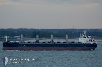
YANGTZE BRIGHTNESS
Bulk Carrier
Current Trip
TANJUNG KAMPEH
| Time Travelled | 21 days |
|---|---|
| Remaining Time | --- |
| Distance Travelled | 3147.75 nm |
| Remaining Distance | --- |
| AVG Speed | 9.6 Knots |
| MAX Speed | 13.3 Knots |
| AVG Wind | 12.7 knots |
| MAX Wind | 27.9 knots |
| MIN Temp | 26.9°C / 80.42°F |
| MAX Temp | 32.3°C / 90.14°F |
| Draught | 6.7 m |
| Position Received | 16 h, 57 m ago |
Current Position
| Longitude | 91.69461° |
|---|---|
| Latitude | 22.13187° |
| Status | Under way using engine |
| Speed | 9.7 Knots |
| Course | 181.8° |
| Area | Bay of Bengal |
| Station | T-AIS |
| Position Received | 16 h, 57 m ago |
Info
Information
The current position of YANGTZE BRIGHTNESS is in Bay of Bengal with coordinates 22.13187° / 91.69461° as reported on 2024-06-25 17:12 by AIS to our vessel tracker app. The vessel's current speed is 9.7 Knots
The vessel YANGTZE BRIGHTNESS (IMO: 9492402, MMSI: 538008543) is a Bulk Carrier that was built in 2010 ( 14 years old ). It's sailing under the flag of [MH] Marshall Is.
In this page you can find informations about the vessels current position, last detected port calls, and current voyage information. If the vessels is not in coverage by AIS you will find the latest position.
The current position of YANGTZE BRIGHTNESS is detected by our AIS receivers and we are not responsible for the reliability of the data. The last position was recorded while the vessel was in Coverage by the Ais receivers of our vessel tracking app.
The current draught of YANGTZE BRIGHTNESS as reported by AIS is 6.7 meters
Weather
| Temperature | 28.6°C / 83.48°F |
|---|---|
| Wind Speed | 12 knots |
| Direction | 127° SE |
| Pressure | 1001.2 hPa |
| Humidity | 83.5 % |
| Cloud Coverage | 100 % |
Featured Company
Last Port Calls
| Port | Arrival | Departure | Time In Port |
|---|---|---|---|
| 2024-05-31 02:29 | 2024-06-04 15:10 | 4 d | |
| 2024-05-25 21:27 | 2024-05-28 19:06 | 2 d | |
| 2024-05-19 07:24 | 2024-05-24 19:42 | 5 d | |
| 2024-04-13 05:14 | 2024-04-15 23:07 | 2 d | |
| 2024-04-10 07:05 | 2024-04-12 08:04 | 2 d | |
| 2024-04-04 01:37 |
Last Trips
| Origin | Departure | Destination | Arrival | Distance | |
|---|---|---|---|---|---|
| 2024-05-29 00:06 | 2024-05-31 06:29 | 589.71 nm | |||
| 2024-05-25 01:12 | 2024-05-26 02:27 | 265.43 nm | |||
| 2024-04-16 07:07 | 2024-05-19 12:54 | 5871.87 nm | |||
| 2024-04-12 16:04 | 2024-04-13 13:14 | 172.43 nm | |||
| 2024-04-04 09:37 | 2024-04-10 15:05 | 97.15 nm |
Events
| Time | Event | Details | Position / Dest | Info |
|---|---|---|---|---|
| 2024-06-25 17:17 | Status Changed | Default Under way using engine |
22.12072 / 91.69425
TANJUNG KAMPEH
|
Speed: 9.7 kn Course: 181.8° |
| 2024-06-25 17:12 | OUT of Coverage |
22.13187 / 91.69461
Bay of Bengal
TANJUNG KAMPEH
|
Speed: 9.7 kn Course: 181.8° |
|
| 2024-06-25 17:12 | Status Changed | Under way using engine Default |
22.13227 / 91.69463
TANJUNG KAMPEH
|
Speed: 9.6 kn Course: 181° |
| 2024-06-25 17:09 | Status Changed | Default Under way using engine |
22.14048 / 91.69497
TANJUNG KAMPEH
|
Speed: 9.7 kn Course: 176.5° |
| 2024-06-25 16:23 | START Moving | 4.91 nm, West of CHITTAGONG |
22.24791 / 91.72951
TANJUNG KAMPEH
|
Speed: 3.1 kn Course: 290° |
| 2024-06-25 16:19 | Status Changed | Under way using engine At anchor |
22.24667 / 91.73114
TANJUNG KAMPEH
|
Speed: 0.3 kn Course: 355° |
| 2024-06-25 16:14 | Status Changed | At anchor Default |
22.24611 / 91.73083
TANJUNG KAMPEH
|
Speed: 0.3 kn Course: 356° |
| 2024-06-25 16:05 | Status Changed | Default At anchor |
22.24710 / 91.73039
TANJUNG KAMPEH
|
Speed: 0.5 kn Course: 357° |
| 2024-06-25 15:56 | Status Changed | At anchor Default |
22.24701 / 91.73020
TANJUNG KAMPEH
|
Speed: 0.4 kn Course: 350° |
| 2024-06-25 15:50 | Status Changed | Default At anchor |
22.24633 / 91.73025
TANJUNG KAMPEH
|
Speed: 0.3 kn Course: 344° |