
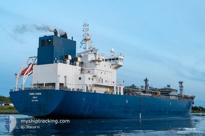
YARA KARA
Tanker D
Current Trip
DKSKA > DZBHA
| Time Travelled | 5 days |
|---|---|
| Remaining Time | --- |
| Distance Travelled | 1514.62 nm |
| Remaining Distance | --- |
| AVG Speed | 12.1 Knots |
| MAX Speed | 17.1 Knots |
| AVG Wind | 15.9 knots |
| MAX Wind | 30 knots |
| MIN Temp | 9.9°C / 49.82°F |
| MAX Temp | 16.3°C / 61.34°F |
| Draught | 7.1 m |
| Position Received | 1 m ago |
Current Position
| Longitude | -10.20376° |
|---|---|
| Latitude | 40.66781° |
| Status | Under way using engine |
| Speed | 13 Knots |
| Course | 178.9° |
| Area | North Atlantic Ocean |
| Station | T-AIS |
| Position Received | 1 m ago |
Info
Information
The current position of YARA KARA is in North Atlantic Ocean with coordinates 40.66781° / -10.20376° as reported on 2024-06-10 19:36 by AIS to our vessel tracker app. The vessel's current speed is 13 Knots
The vessel YARA KARA (IMO: 9734836, MMSI: 258915000) is a Tanker D It's sailing under the flag of [NO] Norway.
In this page you can find informations about the vessels current position, last detected port calls, and current voyage information. If the vessels is not in coverage by AIS you will find the latest position.
The current position of YARA KARA is detected by our AIS receivers and we are not responsible for the reliability of the data. The last position was recorded while the vessel was in Coverage by the Ais receivers of our vessel tracking app.
The current draught of YARA KARA as reported by AIS is 7.1 meters
Weather
| Temperature | 16.3°C / 61.34°F |
|---|---|
| Wind Speed | 27 knots |
| Direction | 2° N |
| Pressure | 1016 hPa |
| Humidity | 82.4 % |
| Cloud Coverage | --- |
Featured Company
Last Port Calls
| Port | Arrival | Departure | Time In Port |
|---|---|---|---|
| 2024-06-03 22:32 | 2024-06-04 23:11 | 1 d | |
| 2024-05-15 21:38 | 2024-05-17 14:46 | 1 d | |
| 2024-04-27 18:07 | 2024-04-29 15:23 | 1 d | |
| 2024-04-11 16:44 | 2024-04-12 14:44 | 22 h |
Last Trips
| Origin | Departure | Destination | Arrival | Distance | |
|---|---|---|---|---|---|
| 2024-05-17 09:46 | 2024-06-04 00:32 | 5292.17 nm | |||
| 2024-04-29 16:23 | 2024-05-15 16:38 | 5383.96 nm | |||
| 2024-04-12 10:44 | 2024-04-27 19:07 | 4300.11 nm | |||
| 2024-03-25 22:38 | 2024-04-11 12:44 | 4797.09 nm |
Events
| Time | Event | Details | Position / Dest | Info |
|---|---|---|---|---|
| 2024-06-10 19:33 | Status Changed | Under way using engine Default |
40.67930 / -10.20383
DKSKA > DZBHA
|
Speed: 13.6 kn Course: 180° |
| 2024-06-10 19:31 | Status Changed | Default Under way using engine |
40.68926 / -10.20380
DKSKA > DZBHA
|
Speed: 13.5 kn Course: 182.7° |
| 2024-06-10 19:26 | Status Changed | Under way using engine Default |
40.70694 / -10.20360
DKSKA > DZBHA
|
Speed: 13.5 kn Course: 182° |
| 2024-06-10 19:18 | Status Changed | Default Under way using engine |
40.73546 / -10.20212
DKSKA > DZBHA
|
Speed: 13.7 kn Course: 182.2° |
| 2024-06-10 19:07 | Status Changed | Under way using engine Default |
40.77762 / -10.20030
DKSKA > DZBHA
|
Speed: 13.5 kn Course: 182° |
| 2024-06-10 18:55 | Status Changed | Default Under way using engine |
40.82323 / -10.19850
DKSKA > DZBHA
|
Speed: 13.6 kn Course: 180° |
| 2024-06-10 18:49 | Status Changed | Under way using engine Default |
40.84866 / -10.19767
DKSKA > DZBHA
|
Speed: 13 kn Course: 180° |
| 2024-06-10 18:33 | Status Changed | Default Under way using engine |
40.90969 / -10.19662
DKSKA > DZBHA
|
Speed: 13.5 kn Course: 180° |
| 2024-06-10 18:28 | Status Changed | Under way using engine Default |
40.92697 / -10.19671
DKSKA > DZBHA
|
Speed: 14.1 kn Course: 180° |
| 2024-06-10 18:27 | Status Changed | Default Under way using engine |
40.93309 / -10.19674
DKSKA > DZBHA
|
Speed: 13.6 kn Course: 180.4° |