
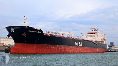
YASA PELICAN
Tanker
Current Trip
| Time Travelled | 6 days |
|---|---|
| Remaining Time | 1 day |
| Distance Travelled | 1834.62 nm |
| Remaining Distance | 396.58 nm |
| AVG Speed | 12 Knots |
| MAX Speed | 15.9 Knots |
| AVG Wind | 13.1 knots |
| MAX Wind | 22.4 knots |
| MIN Temp | 9.2°C / 48.56°F |
| MAX Temp | 27.8°C / 82.04°F |
| Draught | 8 m |
| Position Received | 2 d ago |
Current Position
| Longitude | -79.55632° |
|---|---|
| Latitude | 25.53851° |
| Status | Under way using engine |
| Speed | 11.3 Knots |
| Course | 188° |
| Area | North Atlantic Ocean |
| Station | T-AIS |
| Position Received | 2 d ago |
Info
Information
The current position of YASA PELICAN is in North Atlantic Ocean with coordinates 25.53851° / -79.55632° as reported on 2024-05-07 01:52 by AIS to our vessel tracker app. The vessel's current speed is 11.3 Knots and is heading at the port of HOUSTON. The estimated time of arrival as calculated by vessel tracking app is 2024-05-10 15:56 LT
The vessel YASA PELICAN (IMO: 9857224, MMSI: 538008269) is a Tanker It's sailing under the flag of [MH] Marshall Is.
In this page you can find informations about the vessels current position, last detected port calls, and current voyage information. If the vessels is not in coverage by AIS you will find the latest position.
The current position of YASA PELICAN is detected by our AIS receivers and we are not responsible for the reliability of the data. The last position was recorded while the vessel was in Coverage by the Ais receivers of our vessel tracking app.
The current draught of YASA PELICAN as reported by AIS is 8 meters
Weather
| Temperature | 26.2°C / 79.16°F |
|---|---|
| Wind Speed | 17 knots |
| Direction | 151° SSE |
| Pressure | 1009.7 hPa |
| Humidity | 92.9 % |
| Cloud Coverage | 39 % |
Featured Company
Last Port Calls
| Port | Arrival | Departure | Time In Port |
|---|---|---|---|
| 2024-05-02 15:58 | 2024-05-03 02:26 | 10 h | |
| 2024-04-27 13:21 | 2024-04-28 16:57 | 1 d | |
| 2024-04-11 01:44 | 2024-04-14 13:44 | 3 d | |
| 2024-03-28 17:04 | 2024-03-30 19:37 | 2 d | |
| 2024-03-22 12:20 | 2024-03-24 17:34 | 2 d | |
| 2024-03-14 20:29 | 2024-03-16 07:43 | 1 d | |
| 2024-03-09 22:59 | 2024-03-12 23:51 | 3 d | |
| 2024-03-03 14:15 | 2024-03-04 22:13 | 1 d | |
| 2024-03-02 10:49 |
Last Trips
| Origin | Departure | Destination | Arrival | Distance | |
|---|---|---|---|---|---|
| 2024-04-28 12:57 | 2024-05-02 11:58 | 77.22 nm | |||
| 2024-04-14 15:44 | 2024-04-27 09:21 | 3524.60 nm | |||
| 2024-03-30 20:37 | 2024-04-11 03:44 | 1017.64 nm | |||
| 2024-03-24 18:34 | 2024-03-28 18:04 | 1083.58 nm | |||
| 2024-03-16 08:43 | 2024-03-22 13:20 | 569.39 nm | |||
| 2024-03-13 00:51 | 2024-03-14 21:29 | 546.35 nm | |||
| 2024-03-05 00:13 | 2024-03-09 23:59 | 1176.13 nm | |||
| 2024-03-02 12:49 | 2024-03-03 16:15 | 313.56 nm |
Events
| Time | Event | Details | Position / Dest | Info |
|---|---|---|---|---|
| 2024-05-07 02:00 | Status Changed | Default Under way using engine |
25.51502 / -79.55994
USHOU
|
Speed: 11.3 kn Course: 188° |
| 2024-05-07 01:52 | OUT of Coverage |
25.53851 / -79.55632
North Atlantic Ocean
USHOU
|
Speed: 11.3 kn Course: 188° |
|
| 2024-05-07 00:52 | Status Changed | Under way using engine Default |
25.72631 / -79.52460
USHOU
|
Speed: 11.3 kn Course: 188° |
| 2024-05-07 00:21 | Status Changed | Default Under way using engine |
25.82254 / -79.50999
USHOU
|
Speed: 11.3 kn Course: 187.4° |
| 2024-05-06 23:20 | Status Changed | Under way using engine Default |
26.01568 / -79.48173
USHOU
|
Speed: 11.4 kn Course: 188° |
| 2024-05-06 23:03 | Status Changed | Default Under way using engine |
26.06650 / -79.47410
USHOU
|
Speed: 11.3 kn Course: 187.5° |
| 2024-05-06 22:17 | ETA Changed | 2024/05/10 12:00 2024/05/10 08:00 |
26.20945 / -79.45318
USHOU
|
Speed: 11 kn Course: 187.8° |
| 2024-05-06 21:44 | Status Changed | Under way using engine Default |
26.30802 / -79.43842
USHOU
|
Speed: 10.5 kn Course: 188° |
| 2024-05-06 21:44 | IN Coverage |
26.30802 / -79.43842
North Atlantic Ocean
USHOU
|
Speed: 10.7 kn Course: 187.8° |
|
| 2024-05-06 18:49 | OUT of Coverage |
26.82080 / -79.40424
North Atlantic Ocean
USHOU
|
Speed: 11 kn Course: 181.3° |