
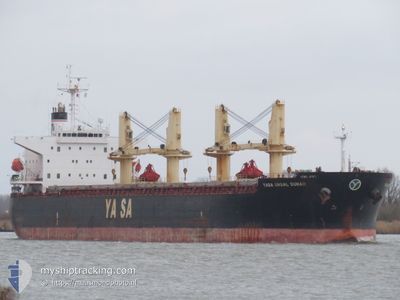
YASA UNSAL SUNAR
Bulk Carrier
Current Trip
| Time Travelled | 10 days |
|---|---|
| Remaining Time | --- |
| Distance Travelled | 3186.65 nm |
| Remaining Distance | --- |
| AVG Speed | 11.6 Knots |
| MAX Speed | 11.6 Knots |
| AVG Wind | 15.5 knots |
| MAX Wind | 32 knots |
| MIN Temp | 14.3°C / 57.74°F |
| MAX Temp | 26.2°C / 79.16°F |
| Draught | 6.5 m |
| Position Received | 4 d ago |
Current Position
| Longitude | -20.88413° |
|---|---|
| Latitude | 27.59170° |
| Status | Under way using engine |
| Speed | 12.9 Knots |
| Course | 227° |
| Area | North Atlantic Ocean |
| Station | T-AIS |
| Position Received | 4 d ago |
Info
Information
The current position of YASA UNSAL SUNAR is in North Atlantic Ocean with coordinates 27.59170° / -20.88413° as reported on 2024-05-12 08:03 by AIS to our vessel tracker app. The vessel's current speed is 12.9 Knots and is heading at the port of SANTAREM. The estimated time of arrival as calculated by vessel tracking app is 2024-05-20 01:00 LT
The vessel YASA UNSAL SUNAR (IMO: 9396206, MMSI: 538002748) is a Bulk Carrier that was built in 2007 ( 17 years old ). It's sailing under the flag of [MH] Marshall Is.
In this page you can find informations about the vessels current position, last detected port calls, and current voyage information. If the vessels is not in coverage by AIS you will find the latest position.
The current position of YASA UNSAL SUNAR is detected by our AIS receivers and we are not responsible for the reliability of the data. The last position was recorded while the vessel was in Coverage by the Ais receivers of our vessel tracking app.
The current draught of YASA UNSAL SUNAR as reported by AIS is 6.5 meters
Weather
| Temperature | 26.2°C / 79.16°F |
|---|---|
| Wind Speed | 16 knots |
| Direction | 79° E |
| Pressure | 1013.2 hPa |
| Humidity | 73.4 % |
| Cloud Coverage | 79 % |
Featured Company
Last Port Calls
| Port | Arrival | Departure | Time In Port |
|---|---|---|---|
| 2024-05-03 03:41 | 2024-05-06 12:56 | 3 d | |
| 2024-04-19 11:46 | 2024-04-21 07:09 | 1 d | |
| 2024-04-09 02:41 | 2024-04-14 13:10 | 5 d | |
| 2024-03-20 02:12 |
Most Visited Ports (Last year)
| Port | Arrivals | |
|---|---|---|
| 3 | ||
| 2 | ||
| 2 | ||
| 2 | ||
| 1 | ||
| 1 |
Events
| Time | Event | Details | Position / Dest | Info |
|---|---|---|---|---|
| 2024-05-12 08:10 | Status Changed | Default Under way using engine |
27.57568 / -20.90413
BRSTM
|
Speed: 12.9 kn Course: 227° |
| 2024-05-12 08:03 | Status Changed | Under way using engine Default |
27.59170 / -20.88413
BRSTM
|
Speed: 12.8 kn Course: 228° |
| 2024-05-12 08:03 | OUT of Coverage |
27.59170 / -20.88413
North Atlantic Ocean
BRSTM
|
Speed: 12.9 kn Course: 227° |
|
| 2024-05-12 07:40 | Status Changed | Default Under way using engine |
27.64893 / -20.81358
BRSTM
|
Speed: 12.7 kn Course: 228° |
| 2024-05-12 07:30 | Status Changed | Under way using engine Default |
27.67225 / -20.78527
BRSTM
|
Speed: 12.8 kn Course: 225° |
| 2024-05-12 07:11 | IN Coverage |
27.66942 / -20.78863
North Atlantic Ocean
BRSTM
|
Speed: 12.8 kn Course: 225° |
|
| 2024-05-12 02:54 | Status Changed | Default Under way using engine |
28.30755 / -19.93260
BRSTM
|
Speed: 12.7 kn Course: 232° |
| 2024-05-12 02:49 | OUT of Coverage |
28.31643 / -19.91932
North Atlantic Ocean
BRSTM
|
Speed: 12.7 kn Course: 232° |
|
| 2024-05-12 02:45 | Status Changed | Under way using engine Default |
28.32620 / -19.90505
BRSTM
|
Speed: 12.7 kn Course: 233° |
| 2024-05-12 02:41 | IN Coverage |
28.32447 / -19.90767
North Atlantic Ocean
BRSTM
|
Speed: 12.7 kn Course: 233° |