
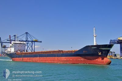
YEBA
General Cargo
Current Trip
| Time Travelled | 13 days |
|---|---|
| Remaining Time | --- |
| Distance Travelled | 330.73 nm |
| Remaining Distance | --- |
| AVG Speed | 9.8 Knots |
| MAX Speed | 11 Knots |
| AVG Wind | 8.9 knots |
| MAX Wind | 18.9 knots |
| MIN Temp | 11.7°C / 53.06°F |
| MAX Temp | 23.9°C / 75.02°F |
| Draught | 4.7 m |
| Position Received | 5 h, 7 m ago |
Current Position
| Longitude | 3.11967° |
|---|---|
| Latitude | 43.01533° |
| Status | At anchor |
| Speed | 0.2 Knots |
| Course | 288° |
| Area | Mediterranean Sea - Western Basin |
| Station | T-AIS |
| Position Received | 5 h, 7 m ago |
Info
Information
The current position of YEBA is in Mediterranean Sea - Western Basin with coordinates 43.01533° / 3.11967° as reported on 2024-05-21 00:56 by AIS to our vessel tracker app. The vessel's current speed is 0.2 Knots
The vessel YEBA (IMO: 9045728, MMSI: 374552000) is a General Cargo that was built in 2004 ( 20 years old ). It's sailing under the flag of [PA] Panama.
In this page you can find informations about the vessels current position, last detected port calls, and current voyage information. If the vessels is not in coverage by AIS you will find the latest position.
The current position of YEBA is detected by our AIS receivers and we are not responsible for the reliability of the data. The last position was recorded while the vessel was in Coverage by the Ais receivers of our vessel tracking app.
The current draught of YEBA as reported by AIS is 4.7 meters
Weather
| Temperature | 13.5°C / 56.3°F |
|---|---|
| Wind Speed | 13 knots |
| Direction | 300° WNW |
| Pressure | 1011.3 hPa |
| Humidity | 75.5 % |
| Cloud Coverage | 71 % |
Featured Company
Last Port Calls
| Port | Arrival | Departure | Time In Port |
|---|---|---|---|
| 2024-05-05 17:51 | 2024-05-07 14:24 | 1 d | |
| 2024-04-17 08:48 | 2024-04-20 13:02 | 3 d | |
| 2024-03-24 02:45 | 2024-03-26 21:01 | 2 d | |
| 2024-03-19 17:25 | 2024-03-21 01:11 | 1 d | |
| 2024-03-11 13:27 | 2024-03-13 23:26 | 2 d | |
| 2024-03-09 03:48 | 2024-03-10 04:43 | 1 d |
Last Trips
| Origin | Departure | Destination | Arrival | Distance | |
|---|---|---|---|---|---|
| 2024-04-20 16:02 | 2024-05-05 19:51 | 1777.52 nm | |||
| 2024-03-26 22:01 | 2024-04-17 11:48 | 3492.97 nm | |||
| 2024-03-21 01:11 | 2024-03-24 03:45 | 686.96 nm | |||
| 2024-03-14 00:26 | 2024-03-19 17:25 | 663.58 nm | |||
| 2024-03-10 05:43 | 2024-03-11 14:27 | 91.59 nm | |||
| 2024-02-29 08:51 | 2024-03-09 04:48 | 1450.04 nm |
Events
| Time | Event | Details | Position / Dest | Info |
|---|---|---|---|---|
| 2024-05-21 01:02 | Status Changed | Default At anchor |
43.01500 / 3.11833
FRNOU
|
Speed: 0.2 kn Course: 288° |
| 2024-05-21 00:56 | Status Changed | At anchor Default |
43.01533 / 3.11967
FRNOU
|
Speed: Course: -1° |
| 2024-05-21 00:56 | OUT of Coverage |
43.01533 / 3.11967
Mediterranean Sea - Western Basin
|
Speed: 0.2 kn Course: 259° |
|
| 2024-05-21 00:41 | Status Changed | Default At anchor |
43.01500 / 3.11833
FRNOU
|
Speed: 0.3 kn Course: 315° |
| 2024-05-21 00:29 | Status Changed | At anchor Default |
43.01517 / 3.11933
FRNOU
|
Speed: Course: -1° |
| 2024-05-21 00:05 | Status Changed | Default At anchor |
43.01500 / 3.11833
FRNOU
|
Speed: 0.3 kn Course: 314° |
| 2024-05-21 00:02 | Status Changed | At anchor Default |
43.01533 / 3.11967
FRNOU
|
Speed: Course: -1° |
| 2024-05-20 23:59 | IN Coverage |
43.01533 / 3.11967
Mediterranean Sea - Western Basin
|
Speed: 0.3 kn Course: 55° |
|
| 2024-05-20 17:02 | Status Changed | Default At anchor |
43.01500 / 3.11833
FRNOU
|
Speed: 0.2 kn Course: 264° |
| 2024-05-20 16:50 | OUT of Coverage |
43.01633 / 3.11950
Mediterranean Sea - Western Basin
|
Speed: 0.2 kn Course: 33° |