
YM INSTRUCTION
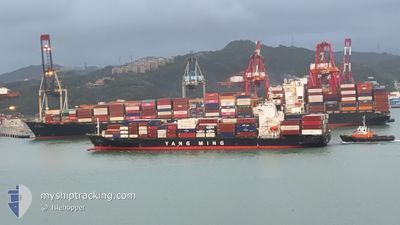
Container Ship
Current Trip
| Time Travelled | 9 h, 21 mins |
|---|---|
| Remaining Time | 19 h, 31 mins |
| Distance Travelled | 144.98 nm |
| Remaining Distance | 372.80 nm |
| AVG Speed | 15.6 Knots |
| MAX Speed | 18.4 Knots |
| AVG Wind | 8.2 knots |
| MAX Wind | 13 knots |
| MIN Temp | 28.2°C / 82.76°F |
| MAX Temp | 29.3°C / 84.74°F |
| Draught | 9.2 m |
| Position Received | 7 h, 40 m ago |
Current Position
| Longitude | 114.09868° |
|---|---|
| Latitude | 21.98615° |
| Status | Under way using engine |
| Speed | 17.3 Knots |
| Course | 223° |
| Area | South China Sea |
| Station | T-AIS |
| Position Received | 7 h, 40 m ago |
Info
Information
The current position of YM INSTRUCTION is in South China Sea with coordinates 21.98615° / 114.09868° as reported on 2024-06-20 04:06 by AIS to our vessel tracker app. The vessel's current speed is 17.3 Knots and is heading at the port of HAI PHONG. The estimated time of arrival as calculated by vessel tracking app is 2024-06-21 07:17 LT
The vessel YM INSTRUCTION (IMO: 9331086, MMSI: 636013118) is a Container Ship that was built in 2007 ( 17 years old ). It's sailing under the flag of [LR] Liberia.
In this page you can find informations about the vessels current position, last detected port calls, and current voyage information. If the vessels is not in coverage by AIS you will find the latest position.
The current position of YM INSTRUCTION is detected by our AIS receivers and we are not responsible for the reliability of the data. The last position was recorded while the vessel was in Coverage by the Ais receivers of our vessel tracking app.
The current draught of YM INSTRUCTION as reported by AIS is 9.2 meters
Weather
| Temperature | 29.1°C / 84.38°F |
|---|---|
| Wind Speed | 14 knots |
| Direction | 153° SSE |
| Pressure | 1003.5 hPa |
| Humidity | 87.1 % |
| Cloud Coverage | 100 % |
Featured Company
Last Port Calls
| Port | Arrival | Departure | Time In Port |
|---|---|---|---|
| 2024-06-19 15:09 | 2024-06-20 02:25 | 11 h | |
| 2024-06-17 07:30 | 2024-06-18 15:54 | 1 d | |
| 2024-06-15 23:14 | 2024-06-16 22:08 | 22 h | |
| 2024-06-14 06:12 | 2024-06-15 12:15 | 1 d | |
| 2024-06-13 00:01 | 2024-06-13 08:24 | 8 h | |
| 2024-06-09 09:21 | 2024-06-09 17:01 | 7 h | |
| 2024-06-04 12:24 | 2024-06-05 02:07 | 13 h | |
| 2024-06-01 21:55 | 2024-06-02 23:51 | 1 d | |
| 2024-05-25 08:32 | 2024-05-25 15:04 | 6 h | |
| 2024-05-21 17:32 | 2024-05-22 00:06 | 6 h |
Last Trips
| Origin | Departure | Destination | Arrival | Distance | |
|---|---|---|---|---|---|
| 2024-06-18 23:54 | 2024-06-19 23:09 | 349.78 nm | |||
| 2024-06-17 06:08 | 2024-06-17 15:30 | 136.33 nm | |||
| 2024-06-15 20:15 | 2024-06-16 07:14 | 131.00 nm | |||
| 2024-06-13 16:24 | 2024-06-14 14:12 | 358.88 nm | |||
| 2024-06-10 00:01 | 2024-06-13 08:01 | 791.46 nm | |||
| 2024-06-05 10:07 | 2024-06-09 16:21 | 1370.12 nm | |||
| 2024-06-03 07:51 | 2024-06-04 20:24 | 194.95 nm | |||
| 2024-05-25 22:04 | 2024-06-02 05:55 | 1234.89 nm | |||
| 2024-05-22 08:06 | 2024-05-25 15:32 | 793.93 nm | |||
| 2024-05-21 02:44 | 2024-05-22 01:32 | 351.84 nm |
Events
| Time | Event | Details | Position / Dest | Info |
|---|---|---|---|---|
| 2024-06-20 04:13 | Status Changed | Default Under way using engine |
21.95482 / 114.10620
HKHKG>VNHPH
|
Speed: 17.3 kn Course: 223° |
| 2024-06-20 04:06 | OUT of Coverage |
21.98615 / 114.09868
South China Sea
HKHKG>VNHPH
|
Speed: 17.3 kn Course: 223° |
|
| 2024-06-20 03:19 | Status Changed | Under way using engine Default |
22.16563 / 114.19682
HKHKG>VNHPH
|
Speed: 14.3 kn Course: 148° |
| 2024-06-20 03:18 | Status Changed | Default Under way using engine |
22.17125 / 114.19366
HKHKG>VNHPH
|
Speed: 14.3 kn Course: 149° |
| 2024-06-20 02:25 | PORT DEPARTURE |
|
22.31927 / 114.10442
HKHKG>VNHPH
|
Speed: 12.7 kn Course: 245° |
| 2024-06-20 02:17 | START Moving |
22.32993 / 114.12255
[HK] HONG KONG
|
Speed: 3.2 kn Course: 240° |
|
| 2024-06-20 01:56 | Status Changed | Under way using engine Moored |
22.33408 / 114.12455
[HK] HONG KONG
|
Speed: Course: 342° |
| 2024-06-20 01:41 | Draught Changed | 9.2 9.1 |
22.33413 / 114.12453
[HK] HONG KONG
|
Speed: Course: 342° |
| 2024-06-19 17:12 | Destination Changed | HKHKG>VNHPH TWKHH>HKHKG |
22.33407 / 114.12475
[HK] HONG KONG
|
Speed: Course: 342° |
| 2024-06-19 17:12 | ETA Changed | 2024/06/21 10:00 2024/06/19 14:30 |
22.33407 / 114.12475
[HK] HONG KONG
|
Speed: Course: 342° |