
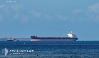
YM PIONEER
Cargo
Current Trip
| Time Travelled | 4 days |
|---|---|
| Remaining Time | --- |
| Distance Travelled | 1320.31 nm |
| Remaining Distance | --- |
| AVG Speed | 10.4 Knots |
| MAX Speed | 14.9 Knots |
| AVG Wind | 11.9 knots |
| MAX Wind | 21.7 knots |
| MIN Temp | 25.1°C / 77.18°F |
| MAX Temp | 29.8°C / 85.64°F |
| Draught | 8.1 m |
| Position Received | 4 d ago |
Current Position
| Longitude | 103.44030° |
|---|---|
| Latitude | 1.24034° |
| Status | Under way using engine |
| Speed | 12.4 Knots |
| Course | 282.2° |
| Area | Malacca Strait |
| Station | T-AIS |
| Position Received | 4 d ago |
Info
Information
The current position of YM PIONEER is in Malacca Strait with coordinates 1.24034° / 103.44030° as reported on 2024-06-21 23:39 by AIS to our vessel tracker app. The vessel's current speed is 12.4 Knots and is heading at the port of SANTOS. The estimated time of arrival as calculated by vessel tracking app is 2024-07-25 12:00 LT
The vessel YM PIONEER (IMO: 9902548, MMSI: 636020448) is a Cargo It's sailing under the flag of [LR] Liberia.
In this page you can find informations about the vessels current position, last detected port calls, and current voyage information. If the vessels is not in coverage by AIS you will find the latest position.
The current position of YM PIONEER is detected by our AIS receivers and we are not responsible for the reliability of the data. The last position was recorded while the vessel was in Coverage by the Ais receivers of our vessel tracking app.
The current draught of YM PIONEER as reported by AIS is 8.1 meters
Weather
| Temperature | 28.8°C / 83.84°F |
|---|---|
| Wind Speed | 11 knots |
| Direction | 142° SE |
| Pressure | 1008 hPa |
| Humidity | 75.5 % |
| Cloud Coverage | 100 % |
Featured Company
Last Port Calls
| Port | Arrival | Departure | Time In Port |
|---|---|---|---|
| 2024-06-14 13:25 | 2024-06-21 16:57 | 7 d | |
| 2024-06-09 16:29 | 2024-06-13 15:45 | 3 d | |
| 2024-04-19 06:08 | 2024-04-23 18:39 | 4 d | |
| 2024-04-06 13:18 | 2024-04-10 19:42 | 4 d |
Most Visited Ports (Last year)
| Port | Arrivals | |
|---|---|---|
| 1 | ||
| 1 | ||
| 1 | ||
| 1 | ||
| 1 | ||
| 1 |
Last Trips
| Origin | Departure | Destination | Arrival | Distance | |
|---|---|---|---|---|---|
| 2024-06-13 23:45 | 2024-06-14 21:25 | 241.45 nm | |||
| 2024-04-23 15:39 | 2024-06-10 00:29 | 8842.57 nm | |||
| 2024-04-10 16:42 | 2024-04-19 03:08 | 841.83 nm | |||
| 2024-03-04 15:14 | 2024-04-06 10:18 | 9181.39 nm |
Events
| Time | Event | Details | Position / Dest | Info |
|---|---|---|---|---|
| 2024-06-21 23:45 | Status Changed | Default Under way using engine |
1.24521 / 103.41757
BRSSZ
|
Speed: 12.4 kn Course: 282.2° |
| 2024-06-21 23:39 | OUT of Coverage |
1.24034 / 103.44030
Malacca Strait
|
Speed: 12.4 kn Course: 282.2° |
|
| 2024-06-21 23:34 | Change Sea Area | Malaysian part of the Malacca Strait Malaysian part of the Singapore Strait |
1.23702 / 103.45561
Malacca Strait
|
Speed: 12.5 kn Course: 282.4° |
| 2024-06-21 22:53 | Change Sea Area | Malaysian part of the Singapore Strait Indonesian part of the Singapore Strait |
1.20049 / 103.58976
Singapore Strait
|
Speed: 11.3 kn Course: 264.2° |
| 2024-06-21 22:20 | Change Sea Area | Indonesian part of the Singapore Strait Singaporean part of the Singapore Strait |
1.16455 / 103.69143
Singapore Strait
|
Speed: 11.6 kn Course: 303° |
| 2024-06-21 19:38 | Change Sea Area | Singaporean part of the Singapore Strait Indonesian part of the Singapore Strait |
1.26145 / 104.01047
Singapore Strait
|
Speed: 8.6 kn Course: 265.8° |
| 2024-06-21 19:11 | Change Sea Area | Indonesian part of the Singapore Strait Malaysian part of the Singapore Strait |
1.26905 / 104.07614
Singapore Strait
|
Speed: 8.1 kn Course: 260.1° |
| 2024-06-21 18:07 | Change Sea Area | Malaysian part of the Singapore Strait Singaporean part of the Singapore Strait |
1.35369 / 104.05230
Singapore Strait
|
Speed: 8.8 kn Course: 129.9° |
| 2024-06-21 17:13 | Draught Changed | 8.1 9.1 |
1.40106 / 103.94198
BRSSZ
|
Speed: 10.8 kn Course: 134.6° |
| 2024-06-21 17:13 | ETA Changed | 2024/07/25 12:00 2024/07/24 15:00 |
1.40106 / 103.94198
BRSSZ
|
Speed: 10.8 kn Course: 134.6° |